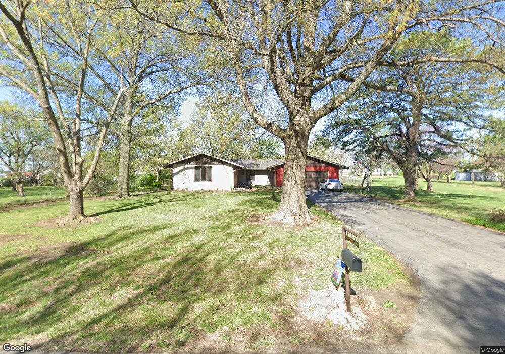
2011 SW Broadview Dr Topeka, KS 66615
Estimated Value: $275,000 - $319,000
3
Beds
2
Baths
1,908
Sq Ft
$152/Sq Ft
Est. Value
About This Home
This home is located at 2011 SW Broadview Dr, Topeka, KS 66615 and is currently estimated at $289,750, approximately $151 per square foot. 2011 SW Broadview Dr is a home located in Shawnee County with nearby schools including Wanamaker Elementary School, Washburn Rural Middle School, and Washburn Rural High School.
Ownership History
Date
Name
Owned For
Owner Type
Purchase Details
Closed on
Oct 28, 2015
Sold by
Paige Mitchell L and Paige Lorie A
Bought by
Paige Mitchell L
Current Estimated Value
Home Financials for this Owner
Home Financials are based on the most recent Mortgage that was taken out on this home.
Original Mortgage
$144,586
Outstanding Balance
$116,025
Interest Rate
4.4%
Mortgage Type
FHA
Estimated Equity
$173,725
Purchase Details
Closed on
Sep 2, 2011
Sold by
Teagarden Loretta and Teagarden George
Bought by
Paige Mitchell L and Paige Lori A
Home Financials for this Owner
Home Financials are based on the most recent Mortgage that was taken out on this home.
Original Mortgage
$146,197
Interest Rate
4.25%
Mortgage Type
FHA
Create a Home Valuation Report for This Property
The Home Valuation Report is an in-depth analysis detailing your home's value as well as a comparison with similar homes in the area
Purchase History
| Date | Buyer | Sale Price | Title Company |
|---|---|---|---|
| Paige Mitchell L | -- | None Available | |
| Paige Mitchell L | -- | Kansas Secured Title |
Source: Public Records
Mortgage History
| Date | Status | Borrower | Loan Amount |
|---|---|---|---|
| Open | Paige Mitchell L | $144,586 | |
| Closed | Paige Mitchell L | $146,197 |
Source: Public Records
Tax History
| Year | Tax Paid | Tax Assessment Tax Assessment Total Assessment is a certain percentage of the fair market value that is determined by local assessors to be the total taxable value of land and additions on the property. | Land | Improvement |
|---|---|---|---|---|
| 2025 | $3,448 | $26,151 | -- | -- |
| 2023 | $3,448 | $24,762 | $0 | $0 |
| 2022 | $2,871 | $22,109 | $0 | $0 |
| 2021 | $2,497 | $19,565 | $0 | $0 |
| 2020 | $2,326 | $18,634 | $0 | $0 |
| 2019 | $2,287 | $18,091 | $0 | $0 |
| 2018 | $2,069 | $17,564 | $0 | $0 |
| 2017 | $2,173 | $17,220 | $0 | $0 |
| 2014 | $2,174 | $16,882 | $0 | $0 |
Source: Public Records
Map
Nearby Homes
- 2393 SW Fountain Place Unit 4
- 2448 SW Golf View Ct
- 6250 SW 21st Terrace
- 7105 SW 17th Terrace
- 2408 SW Kings Ct
- 2404 SW Brookhaven Ln
- 2253 SW Alameda Dr
- 2465 SW Brookhaven Ln
- 2424 SW Pepperwood Cir
- 2221 SW Brookfield St
- 2311 SW Brookfield St
- 2601 SW Kingsrow Rd
- 7355 SW 23rd Ct
- 2809 SW Tallgrass Dr
- 2231 SW Westport Place
- 0000 SW Urish Rd
- 6701 SW Swonthold Rd
- 7600 SW 24th Terrace
- 7612 SW 24th Terrace
- 5859 SW 22nd Terrace Unit 3
- 6720 SW 21st St
- 6728 SW 21st St
- 2006 SW Broadview Dr
- 6648 SW 21st St
- 2001 SW Broadview Dr
- 6740 SW 21st St
- 6640 SW 21st St
- 1931 SW Broadview Dr
- 1934 SW Broadview Dr
- 6742 SW 21st St
- 1936 SW Urish Rd
- 6630 SW 21st St
- 2024 SW Urish Rd
- 2018 SW Urish Rd
- 1930 SW Broadview Dr
- 6741 SW 21st St
- 6748 SW 21st St
- 1921 SW Broadview Dr
- 1930 SW Urish Rd
- 6620 SW 21st St
Your Personal Tour Guide
Ask me questions while you tour the home.