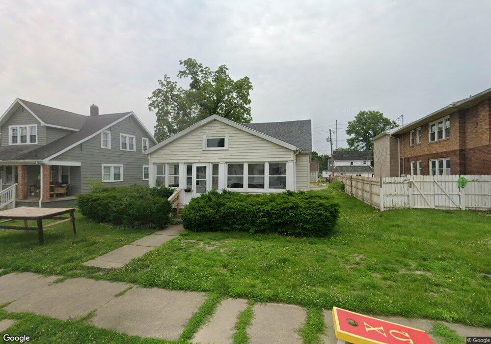
2011 W Main St Muncie, IN 47303
Westside NeighborhoodEstimated Value: $156,000 - $198,807
4
Beds
2
Baths
2,384
Sq Ft
$74/Sq Ft
Est. Value
About This Home
This home is located at 2011 W Main St, Muncie, IN 47303 and is currently estimated at $176,952, approximately $74 per square foot. 2011 W Main St is a home located in Delaware County with nearby schools including West View Elementary School, Muncie Central High School, and Northside Middle School.
Ownership History
Date
Name
Owned For
Owner Type
Purchase Details
Closed on
Sep 1, 2023
Sold by
Campus Enterprises Llc
Bought by
Cardinal Cribs Llc
Current Estimated Value
Home Financials for this Owner
Home Financials are based on the most recent Mortgage that was taken out on this home.
Original Mortgage
$143,625
Outstanding Balance
$136,615
Interest Rate
7.09%
Mortgage Type
Credit Line Revolving
Estimated Equity
$40,337
Purchase Details
Closed on
Sep 8, 2005
Sold by
Buck Steven E and Buck Stacy A
Bought by
Campus Enterprises Llc
Create a Home Valuation Report for This Property
The Home Valuation Report is an in-depth analysis detailing your home's value as well as a comparison with similar homes in the area
Home Values in the Area
Average Home Value in this Area
Purchase History
| Date | Buyer | Sale Price | Title Company |
|---|---|---|---|
| Cardinal Cribs Llc | -- | None Listed On Document | |
| Campus Enterprises Llc | -- | None Available |
Source: Public Records
Mortgage History
| Date | Status | Borrower | Loan Amount |
|---|---|---|---|
| Open | Cardinal Cribs Llc | $143,625 |
Source: Public Records
Tax History Compared to Growth
Tax History
| Year | Tax Paid | Tax Assessment Tax Assessment Total Assessment is a certain percentage of the fair market value that is determined by local assessors to be the total taxable value of land and additions on the property. | Land | Improvement |
|---|---|---|---|---|
| 2024 | $2,882 | $138,700 | $16,200 | $122,500 |
| 2023 | $2,420 | $115,600 | $13,500 | $102,100 |
| 2022 | $2,326 | $110,900 | $13,500 | $97,400 |
| 2021 | $2,202 | $104,700 | $13,400 | $91,300 |
| 2020 | $1,874 | $88,300 | $12,200 | $76,100 |
| 2019 | $1,874 | $88,300 | $12,200 | $76,100 |
| 2018 | $1,796 | $84,400 | $12,200 | $72,200 |
| 2017 | $1,750 | $82,100 | $10,900 | $71,200 |
| 2016 | $1,672 | $78,200 | $10,400 | $67,800 |
| 2014 | $1,361 | $65,900 | $8,300 | $57,600 |
| 2013 | -- | $62,600 | $8,000 | $54,600 |
Source: Public Records
Map
Nearby Homes
- 312 S Nichols Ave
- 1602 W Adams St
- 1600 W Adams St
- 1616 W White River Blvd
- 512 S Talley Ave
- 216 S Dill St
- 519 S Talley Ave
- 409 S Celia Ave
- 801 S Brittain Ave Unit 8 SFAM Homes Total
- 1300 W University Ave
- 1004 N Meadow Ln
- 1319 W Kilgore Ave
- 520 N Alden Rd
- 223 N Riley Rd
- 207 N Winthrop Rd
- 1024 W Powers St
- 307 N Winthrop Rd
- 303 S Proud St
- 305 S Proud St
- 1308 N Woodridge Ave
- 2015 W Main St
- 2009 W Main St
- 100 S Talley Ave
- 2005 W Main St
- 2010 W Jackson St
- 2020 W Jackson St
- 2006 W Jackson St
- 101 S College Ave
- 2008 W Main St
- 2004 W Jackson St
- 2024 W Jackson St
- 2006 W Main St
- 2020 W Main St
- 2004 W Main St
- 2024 W Main St
- 2000 W Jackson St
- 2000 1/2 W Jackson St
- 101 S Talley Ave
- 2100 W Jackson St
- 109 S Talley Ave