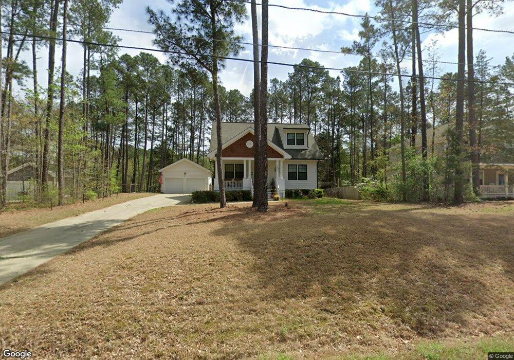
2011 Watson Rd Durham, NC 27704
Northeast Durham NeighborhoodEstimated Value: $404,291 - $478,000
3
Beds
3
Baths
1,516
Sq Ft
$297/Sq Ft
Est. Value
About This Home
This home is located at 2011 Watson Rd, Durham, NC 27704 and is currently estimated at $450,573, approximately $297 per square foot. 2011 Watson Rd is a home located in Durham County with nearby schools including Merrick-Moore Elementary School, John W Neal Middle School, and Southern School of Energy & Sustainability.
Ownership History
Date
Name
Owned For
Owner Type
Purchase Details
Closed on
Mar 30, 2017
Sold by
Durham Building Co Llc
Bought by
Edwards Jenifer Loreen
Current Estimated Value
Home Financials for this Owner
Home Financials are based on the most recent Mortgage that was taken out on this home.
Original Mortgage
$275,294
Outstanding Balance
$228,393
Interest Rate
4.1%
Mortgage Type
VA
Estimated Equity
$222,180
Purchase Details
Closed on
Dec 13, 2015
Sold by
Smith Marvin J
Bought by
Newman Land Company Llc
Create a Home Valuation Report for This Property
The Home Valuation Report is an in-depth analysis detailing your home's value as well as a comparison with similar homes in the area
Home Values in the Area
Average Home Value in this Area
Purchase History
| Date | Buyer | Sale Price | Title Company |
|---|---|---|---|
| Edwards Jenifer Loreen | $266,500 | -- | |
| Newman Land Company Llc | $40,000 | Attorney |
Source: Public Records
Mortgage History
| Date | Status | Borrower | Loan Amount |
|---|---|---|---|
| Open | Edwards Jenifer Loreen | $275,294 |
Source: Public Records
Tax History
| Year | Tax Paid | Tax Assessment Tax Assessment Total Assessment is a certain percentage of the fair market value that is determined by local assessors to be the total taxable value of land and additions on the property. | Land | Improvement |
|---|---|---|---|---|
| 2025 | $3,930 | $396,469 | $94,375 | $302,094 |
| 2024 | $3,480 | $249,509 | $30,140 | $219,369 |
| 2023 | $3,268 | $249,509 | $30,140 | $219,369 |
| 2022 | $3,193 | $249,509 | $30,140 | $219,369 |
| 2021 | $3,179 | $249,509 | $30,140 | $219,369 |
| 2020 | $3,104 | $249,509 | $30,140 | $219,369 |
| 2019 | $3,104 | $249,509 | $30,140 | $219,369 |
| 2018 | $2,103 | $168,629 | $26,372 | $142,257 |
| 2017 | $1,357 | $100,769 | $26,372 | $74,397 |
| 2016 | $332 | $25,532 | $25,532 | $0 |
| 2015 | $388 | $28,039 | $28,039 | $0 |
| 2014 | $388 | $28,039 | $28,039 | $0 |
Source: Public Records
Map
Nearby Homes
- 2406 Winburn Ave
- 18 Syracuse Place
- 1515 Milan St
- 1832 E Geer St
- 1113 Midland Terrace
- 1905 Milan St
- 2632 Melrose Ave
- 1823 E Geer St
- 1811 E Geer St
- 1401 Milan St
- 2113 Aiken Ave
- 2028 Buffalo Way
- 2027 Buffalo Way
- 3007 Chrys St
- 3019 Chrys St
- 2204 Rabbitbrush St
- 3017 Chrys St
- 2206 Rabbitbrush St
- 2210 Rabbitbrush St
- 3010 Chrys St
- 2015 Watson Rd
- 2411 Winburn Ave
- 2012 Watson Rd
- 2003 Watson Rd
- 0 Winburn Ave
- LOT #2 Winburn Ave
- 2609 Winburn Ave
- 2607 Winburn Ave
- 2605 Winburn Ave
- 2325 Winburn Ave
- 2412 Winburn Ave
- 2413 Winburn Ave
- 2008 Watson St
- 2008 Watson St Unit 11
- 2328 Lindmont Ave
- 2402 Winburn Ave
- 2408 Lindmont Ave
- 2408 Winburn Ave
- 2408 Winburn Ave Unit 3
- 2321 Winburn Ave
Your Personal Tour Guide
Ask me questions while you tour the home.