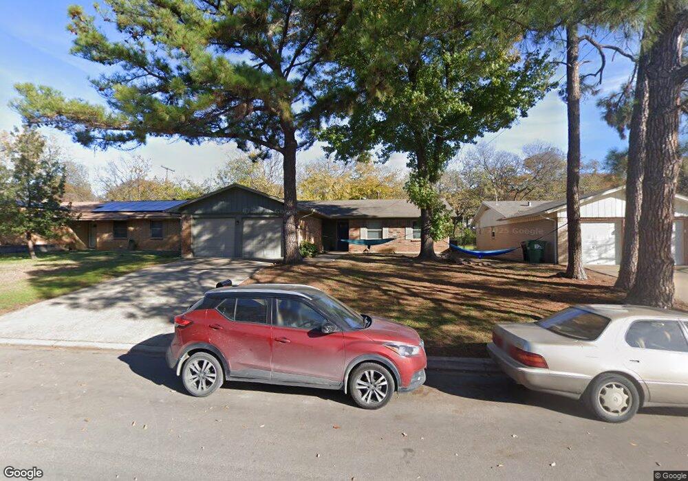
2011 Westwood Dr Denton, TX 76205
Denia NeighborhoodEstimated Value: $284,625 - $316,000
3
Beds
2
Baths
1,541
Sq Ft
$197/Sq Ft
Est. Value
About This Home
This home is located at 2011 Westwood Dr, Denton, TX 76205 and is currently estimated at $304,156, approximately $197 per square foot. 2011 Westwood Dr is a home located in Denton County with nearby schools including Borman Elementary School, McMath Middle School, and Denton High School.
Ownership History
Date
Name
Owned For
Owner Type
Purchase Details
Closed on
Jul 12, 2019
Sold by
Ail Investment Lp
Bought by
City Of Fort Worth Texas
Current Estimated Value
Purchase Details
Closed on
Jul 31, 2013
Sold by
Wells Fargo Bank National Association
Bought by
Miles Eric D and Miles Becky G
Home Financials for this Owner
Home Financials are based on the most recent Mortgage that was taken out on this home.
Original Mortgage
$50,000
Interest Rate
4.34%
Mortgage Type
New Conventional
Purchase Details
Closed on
Apr 2, 2013
Sold by
Sinise Alan and Sinise Anthony
Bought by
Wells Fargo Bank National Association
Purchase Details
Closed on
Apr 26, 2006
Sold by
Sinise Anthony and Sinise Alana
Bought by
Wells Fargo Bank National Association
Home Financials for this Owner
Home Financials are based on the most recent Mortgage that was taken out on this home.
Original Mortgage
$93,492
Interest Rate
9.64%
Mortgage Type
Purchase Money Mortgage
Create a Home Valuation Report for This Property
The Home Valuation Report is an in-depth analysis detailing your home's value as well as a comparison with similar homes in the area
Home Values in the Area
Average Home Value in this Area
Purchase History
| Date | Buyer | Sale Price | Title Company |
|---|---|---|---|
| City Of Fort Worth Texas | -- | None Available | |
| Miles Eric D | -- | None Available | |
| Wells Fargo Bank National Association | $100,000 | None Available | |
| Wells Fargo Bank National Association | $96,000 | None Available | |
| Sinise Anthony | -- | Reunion Title |
Source: Public Records
Mortgage History
| Date | Status | Borrower | Loan Amount |
|---|---|---|---|
| Previous Owner | Miles Eric D | $50,000 | |
| Previous Owner | Sinise Anthony | $93,492 |
Source: Public Records
Tax History Compared to Growth
Tax History
| Year | Tax Paid | Tax Assessment Tax Assessment Total Assessment is a certain percentage of the fair market value that is determined by local assessors to be the total taxable value of land and additions on the property. | Land | Improvement |
|---|---|---|---|---|
| 2025 | $4,806 | $228,000 | $55,800 | $172,200 |
| 2024 | $4,806 | $249,000 | $55,800 | $193,200 |
| 2023 | $5,652 | $296,000 | $52,836 | $243,164 |
| 2022 | $5,691 | $260,000 | $55,800 | $204,200 |
| 2021 | $4,385 | $197,251 | $37,200 | $160,051 |
| 2020 | $4,351 | $190,351 | $37,200 | $153,151 |
| 2019 | $4,634 | $194,199 | $37,200 | $156,999 |
| 2018 | $3,788 | $156,801 | $37,200 | $119,601 |
| 2017 | $3,850 | $155,777 | $35,340 | $120,437 |
| 2016 | $3,027 | $122,452 | $22,320 | $100,132 |
| 2015 | $2,619 | $100,000 | $22,320 | $77,680 |
| 2013 | -- | $104,182 | $26,040 | $78,142 |
Source: Public Records
Map
Nearby Homes
- 2302 Mercedes Rd
- 1523 Oakwood Dr
- 1619 Mccormick St
- 2314 Leslie St
- 631 Acme St
- 1211 Lindsey St
- 2421 Mercedes Rd
- 2305 Bernard St
- 2216 Redwing Dr
- 2605 Mccormick St
- 2216 Ruff Rd
- 2609 Mccormick St
- 2321 Ruff Rd
- 2617 Mccormick St
- 2700 Mccormick St
- 2621 Mccormick St
- 2513 Goldfinch Dr
- 2708 Mccormick St
- 1618 Kendolph Dr
- 2512 Goldfinch Dr
- 2007 Westwood Dr
- 2015 Westwood Dr
- 2010 Mercedes Rd
- 2003 Westwood Dr
- 2019 Westwood Dr
- 2006 Mercedes Rd
- 2014 Mercedes Rd
- 2010 Westwood Dr
- 2018 Mercedes Rd
- 2002 Mercedes Rd
- 2014 Westwood Dr
- 2006 Westwood Dr
- 1919 Westwood Dr
- 2023 Westwood Dr
- 2002 Westwood Dr
- 2018 Westwood Dr
- 1918 Mercedes Rd
- 2022 Mercedes Rd
- 1915 Westwood Dr
- 1918 Westwood Dr