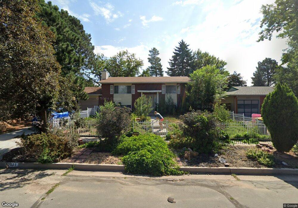
2011 Wold Ave Colorado Springs, CO 80909
Village Seven NeighborhoodEstimated Value: $383,737 - $435,000
4
Beds
1
Bath
1,862
Sq Ft
$215/Sq Ft
Est. Value
About This Home
This home is located at 2011 Wold Ave, Colorado Springs, CO 80909 and is currently estimated at $400,684, approximately $215 per square foot. 2011 Wold Ave is a home located in El Paso County with nearby schools including Madison Elementary School, Sabin Middle School, and Mitchell High School.
Ownership History
Date
Name
Owned For
Owner Type
Purchase Details
Closed on
Jan 6, 2021
Sold by
Briggs Mark Steven
Bought by
Mclean Laura
Current Estimated Value
Home Financials for this Owner
Home Financials are based on the most recent Mortgage that was taken out on this home.
Original Mortgage
$10,978
Outstanding Balance
$9,798
Interest Rate
2.71%
Mortgage Type
Stand Alone Second
Estimated Equity
$390,886
Purchase Details
Closed on
Sep 1, 1993
Bought by
Briggs Mark S and Briggs Cynthia M
Purchase Details
Closed on
Jul 24, 1992
Bought by
Briggs Mark S and Briggs Cynthia M
Purchase Details
Closed on
Feb 2, 1989
Bought by
Briggs Mark S and Briggs Cynthia M
Create a Home Valuation Report for This Property
The Home Valuation Report is an in-depth analysis detailing your home's value as well as a comparison with similar homes in the area
Home Values in the Area
Average Home Value in this Area
Purchase History
| Date | Buyer | Sale Price | Title Company |
|---|---|---|---|
| Mclean Laura | -- | Empire Title Co Springs Llc | |
| Mclean Laura | $305,000 | Empire Title Co Springs Llc | |
| Briggs Mark S | $84,900 | -- | |
| Briggs Mark S | $43,000 | -- | |
| Briggs Mark S | -- | -- |
Source: Public Records
Mortgage History
| Date | Status | Borrower | Loan Amount |
|---|---|---|---|
| Open | Mclean Laura | $10,978 | |
| Open | Mclean Laura | $295,850 |
Source: Public Records
Tax History Compared to Growth
Tax History
| Year | Tax Paid | Tax Assessment Tax Assessment Total Assessment is a certain percentage of the fair market value that is determined by local assessors to be the total taxable value of land and additions on the property. | Land | Improvement |
|---|---|---|---|---|
| 2025 | $1,292 | $26,860 | -- | -- |
| 2024 | $1,179 | $27,650 | $5,490 | $22,160 |
| 2022 | $1,105 | $19,750 | $4,170 | $15,580 |
| 2021 | $1,199 | $20,320 | $4,290 | $16,030 |
| 2020 | $1,074 | $15,830 | $3,720 | $12,110 |
| 2019 | $1,069 | $15,830 | $3,720 | $12,110 |
| 2018 | $1,038 | $14,150 | $3,240 | $10,910 |
| 2017 | $983 | $14,150 | $3,240 | $10,910 |
| 2016 | $735 | $12,680 | $2,710 | $9,970 |
| 2015 | $732 | $12,680 | $2,710 | $9,970 |
| 2014 | $706 | $11,740 | $2,710 | $9,030 |
Source: Public Records
Map
Nearby Homes
- 2030 Bryant Ave
- 2006 Devon St
- 2021 N Academy Blvd
- 3916 Constitution Ave
- 2103 Greenwich Cir E
- 4017 Loring Cir N
- 4011 Loring Cir N
- The Cedar Plan at Paint Brush Hills
- The Grand Royal Plan at Paint Brush Hills
- The Garden Plan at Paint Brush Hills
- 1927 N Academy Blvd
- 2210 Greenwich Cir W
- 2335 Zane Place
- 2215 Northglen Dr
- 2219 Stratford Ln
- 2043 Sussex Ln
- 4307 Valli Vista Rd
- 1940 Sussex Ln
- 1625 N Murray Blvd Unit 230
- 1625 N Murray Blvd Unit 142