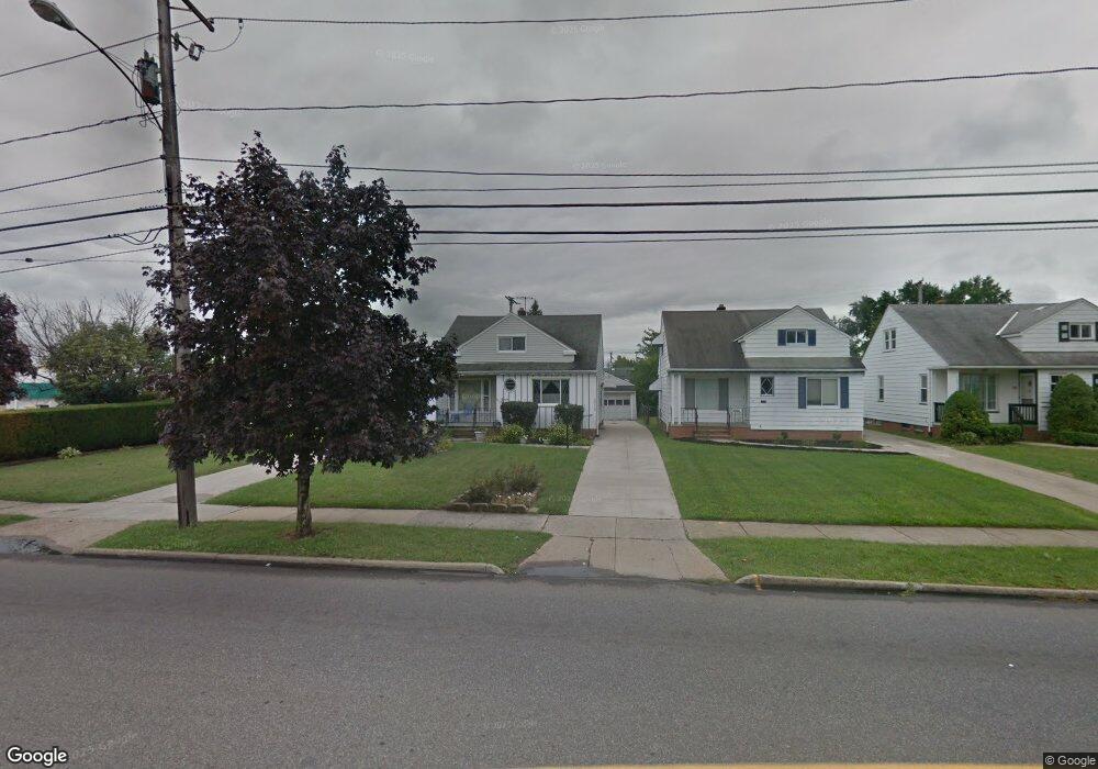
20112 Libby Rd Maple Heights, OH 44137
Estimated Value: $108,000 - $144,000
3
Beds
1
Bath
1,240
Sq Ft
$101/Sq Ft
Est. Value
About This Home
This home is located at 20112 Libby Rd, Maple Heights, OH 44137 and is currently estimated at $124,707, approximately $100 per square foot. 20112 Libby Rd is a home located in Cuyahoga County with nearby schools including Abraham Lincoln Elementary School, Rockside/ J.F. Kennedy School, and Barack Obama School.
Ownership History
Date
Name
Owned For
Owner Type
Purchase Details
Closed on
Nov 10, 2025
Sold by
Williams Mildred
Bought by
Williams Michael
Current Estimated Value
Purchase Details
Closed on
Jun 29, 1987
Sold by
Lerchbacher Mark C
Bought by
Williams Mildred
Purchase Details
Closed on
Sep 6, 1985
Bought by
Lerchbacher Mark C
Purchase Details
Closed on
Apr 22, 1985
Sold by
Holsopple Donna Rae
Bought by
Transohio Savings Bank.
Purchase Details
Closed on
Sep 13, 1979
Sold by
Marnick Jos F and Marnick Prina A
Bought by
Holsopple Donna Rae
Purchase Details
Closed on
Jan 1, 1975
Bought by
Marnick Jos F and Marnick Prina A
Create a Home Valuation Report for This Property
The Home Valuation Report is an in-depth analysis detailing your home's value as well as a comparison with similar homes in the area
Home Values in the Area
Average Home Value in this Area
Purchase History
| Date | Buyer | Sale Price | Title Company |
|---|---|---|---|
| Williams Michael | -- | None Listed On Document | |
| Williams Mildred | $48,000 | -- | |
| Lerchbacher Mark C | $42,000 | -- | |
| Transohio Savings Bank. | $29,000 | -- | |
| Holsopple Donna Rae | $45,100 | -- | |
| Marnick Jos F | -- | -- |
Source: Public Records
Tax History
| Year | Tax Paid | Tax Assessment Tax Assessment Total Assessment is a certain percentage of the fair market value that is determined by local assessors to be the total taxable value of land and additions on the property. | Land | Improvement |
|---|---|---|---|---|
| 2024 | $2,585 | $38,955 | $5,250 | $33,705 |
| 2023 | $1,634 | $24,470 | $4,240 | $20,230 |
| 2022 | $1,666 | $24,465 | $4,235 | $20,230 |
| 2021 | $1,777 | $24,470 | $4,240 | $20,230 |
| 2020 | $1,293 | $18,550 | $3,220 | $15,330 |
| 2019 | $1,282 | $53,000 | $9,200 | $43,800 |
| 2018 | $53 | $18,550 | $3,220 | $15,330 |
| 2017 | $1,236 | $18,000 | $4,170 | $13,830 |
| 2016 | $1,192 | $18,000 | $4,170 | $13,830 |
| 2015 | $1,278 | $18,000 | $4,170 | $13,830 |
| 2014 | $1,278 | $19,780 | $4,590 | $15,190 |
Source: Public Records
Map
Nearby Homes
- 5147 Warrensville Center Rd
- 19289 Stafford Ave
- 19520 Maple Heights Blvd
- 20806 Clare Ave
- 20905 Clare Ave
- 19931 Raymond St
- 20517 Raymond St
- 21202 Gardenview Dr
- 20600 Watson Rd
- 5165 Camden Rd
- 21202 Hillgrove Ave
- 20715 Watson Rd
- 5194 Homewood Ave
- 21207 Franklin Rd
- 20705 Hansen Rd
- 18909 Maple Heights Blvd
- 19113 Watercrest Ave
- 21607 Libby Rd
- 5409 Hollywood Ave
- 20648 Donny Brook Rd
- 20108 Libby Rd
- 20116 Libby Rd
- 20104 Libby Rd
- 20017 Stockton Ave
- 20100 Libby Rd
- 20013 Stockton Ave
- 20009 Stockton Ave
- 20016 Libby Rd
- 20005 Stockton Ave
- 20012 Libby Rd
- 20115 Libby Rd
- 20119 Libby Rd
- 20103 Libby Rd
- 20001 Stockton Ave
- 20008 Libby Rd
- 20019 Libby Rd
- 20017 Libby Rd
- 19917 Stockton Ave
- 20004 Libby Rd
- 5264 Warrensville Center Rd
Your Personal Tour Guide
Ask me questions while you tour the home.