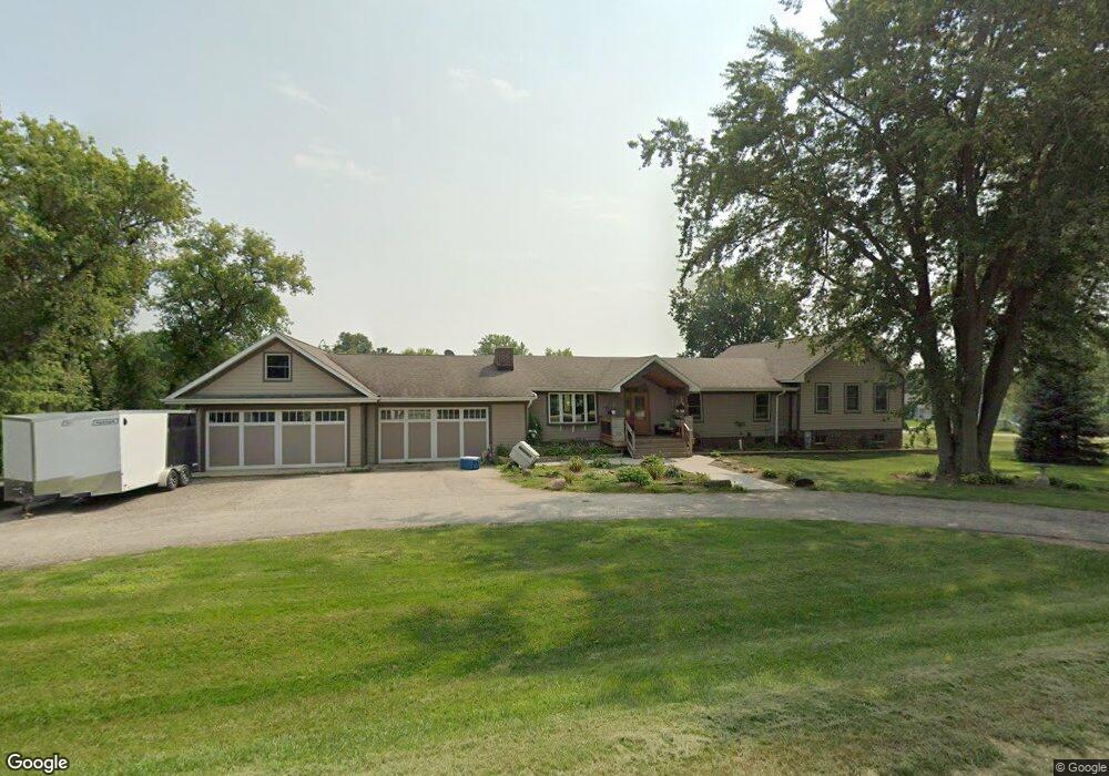
20115 W Coral Rd Marengo, IL 60152
Riley NeighborhoodEstimated Value: $460,334 - $535,000
Studio
--
Bath
--
Sq Ft
2
Acres
About This Home
This home is located at 20115 W Coral Rd, Marengo, IL 60152 and is currently estimated at $509,445. 20115 W Coral Rd is a home located in McHenry County with nearby schools including Riley Community Consolidated School District 18, Marengo Community High School, and Zion Lutheran School.
Ownership History
Date
Name
Owned For
Owner Type
Purchase Details
Closed on
Mar 13, 2025
Sold by
Beisner Paul R and Beisner Caryn A
Bought by
Paul R Beisner And Caryn A Beisner Marital Tr and Beisner
Current Estimated Value
Create a Home Valuation Report for This Property
The Home Valuation Report is an in-depth analysis detailing your home's value as well as a comparison with similar homes in the area
Home Values in the Area
Average Home Value in this Area
Purchase History
| Date | Buyer | Sale Price | Title Company |
|---|---|---|---|
| Paul R Beisner And Caryn A Beisner Marital Tr | -- | None Listed On Document |
Source: Public Records
Tax History
| Year | Tax Paid | Tax Assessment Tax Assessment Total Assessment is a certain percentage of the fair market value that is determined by local assessors to be the total taxable value of land and additions on the property. | Land | Improvement |
|---|---|---|---|---|
| 2024 | $6,390 | $135,905 | $11,020 | $124,885 |
| 2023 | $8,334 | $121,106 | $9,820 | $111,286 |
| 2022 | $8,389 | $111,045 | $9,004 | $102,041 |
| 2021 | $5,968 | $102,886 | $8,342 | $94,544 |
| 2020 | $7,857 | $97,264 | $7,886 | $89,378 |
| 2019 | $8,371 | $93,094 | $7,548 | $85,546 |
| 2018 | $7,999 | $90,005 | $5,806 | $84,199 |
| 2017 | $7,856 | $87,003 | $5,612 | $81,391 |
| 2016 | $7,765 | $83,689 | $5,398 | $78,291 |
| 2013 | -- | $90,501 | $20,201 | $70,300 |
Source: Public Records
Map
Nearby Homes
- 8808 S Hill Rd
- 935 Courtney Ln
- 0 Ratfield Rd
- 725 Cloverleaf Dr
- 509 Lynnann Ct
- 18708 Beck Rd
- 0 S Grant Hwy
- 600 Spring Dr
- 19923 E Grant Hwy
- 832 Mary Ct
- 5 Lindow Ave
- 8 Lindow Ave
- 6 Lindow Ave
- 737 E Grant Hwy
- 214 S Prospect St
- 832 Oak Manor Dr
- 7441 Great Northern Trail
- 422 Damen St
- 22105 Anthony Rd
- 704 Echo (Lot 21) Trail
- 20111 W Coral Rd
- 0 W Coral Rd
- 7915 S Hill Rd
- 20110 W Coral Rd
- 8012 S Hill Rd
- 20120 W Coral Rd
- 20107 W Coral Rd
- 8013 S Hill Rd
- 7907 N Hill Rd
- 20104 W Coral Rd
- 8014 S Hill Rd
- 20217 W Coral Rd
- 20218 W Coral Rd
- 7808 N Hill Rd
- 8015 S Hill Rd
- 8106 S Hill Rd
- 20307 W Coral Rd
- 7719 N Hill Rd
- 8105 S Hill Rd
- 20312 W Coral Rd
