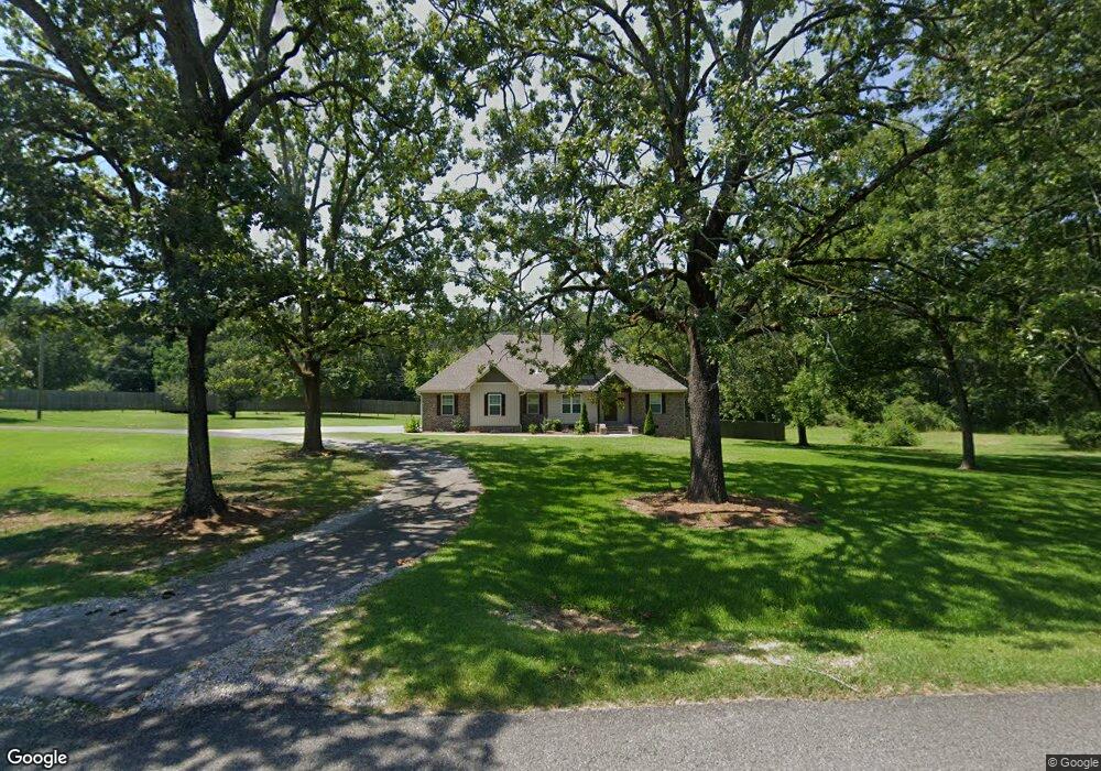
2012 Alfords Bend Rd Gadsden, AL 35903
Estimated Value: $248,000 - $315,191
--
Bed
1
Bath
1,721
Sq Ft
$165/Sq Ft
Est. Value
About This Home
This home is located at 2012 Alfords Bend Rd, Gadsden, AL 35903 and is currently estimated at $283,548, approximately $164 per square foot. 2012 Alfords Bend Rd is a home located in Etowah County with nearby schools including Hokes Bluff Elementary School, Hokes Bluff Middle School, and Hokes Bluff High School.
Ownership History
Date
Name
Owned For
Owner Type
Purchase Details
Closed on
Jul 8, 2019
Sold by
Scott Timothy D and Scott Teri G
Bought by
Humphrey Robin
Current Estimated Value
Purchase Details
Closed on
Jan 31, 2019
Sold by
Thomas Jami L and Lankford Johnnie R
Bought by
Scott Timothy D and Scott Teri G
Purchase Details
Closed on
Sep 5, 2017
Sold by
Estate Of Johnnie Ross Lankford
Bought by
Lankford Jami L and Lankford Johnnie R
Purchase Details
Closed on
Aug 14, 2017
Sold by
Nunnally Jacob and Miranda Shelby Nunnally
Bought by
Thomas Jami L and Lankford Ii Johnnie R
Create a Home Valuation Report for This Property
The Home Valuation Report is an in-depth analysis detailing your home's value as well as a comparison with similar homes in the area
Home Values in the Area
Average Home Value in this Area
Purchase History
| Date | Buyer | Sale Price | Title Company |
|---|---|---|---|
| Humphrey Robin | $19,500 | -- | |
| Scott Timothy D | $22,000 | -- | |
| Lankford Jami L | -- | None Available | |
| Thomas Jami L | $3,200 | None Available |
Source: Public Records
Tax History Compared to Growth
Tax History
| Year | Tax Paid | Tax Assessment Tax Assessment Total Assessment is a certain percentage of the fair market value that is determined by local assessors to be the total taxable value of land and additions on the property. | Land | Improvement |
|---|---|---|---|---|
| 2024 | $1,091 | $27,800 | $1,780 | $26,020 |
| 2023 | $1,091 | $27,780 | $1,770 | $26,010 |
| 2022 | $898 | $23,090 | $1,770 | $21,320 |
| 2021 | $692 | $18,060 | $1,790 | $16,270 |
| 2020 | $89 | $2,180 | $0 | $0 |
| 2019 | $178 | $4,340 | $0 | $0 |
| 2017 | $153 | $3,720 | $0 | $0 |
| 2016 | $0 | $6,180 | $0 | $0 |
| 2015 | -- | $6,180 | $0 | $0 |
| 2013 | -- | $6,200 | $0 | $0 |
Source: Public Records
Map
Nearby Homes
- 2515 Cedar Ridge Cir
- 2420 Cedar Ridge Cir
- 23 acres Appalachian Hwy
- 2440 Bluff Haven Ln
- 2295 Cypress Bend Cir
- 2275 Cypress Bend Cir
- 2425 Bluff Haven Ln
- .44 ac Hackberry Ln
- .31 Ac Lot Hackberry Ln
- 95 Hayes Dr
- 2130 Clinton Place
- 41 Acres/298 Spinks Dr
- 5102 Main St
- 0 Alford Bend Rd Unit 21422369
- 5.79 Acres Appalachian Hwy
- 495 Bluebird Ln
- 5415 Leigh Ave
- 0 Eastview Ave Unit 21423262
- 5111 Louise St
- 5425 4th St
- 2038 Alfords Bend Rd
- 1948 Alford Bend Rd
- 2090 Johnson Dr N
- 1957 Alfords Bend Rd
- 2110 Johnson Dr N
- 1940 Alford Bend Rd
- 2075 Alfords Bend Rd
- 1931 Alfords Bend Rd
- 2092 Alford Bend Rd
- 2188 Johnson Dr N
- 2167 Alford Bend Rd
- 1868 Appalachian Hwy
- 1902 Alfords Bend Rd
- 2525 Cedar Ridge Cir
- 1971 Appalachian Hwy
- 1853 Alfords Bend Rd
- 2535 Cedar Ridge Cir
- 0 Appalachian Hwy Unit 1100883
- 0 Appalachian Hwy Unit 1084957
- 0 Appalachian Hwy Unit 331907