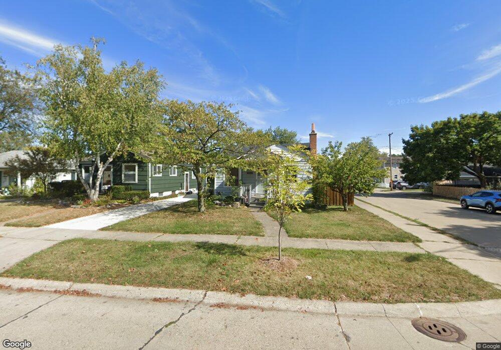
2012 Buckingham Ave Berkley, MI 48072
Estimated Value: $270,000 - $352,000
3
Beds
1
Bath
980
Sq Ft
$318/Sq Ft
Est. Value
About This Home
This home is located at 2012 Buckingham Ave, Berkley, MI 48072 and is currently estimated at $311,771, approximately $318 per square foot. 2012 Buckingham Ave is a home located in Oakland County with nearby schools including Angell Elementary School, Anderson Middle School, and Berkley High School.
Ownership History
Date
Name
Owned For
Owner Type
Purchase Details
Closed on
Jan 21, 2009
Sold by
Mcpherson Jodi N and Ehrlich Jodi N
Bought by
Mcpherson Scott and Mcpherson Jodi N
Current Estimated Value
Purchase Details
Closed on
Jan 26, 2001
Sold by
Robert C Brown Tr
Bought by
Ehrlich Jodi N
Home Financials for this Owner
Home Financials are based on the most recent Mortgage that was taken out on this home.
Original Mortgage
$116,000
Outstanding Balance
$40,360
Interest Rate
7.1%
Estimated Equity
$271,411
Purchase Details
Closed on
Oct 29, 1999
Sold by
Brown Robert C
Bought by
Robert C Brown Tr
Create a Home Valuation Report for This Property
The Home Valuation Report is an in-depth analysis detailing your home's value as well as a comparison with similar homes in the area
Home Values in the Area
Average Home Value in this Area
Purchase History
| Date | Buyer | Sale Price | Title Company |
|---|---|---|---|
| Mcpherson Scott | -- | None Available | |
| Ehrlich Jodi N | $145,000 | -- | |
| Robert C Brown Tr | -- | -- |
Source: Public Records
Mortgage History
| Date | Status | Borrower | Loan Amount |
|---|---|---|---|
| Open | Ehrlich Jodi N | $116,000 |
Source: Public Records
Tax History
| Year | Tax Paid | Tax Assessment Tax Assessment Total Assessment is a certain percentage of the fair market value that is determined by local assessors to be the total taxable value of land and additions on the property. | Land | Improvement |
|---|---|---|---|---|
| 2025 | $2,964 | $128,380 | $0 | $0 |
| 2024 | $2,812 | $121,630 | $0 | $0 |
| 2023 | $2,534 | $112,460 | $0 | $0 |
| 2022 | $2,532 | $103,490 | $0 | $0 |
| 2021 | $2,476 | $99,550 | $0 | $0 |
| 2020 | $2,369 | $96,260 | $0 | $0 |
| 2019 | $2,487 | $90,210 | $0 | $0 |
| 2018 | $2,378 | $82,430 | $0 | $0 |
| 2017 | $2,348 | $80,090 | $0 | $0 |
| 2016 | $2,370 | $76,470 | $0 | $0 |
| 2015 | -- | $70,240 | $0 | $0 |
| 2014 | -- | $63,430 | $0 | $0 |
| 2011 | -- | $58,180 | $0 | $0 |
Source: Public Records
Map
Nearby Homes
- 1888 Griffith Ave
- 2893 Harvard Rd
- 14611 Kingston St
- 2266 Robina Ave
- 1799 Phillips Ave
- 1975 Kipling Ave
- 2863 Columbia Rd
- 14421 Labelle St
- 2654 Royal Ave
- 3050 Catalpa Dr
- 2076 Thomas Ave
- 2679 Oxford Rd
- 14670 Talbot St
- 14710 Loretta Place
- 2795 Robina Ave
- 2828 Robina Ave
- 2438 Columbia Rd
- 13680 Borgman St
- 2427 Harvard Rd
- 2813 Kipling Ave
- 2024 Buckingham Ave
- 2036 Buckingham Ave
- 1992 Buckingham Ave
- 2011 Tyler Ave
- 2023 Tyler Ave
- 2062 Buckingham Ave
- 1991 Tyler Ave
- 1972 Buckingham Ave
- 2053 Tyler Ave
- 1979 Tyler Ave
- 2011 Buckingham Ave
- 1952 Buckingham Ave
- 2071 Tyler Ave
- 1991 Buckingham Ave Unit Bldg-Unit
- 1965 Tyler Ave
- 2043 Buckingham Ave
- 2086 Buckingham Ave
- 1975 Buckingham Ave
- 2085 Tyler Ave
- 2059 Buckingham Ave
Your Personal Tour Guide
Ask me questions while you tour the home.