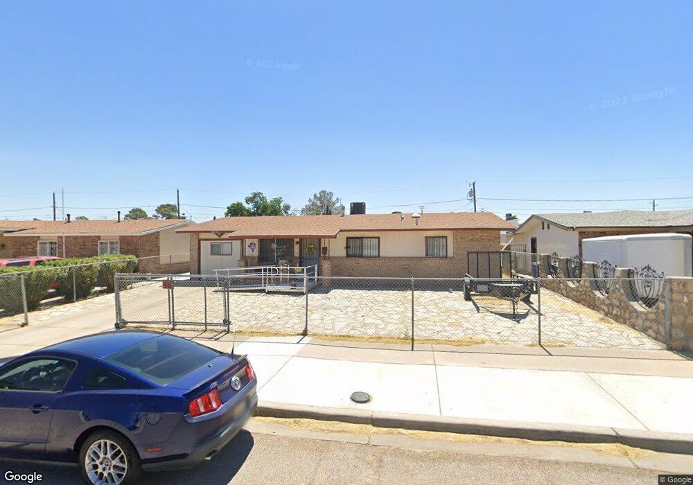
2012 Diciembre Dr El Paso, TX 79935
Pico Norte NeighborhoodEstimated Value: $195,325 - $227,000
3
Beds
2
Baths
1,350
Sq Ft
$153/Sq Ft
Est. Value
About This Home
This home is located at 2012 Diciembre Dr, El Paso, TX 79935 and is currently estimated at $206,581, approximately $153 per square foot. 2012 Diciembre Dr is a home located in El Paso County with nearby schools including Vista Hills Elementary School, J M Hanks High School, and St. Raphael School.
Ownership History
Date
Name
Owned For
Owner Type
Purchase Details
Closed on
Dec 17, 1998
Sold by
Williams Olive and Dc Estate Of Charles Hayden Willi
Bought by
Rawlins Mark Allen and Rawlins Dianne
Current Estimated Value
Home Financials for this Owner
Home Financials are based on the most recent Mortgage that was taken out on this home.
Original Mortgage
$57,500
Outstanding Balance
$13,140
Interest Rate
6.85%
Mortgage Type
VA
Estimated Equity
$193,441
Purchase Details
Closed on
Dec 19, 1995
Sold by
Ranson Frank and Ranson Shirley Ann
Bought by
Majestic Realtors Inc
Create a Home Valuation Report for This Property
The Home Valuation Report is an in-depth analysis detailing your home's value as well as a comparison with similar homes in the area
Home Values in the Area
Average Home Value in this Area
Purchase History
| Date | Buyer | Sale Price | Title Company |
|---|---|---|---|
| Rawlins Mark Allen | -- | -- | |
| Majestic Realtors Inc | -- | -- |
Source: Public Records
Mortgage History
| Date | Status | Borrower | Loan Amount |
|---|---|---|---|
| Open | Rawlins Mark Allen | $57,500 |
Source: Public Records
Tax History Compared to Growth
Tax History
| Year | Tax Paid | Tax Assessment Tax Assessment Total Assessment is a certain percentage of the fair market value that is determined by local assessors to be the total taxable value of land and additions on the property. | Land | Improvement |
|---|---|---|---|---|
| 2025 | -- | $176,681 | -- | -- |
| 2024 | -- | $160,619 | -- | -- |
| 2023 | $4,250 | $146,017 | $0 | $0 |
| 2022 | $4,122 | $132,743 | $0 | $0 |
| 2021 | $3,923 | $120,675 | $19,374 | $101,301 |
| 2020 | $3,593 | $113,765 | $17,586 | $96,179 |
| 2018 | $3,669 | $117,973 | $17,586 | $100,387 |
| 2017 | $2,959 | $96,813 | $17,586 | $79,227 |
| 2016 | $2,959 | $96,813 | $17,586 | $79,227 |
| 2015 | $2,187 | $96,813 | $17,586 | $79,227 |
| 2014 | $2,187 | $100,101 | $17,586 | $82,515 |
Source: Public Records
Map
Nearby Homes
- 2000 Solano Dr
- 1844 Jack Nicklaus Dr Unit 1846
- 2109 Febrero Dr
- 2153 Trawood Dr
- 2201 Trawood Dr
- 2313 Frank Beard Dr
- 2105 Pacheco Dr
- 1730 Bara Dr
- 2325 Ken Venturi Ln
- 2001 Bobby Jones Dr Unit A
- 2009 Bobby Jones Dr Unit B
- 2224 Escarpa Dr
- 1901 Bobby Jones Dr
- 1955 Trawood Dr Unit 12
- 1644 Lomaland Dr Unit 169
- 11012 Bob Stone Dr
- 11016 Bob Stone Dr
- 1909 Crow Dr
- 11013 Bob Stone Dr
- 10916 Miller Barber Dr
- 2016 Diciembre Dr
- 2008 Diciembre Dr
- 2013 Solano Dr
- 2017 Solano Dr
- 2004 Diciembre Dr
- 2009 Solano Dr
- 2018 Diciembre Dr
- 2021 Solano Dr
- 2005 Solano Dr
- 2013 Diciembre Dr
- 2009 Diciembre Dr
- 2020 Diciembre Dr
- 2000 Diciembre Dr
- 2017 Diciembre Dr
- 2005 Diciembre Dr
- 2025 Solano Dr
- 2001 Solano Dr
- 2021 Diciembre Dr
- 2024 Diciembre Dr
- 2001 Diciembre Dr