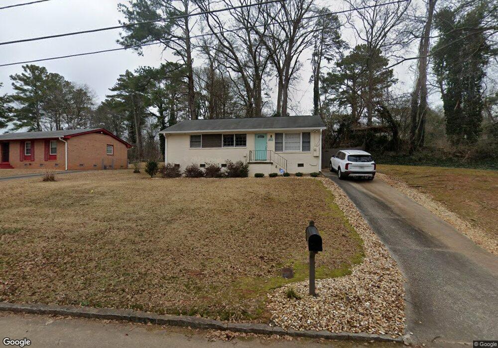
2012 E Starmount Way Decatur, GA 30032
East Lake NeighborhoodEstimated Value: $222,127 - $313,000
3
Beds
1
Bath
1,040
Sq Ft
$245/Sq Ft
Est. Value
About This Home
This home is located at 2012 E Starmount Way, Decatur, GA 30032 and is currently estimated at $254,282, approximately $244 per square foot. 2012 E Starmount Way is a home located in DeKalb County with nearby schools including McNair Middle School, McNair High School, and Charles Drew Charter School.
Ownership History
Date
Name
Owned For
Owner Type
Purchase Details
Closed on
Nov 20, 2020
Sold by
Armstrong Willie Seal
Bought by
Armstrong & Hutch Llc
Current Estimated Value
Purchase Details
Closed on
Nov 15, 2019
Sold by
West Parrie Lee Estate
Bought by
Armstrong Willie Seal
Create a Home Valuation Report for This Property
The Home Valuation Report is an in-depth analysis detailing your home's value as well as a comparison with similar homes in the area
Home Values in the Area
Average Home Value in this Area
Purchase History
| Date | Buyer | Sale Price | Title Company |
|---|---|---|---|
| Armstrong & Hutch Llc | -- | -- | |
| Armstrong Willie Seal | -- | -- |
Source: Public Records
Tax History Compared to Growth
Tax History
| Year | Tax Paid | Tax Assessment Tax Assessment Total Assessment is a certain percentage of the fair market value that is determined by local assessors to be the total taxable value of land and additions on the property. | Land | Improvement |
|---|---|---|---|---|
| 2025 | $4,297 | $87,040 | $38,298 | $48,742 |
| 2024 | $4,294 | $87,040 | $38,298 | $48,742 |
| 2023 | $4,294 | $87,040 | $38,480 | $48,560 |
| 2022 | $3,220 | $64,680 | $30,400 | $34,280 |
| 2021 | $3,220 | $64,680 | $30,400 | $34,280 |
| 2020 | $2,794 | $64,680 | $30,400 | $34,280 |
| 2019 | $2,238 | $66,000 | $11,400 | $54,600 |
| 2018 | $1,680 | $60,880 | $11,400 | $49,480 |
| 2017 | $1,711 | $48,920 | $6,000 | $42,920 |
| 2016 | $1,487 | $43,600 | $6,000 | $37,600 |
| 2014 | $421 | $12,160 | $3,040 | $9,120 |
Source: Public Records
Map
Nearby Homes
- 2004 E Starmount Way
- 2007 Mcafee Place
- 2007 Mcafee Place
- 2003 Mcafee Place
- 2011 Mcafee Place
- 1994 E Starmount Way
- 1997 Mcafee Place
- 2141 Garden Cir
- 1988 E Starmount Way
- 1985 Mcafee Place
- 2137 Garden Cir
- 1982 E Starmount Way
- 1979 Mcafee Place
- 2137 Mcafee Rd
- 2107 Mcafee Rd
- 2131 Garden Cir
- 2006 Mcafee Place
- 2002 Mcafee Place
- 2002 Mcafee Place Unit 2002
- 2010 Mcafee Place