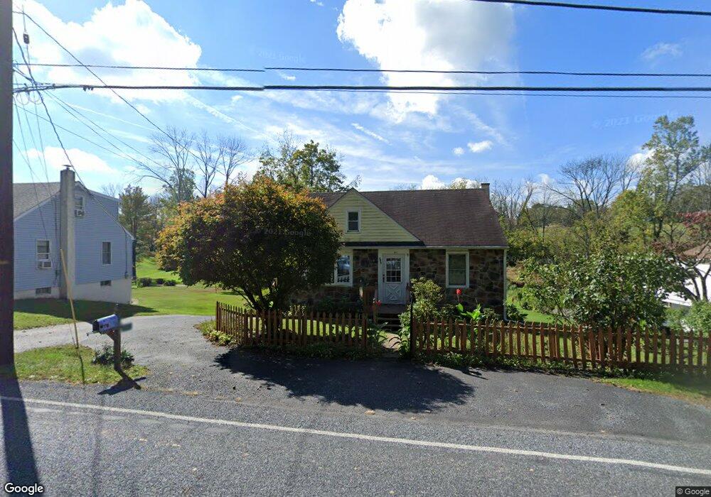
2012 Farmington Ave Pottstown, PA 19464
Estimated Value: $231,816 - $313,000
2
Beds
1
Bath
1,165
Sq Ft
$242/Sq Ft
Est. Value
About This Home
This home is located at 2012 Farmington Ave, Pottstown, PA 19464 and is currently estimated at $282,204, approximately $242 per square foot. 2012 Farmington Ave is a home located in Berks County with nearby schools including Boyertown Area Senior High School.
Ownership History
Date
Name
Owned For
Owner Type
Purchase Details
Closed on
May 23, 1958
Bought by
Berger William H and Berger Mildred D
Current Estimated Value
Create a Home Valuation Report for This Property
The Home Valuation Report is an in-depth analysis detailing your home's value as well as a comparison with similar homes in the area
Home Values in the Area
Average Home Value in this Area
Purchase History
| Date | Buyer | Sale Price | Title Company |
|---|---|---|---|
| Berger William H | -- | -- |
Source: Public Records
Tax History Compared to Growth
Tax History
| Year | Tax Paid | Tax Assessment Tax Assessment Total Assessment is a certain percentage of the fair market value that is determined by local assessors to be the total taxable value of land and additions on the property. | Land | Improvement |
|---|---|---|---|---|
| 2025 | $1,021 | $73,400 | $33,800 | $39,600 |
| 2024 | $3,234 | $73,400 | $33,800 | $39,600 |
| 2023 | $3,118 | $73,400 | $33,800 | $39,600 |
| 2022 | $3,054 | $73,400 | $33,800 | $39,600 |
| 2021 | $2,984 | $73,400 | $33,800 | $39,600 |
| 2020 | $2,884 | $73,400 | $33,800 | $39,600 |
| 2019 | $2,813 | $73,400 | $33,800 | $39,600 |
| 2018 | $2,714 | $73,400 | $33,800 | $39,600 |
| 2017 | $2,565 | $73,400 | $33,800 | $39,600 |
| 2016 | $783 | $73,400 | $33,800 | $39,600 |
| 2015 | $768 | $73,400 | $33,800 | $39,600 |
| 2014 | $696 | $73,400 | $33,800 | $39,600 |
Source: Public Records
Map
Nearby Homes
- 318 Haven Dr
- 314 Haven Dr
- 302 Haven Dr
- 296 Haven Dr
- 290 Haven Dr
- Laurel Plan at Pottsgrove Hunt - 55+
- NEUVILLE Plan at Pottsgrove Hunt - 55+
- Lismore Plan at Pottsgrove Hunt - 55+
- 157 Forage Cir
- 284 Haven Dr
- 278 Haven Dr
- 145 Forage Cir
- 201 Lilly Dr
- 158 Lilly Dr
- 164 Birdsong Way
- 141 Greshville Rd
- 110 Lilly Dr
- 1016 Fallbrook Ln
- 126 Pine Ford Rd Unit 65
- 2146 Gilbertsville Rd
- 2010 Farmington Ave
- 2016 Farmington Ave
- 2006 Farmington Ave
- 2018 Farmington Ave
- 2004 Farmington Ave
- 2002 Farmington Ave
- 2 Farmington Ct
- 2000 Farmington Ave
- 1931 Farmington Ave
- 1940 Farmington Ave
- 1925 Farmington Ave
- 1913 Farmington Ave
- 1922 Farmington Ave
- 2037 Farmington Ave
- 1905 Farmington Ave
- 1959 Gross Rd
- 1887 Farmington Ave
- 1961 Gross Rd
- 1950 Gross Rd
- 1879 Farmington Ave