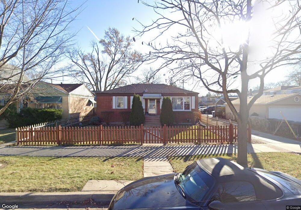
2012 Foster St Evanston, IL 60201
West Evanston NeighborhoodEstimated Value: $299,000 - $382,000
2
Beds
1
Bath
1,000
Sq Ft
$336/Sq Ft
Est. Value
About This Home
This home is located at 2012 Foster St, Evanston, IL 60201 and is currently estimated at $335,944, approximately $335 per square foot. 2012 Foster St is a home located in Cook County with nearby schools including Kingsley Elementary School, Haven Middle School, and Evanston Township High School.
Ownership History
Date
Name
Owned For
Owner Type
Purchase Details
Closed on
May 16, 2003
Sold by
Edwards Anthony and Laird Edwards Rosemarie
Bought by
Mendoza Jaime
Current Estimated Value
Home Financials for this Owner
Home Financials are based on the most recent Mortgage that was taken out on this home.
Original Mortgage
$178,600
Outstanding Balance
$75,149
Interest Rate
5.71%
Mortgage Type
Unknown
Estimated Equity
$260,795
Create a Home Valuation Report for This Property
The Home Valuation Report is an in-depth analysis detailing your home's value as well as a comparison with similar homes in the area
Home Values in the Area
Average Home Value in this Area
Purchase History
We collect this data history from publicly available records. To have your information removed, we recommend requesting removal directly through your county’s website.
| Date | Buyer | Sale Price | Title Company |
|---|---|---|---|
| Mendoza Jaime | $188,000 | Rtc | |
| Mendoza Jaime | $188,000 | Rtc |
Source: Public Records
Mortgage History
We collect this data history from publicly available records. To have your information removed, we recommend requesting removal directly through your county’s website.
| Date | Status | Borrower | Loan Amount |
|---|---|---|---|
| Open | Mendoza Jaime | $178,600 | |
| Closed | Mendoza Jaime | $178,600 |
Source: Public Records
Tax History
| Year | Tax Paid | Tax Assessment Tax Assessment Total Assessment is a certain percentage of the fair market value that is determined by local assessors to be the total taxable value of land and additions on the property. | Land | Improvement |
|---|---|---|---|---|
| 2025 | $2,541 | $18,456 | $4,531 | $13,925 |
| 2024 | $2,541 | $12,156 | $3,750 | $8,406 |
| 2023 | $2,426 | $12,156 | $3,750 | $8,406 |
| 2022 | $2,426 | $12,156 | $3,750 | $8,406 |
| 2021 | $1,759 | $8,294 | $3,437 | $4,857 |
| 2020 | $1,766 | $8,294 | $3,437 | $4,857 |
| 2019 | $1,780 | $9,310 | $3,437 | $5,873 |
| 2018 | $2,293 | $10,086 | $2,812 | $7,274 |
| 2017 | $2,241 | $10,086 | $2,812 | $7,274 |
| 2016 | $2,237 | $10,086 | $2,812 | $7,274 |
| 2015 | $2,334 | $10,015 | $2,421 | $7,594 |
| 2014 | $2,319 | $10,015 | $2,421 | $7,594 |
| 2013 | $2,258 | $10,015 | $2,421 | $7,594 |
Source: Public Records
Map
Nearby Homes
- 1901 Emerson St
- 2125 Emerson St
- 1822 Brown Ave
- 1832 Hovland Ct
- 2005 Darrow Ave
- 1836 Hartrey Ave
- 1819 Hartrey Ave
- 2106 Darrow Ave
- 2152 Grey Ave
- 1915 Dewey Ave
- 1844 Lemar Ave
- 1727 Dodge Ave
- 1715 Hartrey Ave
- 2144 Dewey Ave
- 1915 Grant St
- 2310 Brown Ave
- 1623 Church St
- 2323 Grey Ave
- 2026 Mcdaniel Ave
- 1727 Mcdaniel Ave Unit A
- 2008 Foster St
- 2008 Foster St
- 2008 Foster St Unit A
- 2004 Foster St
- 2012 Foster St
- 2000 Foster St
- 1934 Brown Ave
- 1932 Brown Ave
- 1928 Foster St
- 2005 Foster St
- 2005 Foster St Unit GDN
- 1945 Grey Ave
- 1939 Grey Ave
- 2007 Foster St
- 1937 Grey Ave
- 2011 Foster St
- 1935 Grey Ave
- 2015 Foster St
- 2017 Foster St
- 1924 Brown Ave
Your Personal Tour Guide
Ask me questions while you tour the home.