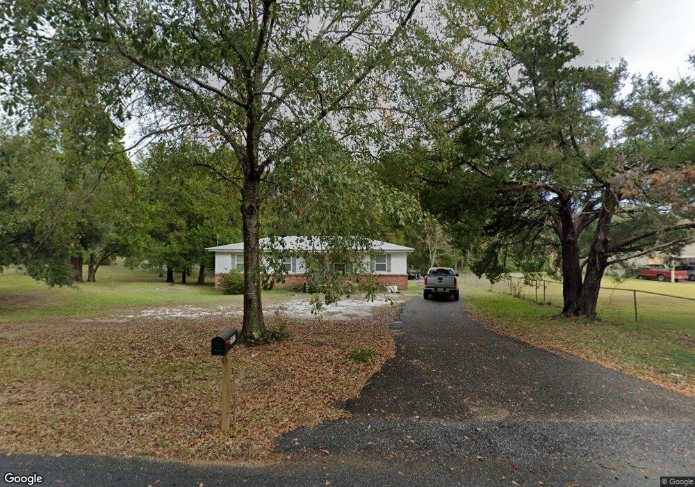
2012 Grider Rd Mobile, AL 36618
Colonial Heights NeighborhoodEstimated Value: $143,000 - $178,000
4
Beds
2
Baths
1,341
Sq Ft
$120/Sq Ft
Est. Value
About This Home
This home is located at 2012 Grider Rd, Mobile, AL 36618 and is currently estimated at $160,992, approximately $120 per square foot. 2012 Grider Rd is a home located in Mobile County with nearby schools including Orchard Elementary School, CL Scarborough Middle School, and Mattie T Blount High School.
Ownership History
Date
Name
Owned For
Owner Type
Purchase Details
Closed on
Apr 10, 2024
Sold by
Cowart Christopher Jay and Ferguson Kathie H
Bought by
Zimmerman Barry Lester and Zimmerman Cynthia
Current Estimated Value
Home Financials for this Owner
Home Financials are based on the most recent Mortgage that was taken out on this home.
Original Mortgage
$160,547
Outstanding Balance
$157,732
Interest Rate
6.94%
Mortgage Type
VA
Estimated Equity
$3,260
Purchase Details
Closed on
Oct 14, 2011
Sold by
Thomas Marie G and Thomas John Lloyd
Bought by
Cowart Christopher Jay and Ferguson Kathie H
Home Financials for this Owner
Home Financials are based on the most recent Mortgage that was taken out on this home.
Original Mortgage
$58,378
Interest Rate
4.26%
Mortgage Type
FHA
Purchase Details
Closed on
Nov 28, 2005
Sold by
Thomas Marie G
Bought by
Thomas John Lloyd and Stokes Annette Thomas
Create a Home Valuation Report for This Property
The Home Valuation Report is an in-depth analysis detailing your home's value as well as a comparison with similar homes in the area
Home Values in the Area
Average Home Value in this Area
Purchase History
| Date | Buyer | Sale Price | Title Company |
|---|---|---|---|
| Zimmerman Barry Lester | $166,500 | None Listed On Document | |
| Cowart Christopher Jay | $59,900 | Fmt | |
| Thomas John Lloyd | -- | -- |
Source: Public Records
Mortgage History
| Date | Status | Borrower | Loan Amount |
|---|---|---|---|
| Open | Zimmerman Barry Lester | $160,547 | |
| Previous Owner | Cowart Christopher Jay | $58,378 |
Source: Public Records
Tax History
| Year | Tax Paid | Tax Assessment Tax Assessment Total Assessment is a certain percentage of the fair market value that is determined by local assessors to be the total taxable value of land and additions on the property. | Land | Improvement |
|---|---|---|---|---|
| 2025 | $725 | $13,250 | $2,000 | $11,250 |
| 2024 | $725 | $8,820 | $2,000 | $6,820 |
| 2023 | $503 | $7,160 | $2,000 | $5,160 |
| 2022 | $289 | $5,080 | $1,080 | $4,000 |
| 2021 | $279 | $4,910 | $1,080 | $3,830 |
| 2020 | $297 | $5,190 | $1,510 | $3,680 |
| 2019 | $283 | $4,980 | $0 | $0 |
| 2018 | $283 | $4,980 | $0 | $0 |
| 2017 | $283 | $4,980 | $0 | $0 |
| 2016 | $360 | $6,200 | $0 | $0 |
| 2013 | $712 | $11,080 | $0 | $0 |
Source: Public Records
Map
Nearby Homes
- 0 Hall Rd Unit 7635847
- 2033 Morganthau Dr
- 0 Williamstowne Curve Unit 7687107
- 1613 Princess Helen Rd W
- 4601 Moffett Rd
- 0 Moffett Rd Unit 7717059
- 0 Moffett Rd Unit 7682624
- 0 Moffett Rd Unit 2
- 0 Moffett Rd Unit 7717031
- 0 Moffett Rd Unit 7549673
- 6513 Grace St
- 6406 Clear Pointe Ct
- 5700 Deerwood Dr N
- 6270 Lausanne Dr N
- 1600 Decatur St
- 6450 Moffett Rd
- 2551 Magnolia Grande Dr
- 6452 Tillery Dr
- 1313 Innsbruck Dr
- 1951 Highland Forest Dr
- 2006 Grider Rd
- 2054 Grider Rd
- 2051 Grider Rd
- 2000 Grider Rd
- 2042 Grider Rd
- 2062 Grider Rd
- 2001 Grider Rd
- 6149 Rose Hill Ln
- 1960 Grider Rd
- 6200 Summer Place Dr N
- 2531 Grider Rd Unit 3
- 6204 Summer Place Dr N
- 0 Grider Rd Unit 2 0220242
- 0 Grider Rd Unit 2
- 6208 Summer Place Dr N
- 1956 Grider Rd
- 2100 Grider Rd
- 6212 Summer Place Dr N
- 2101 Grider Rd
- 0 Rose Hill Ln Unit 635780
Your Personal Tour Guide
Ask me questions while you tour the home.