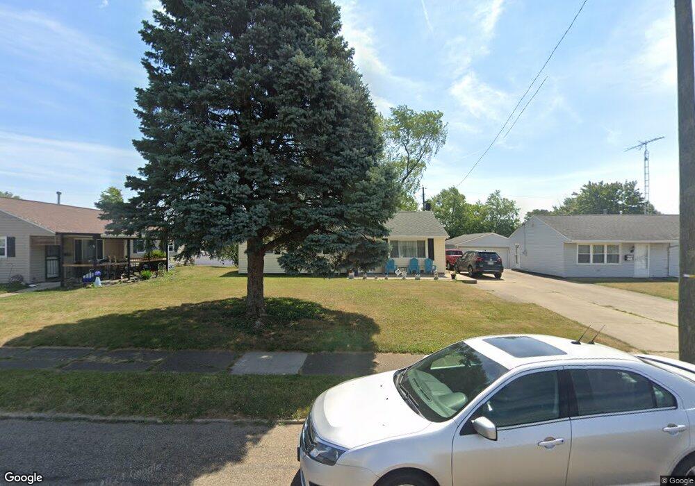
2012 Gridley Ave NE Canton, OH 44705
Fairmount NeighborhoodEstimated Value: $107,000 - $129,000
3
Beds
1
Bath
1,168
Sq Ft
$101/Sq Ft
Est. Value
About This Home
This home is located at 2012 Gridley Ave NE, Canton, OH 44705 and is currently estimated at $117,617, approximately $100 per square foot. 2012 Gridley Ave NE is a home located in Stark County with nearby schools including Belle Stone Elementary School, Early Learning Center @ Schreiber, and Youtz Intermediate School.
Ownership History
Date
Name
Owned For
Owner Type
Purchase Details
Closed on
Aug 5, 2024
Sold by
Williamson Keith A
Bought by
Williamson Keith A and Williamson Caroline M
Current Estimated Value
Create a Home Valuation Report for This Property
The Home Valuation Report is an in-depth analysis detailing your home's value as well as a comparison with similar homes in the area
Home Values in the Area
Average Home Value in this Area
Purchase History
| Date | Buyer | Sale Price | Title Company |
|---|---|---|---|
| Williamson Keith A | -- | None Listed On Document |
Source: Public Records
Tax History
| Year | Tax Paid | Tax Assessment Tax Assessment Total Assessment is a certain percentage of the fair market value that is determined by local assessors to be the total taxable value of land and additions on the property. | Land | Improvement |
|---|---|---|---|---|
| 2025 | -- | $35,040 | $4,940 | $30,100 |
| 2024 | -- | $35,040 | $4,940 | $30,100 |
| 2023 | $498 | $17,470 | $3,640 | $13,830 |
| 2022 | $511 | $17,470 | $3,640 | $13,830 |
| 2021 | $516 | $17,470 | $3,640 | $13,830 |
| 2020 | $386 | $14,570 | $3,050 | $11,520 |
| 2019 | $337 | $14,570 | $3,050 | $11,520 |
Source: Public Records
Map
Nearby Homes
- 1820 Midway Ave NE
- 1824 Root Ave NE
- 2012 Endrow Ave NE
- 2408 21st St NE
- 2102 Endrow Ave NE
- 2529 17th St NE
- 2215 Willowrow Ave NE
- 3106 22nd St NE
- 2208 Willowrow Ave NE
- 2103 Bollinger Ave NE
- 2322 21st St NE
- 1742 Taft Ave NE
- 2438 Indiana Way NE
- 2328 26th St NE
- 2616 Taft Ave NE
- 2211 17th St NE
- 2111 21st St NE
- 2216 17th St NE
- 2321 15th St NE
- 2329 Winfield Way NE
- 2016 Gridley Ave NE
- 2006 Gridley Ave NE
- 2022 Gridley Ave NE
- 2000 Gridley Ave NE
- 2019 Morris Ave NE
- 2007 Morris Ave NE
- 2013 Morris Ave NE
- 2025 Morris Ave NE
- 2001 Morris Ave NE
- 2028 Gridley Ave NE
- 1930 Gridley Ave NE
- 2015 Gridley Ave NE
- 2009 Gridley Ave NE
- 2003 Gridley Ave NE
- 2021 Gridley Ave NE
- 1931 Morris Ave NE
- 2101 Morris Ave NE
- 1933 Gridley Ave NE
- 1924 Gridley Ave NE
- 1924 Gridley Ave NE
Your Personal Tour Guide
Ask me questions while you tour the home.