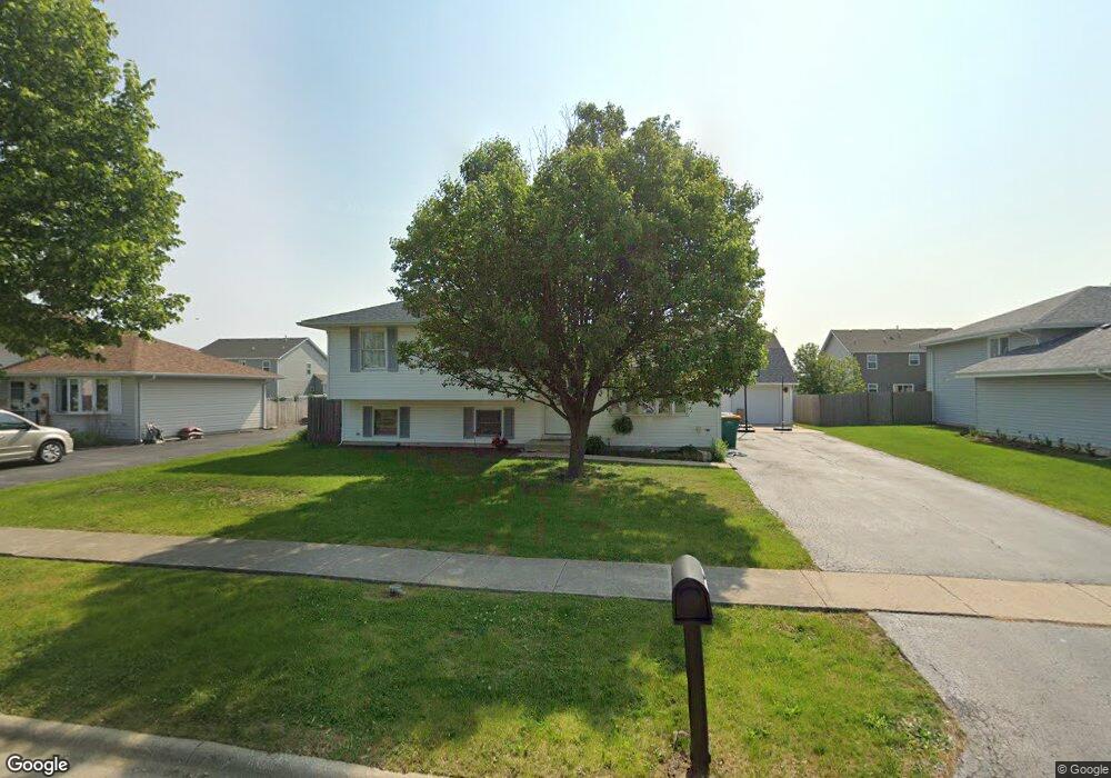
2012 Hastings Dr Plainfield, IL 60586
Fall Creek NeighborhoodEstimated Value: $340,184 - $371,000
3
Beds
2
Baths
1,792
Sq Ft
$198/Sq Ft
Est. Value
About This Home
This home is located at 2012 Hastings Dr, Plainfield, IL 60586 and is currently estimated at $355,546, approximately $198 per square foot. 2012 Hastings Dr is a home located in Will County with nearby schools including Thomas Jefferson Elementary School, Aux Sable Middle School, and Plainfield South High School.
Ownership History
Date
Name
Owned For
Owner Type
Purchase Details
Closed on
Mar 7, 2015
Sold by
Tyma Leslie A and Miller William E
Bought by
Miller William E
Current Estimated Value
Purchase Details
Closed on
Feb 15, 2001
Sold by
Leach Homes Inc
Bought by
Miller William and Miller Leslie
Home Financials for this Owner
Home Financials are based on the most recent Mortgage that was taken out on this home.
Original Mortgage
$138,395
Outstanding Balance
$50,065
Interest Rate
7.1%
Mortgage Type
FHA
Estimated Equity
$305,481
Create a Home Valuation Report for This Property
The Home Valuation Report is an in-depth analysis detailing your home's value as well as a comparison with similar homes in the area
Home Values in the Area
Average Home Value in this Area
Purchase History
| Date | Buyer | Sale Price | Title Company |
|---|---|---|---|
| Miller William E | -- | None Available | |
| Miller William | $140,500 | Ticor Title |
Source: Public Records
Mortgage History
| Date | Status | Borrower | Loan Amount |
|---|---|---|---|
| Open | Miller William | $138,395 |
Source: Public Records
Tax History
| Year | Tax Paid | Tax Assessment Tax Assessment Total Assessment is a certain percentage of the fair market value that is determined by local assessors to be the total taxable value of land and additions on the property. | Land | Improvement |
|---|---|---|---|---|
| 2024 | $6,125 | $93,527 | $21,940 | $71,587 |
| 2023 | $6,125 | $84,472 | $19,816 | $64,656 |
| 2022 | $5,405 | $74,830 | $17,797 | $57,033 |
| 2021 | $5,117 | $69,935 | $16,633 | $53,302 |
| 2020 | $5,036 | $67,951 | $16,161 | $51,790 |
| 2019 | $4,855 | $64,746 | $15,399 | $49,347 |
| 2018 | $4,639 | $60,833 | $14,469 | $46,364 |
| 2017 | $4,494 | $57,810 | $13,750 | $44,060 |
| 2016 | $4,396 | $55,136 | $13,114 | $42,022 |
| 2015 | $4,088 | $51,650 | $12,285 | $39,365 |
| 2014 | $4,088 | $49,826 | $11,851 | $37,975 |
| 2013 | $4,088 | $49,826 | $11,851 | $37,975 |
Source: Public Records
Map
Nearby Homes
- 6709 Buchanan Cir
- 6707 Buchanan Cir
- 6710 Buchanan Cir
- 6703 Buchanan Cir
- 6708 Buchanan Cir
- 6701 Buchanan Cir
- 6706 Buchanan Cir
- 6704 Buchanan Cir
- 6702 Buchanan Cir
- 1812 Overland Dr
- 1810 Legacy Pointe Blvd
- 1800 Overland Dr
- 1803 Overland Dr
- 1802 Overland Dr
- 1801 Overland Dr
- 1810 Overland Dr
- 1806 Overland Dr
- 1804 Overland Dr
- 1807 Overland Dr
- 1805 Overland Dr
- 2010 Hastings Dr
- 2014 Hastings Dr
- 2011 Daly Ln
- 2008 Hastings Dr
- 2009 Daly Ln
- 2016 Hastings Dr
- 6905 Great Falls Dr
- 2013 Daly Ln
- 2007 Daly Ln
- 2015 Daly Ln
- 2005 Daly Ln
- 6904 Townsend Blvd
- 2006 Hastings Dr
- 2009 Hastings Dr
- 6907 Great Falls Dr
- 6906 Townsend Blvd
- 2010 Daly Ln
- 2007 Hastings Dr
- 2012 Daly Ln
- 2003 Daly Ln
Your Personal Tour Guide
Ask me questions while you tour the home.