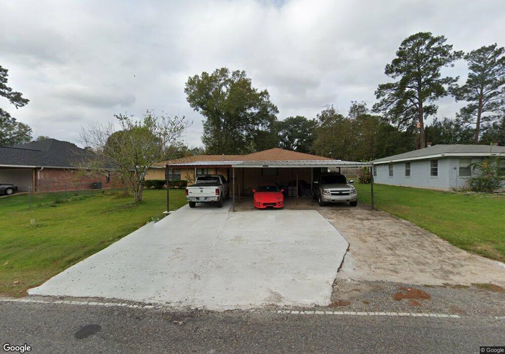
2012 Kings Rd Leesville, LA 71446
Estimated Value: $134,738 - $227,000
3
Beds
2
Baths
2,579
Sq Ft
$68/Sq Ft
Est. Value
About This Home
This home is located at 2012 Kings Rd, Leesville, LA 71446 and is currently estimated at $175,685, approximately $68 per square foot. 2012 Kings Rd is a home located in Vernon Parish with nearby schools including First Assembly Christian Academy, Faith Training Christian Academy Elementary, and Faith Training Christian Academy.
Ownership History
Date
Name
Owned For
Owner Type
Purchase Details
Closed on
Apr 30, 2013
Sold by
Komsuprom Phuriphong and Komsuprom Denitza Sandanska
Bought by
Sandanski Andrey N and Sandanski Jaccara A
Current Estimated Value
Purchase Details
Closed on
Jul 6, 2009
Sold by
Swaby Glenor A Reid and Swaby Lloyd
Bought by
Komsuprom Phiriphong and Komsuprom Denitza
Home Financials for this Owner
Home Financials are based on the most recent Mortgage that was taken out on this home.
Original Mortgage
$139,500
Interest Rate
5.39%
Mortgage Type
Cash
Create a Home Valuation Report for This Property
The Home Valuation Report is an in-depth analysis detailing your home's value as well as a comparison with similar homes in the area
Home Values in the Area
Average Home Value in this Area
Purchase History
| Date | Buyer | Sale Price | Title Company |
|---|---|---|---|
| Sandanski Andrey N | $107,000 | -- | |
| Komsuprom Phiriphong | $139,500 | -- |
Source: Public Records
Mortgage History
| Date | Status | Borrower | Loan Amount |
|---|---|---|---|
| Previous Owner | Komsuprom Phiriphong | $139,500 |
Source: Public Records
Tax History
| Year | Tax Paid | Tax Assessment Tax Assessment Total Assessment is a certain percentage of the fair market value that is determined by local assessors to be the total taxable value of land and additions on the property. | Land | Improvement |
|---|---|---|---|---|
| 2025 | $1,103 | $11,150 | $440 | $10,710 |
| 2024 | $1,313 | $11,150 | $440 | $10,710 |
| 2023 | $1,215 | $10,360 | $440 | $9,920 |
| 2022 | $1,195 | $10,360 | $440 | $9,920 |
| 2021 | $1,271 | $10,360 | $440 | $9,920 |
| 2020 | $1,310 | $10,360 | $440 | $9,920 |
| 2019 | $1,351 | $10,360 | $440 | $9,920 |
| 2018 | $1,346 | $10,360 | $440 | $9,920 |
| 2017 | $1,345 | $10,360 | $440 | $9,920 |
| 2015 | $1,313 | $10,360 | $440 | $9,920 |
| 2014 | $1,175 | $10,360 | $440 | $9,920 |
| 2013 | $1,393 | $10,360 | $440 | $9,920 |
Source: Public Records
Map
Nearby Homes
- 2010 Allison St
- 0 Sartor St
- 1404 Aaron Ave
- 1406 Kings Rd
- 1402 Aaron Ave
- TBD Boone St
- 190 Roberts Acres Rd
- 2105 Miriam St
- 912 Milton St
- 1122 Anderson Dr
- 1409 S 11th St
- 1101 Marvin Ave
- 1111 Anderson Dr
- 1112 Anderson Dr
- 0 Iowa St
- 0 Aaron Milton and Karen Lots Unit 29-1413
- 1104 Anderson Dr
- 611 Magnolia St
- 0 9th St S
- 506 Mcfarland St
Your Personal Tour Guide
Ask me questions while you tour the home.