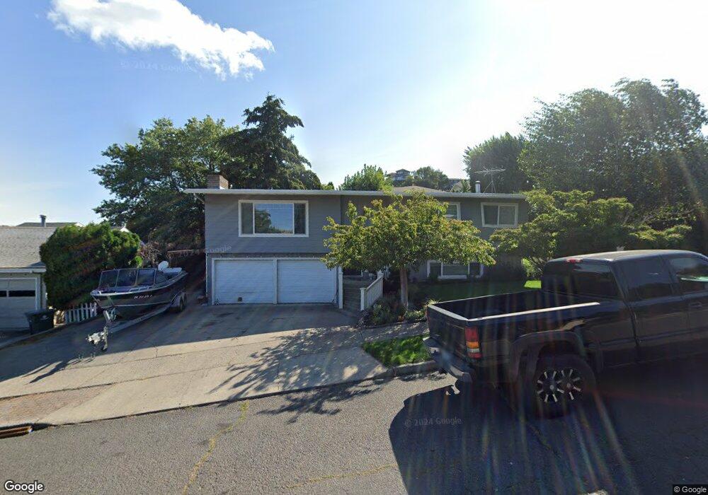
2012 Lewis St the Dalles, OR 97058
Estimated Value: $457,000 - $495,000
4
Beds
2
Baths
1,336
Sq Ft
$353/Sq Ft
Est. Value
About This Home
This home is located at 2012 Lewis St, the Dalles, OR 97058 and is currently estimated at $471,828, approximately $353 per square foot. 2012 Lewis St is a home located in Wasco County with nearby schools including Dry Hollow Elementary School, The Dalles Middle School, and The Dalles High School.
Ownership History
Date
Name
Owned For
Owner Type
Purchase Details
Closed on
Sep 12, 2016
Sold by
Evans Kurt and Evans Tiffany L
Bought by
Evans Kurtis and Evans Tiffany
Current Estimated Value
Home Financials for this Owner
Home Financials are based on the most recent Mortgage that was taken out on this home.
Original Mortgage
$194,085
Outstanding Balance
$154,185
Interest Rate
3.43%
Mortgage Type
VA
Estimated Equity
$317,643
Purchase Details
Closed on
Oct 5, 2007
Sold by
Carson Carl and Carson Roberta E
Bought by
Larson Brent E and Larson Tiffany L
Home Financials for this Owner
Home Financials are based on the most recent Mortgage that was taken out on this home.
Original Mortgage
$112,500
Interest Rate
6.46%
Mortgage Type
New Conventional
Create a Home Valuation Report for This Property
The Home Valuation Report is an in-depth analysis detailing your home's value as well as a comparison with similar homes in the area
Purchase History
| Date | Buyer | Sale Price | Title Company |
|---|---|---|---|
| Evans Kurtis | -- | Wasco Title Inc | |
| Larson Brent E | $272,000 | -- |
Source: Public Records
Mortgage History
| Date | Status | Borrower | Loan Amount |
|---|---|---|---|
| Open | Evans Kurtis | $194,085 | |
| Closed | Larson Brent E | $112,500 |
Source: Public Records
Tax History
| Year | Tax Paid | Tax Assessment Tax Assessment Total Assessment is a certain percentage of the fair market value that is determined by local assessors to be the total taxable value of land and additions on the property. | Land | Improvement |
|---|---|---|---|---|
| 2025 | $4,247 | $236,393 | -- | -- |
| 2024 | $4,131 | $229,508 | -- | -- |
| 2023 | $4,011 | $222,824 | $0 | $0 |
| 2022 | $3,921 | $387,436 | $0 | $0 |
| 2021 | $3,802 | $376,151 | $0 | $0 |
| 2020 | $3,707 | $365,195 | $0 | $0 |
| 2019 | $3,915 | $354,558 | $0 | $0 |
| 2018 | $3,806 | $192,211 | $0 | $0 |
| 2017 | $3,686 | $186,613 | $0 | $0 |
| 2016 | $3,549 | $181,178 | $0 | $0 |
Source: Public Records
Map
Nearby Homes
- 2111 View Ct
- 1514 E 14th St
- 1501 E 14th St
- 1620 E 13th Place
- 1625 E 13th Place
- 1904 Quinton St
- 1300 View Ct
- 1508 E 12th St
- 1509 Quinton St
- 1812 Roberts St
- 1704 Oakwood Dr
- 826 E 15th St
- 1514 E 10th St
- 910 E 13th St
- 1610 Kelly Ave
- 1211 E 10th St
- 1020 Oregon St
- 731 E 19th St
- 1022 E 10th St
- 724 E 14th St
Your Personal Tour Guide
Ask me questions while you tour the home.