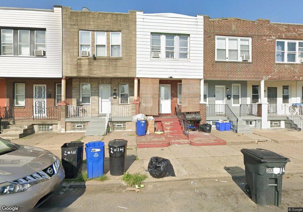
2012 Margaret St Philadelphia, PA 19124
Frankford NeighborhoodEstimated Value: $106,000 - $168,000
3
Beds
1
Bath
1,176
Sq Ft
$119/Sq Ft
Est. Value
About This Home
This home is located at 2012 Margaret St, Philadelphia, PA 19124 and is currently estimated at $140,172, approximately $119 per square foot. 2012 Margaret St is a home located in Philadelphia County with nearby schools including Allen M. Stearne School, Frankford High School, and Mastery Schools Smedley Elementary.
Ownership History
Date
Name
Owned For
Owner Type
Purchase Details
Closed on
Aug 13, 2008
Sold by
Hud
Bought by
Jackson Douglass A
Current Estimated Value
Purchase Details
Closed on
Feb 22, 2008
Sold by
Chase Home Finance Llc
Bought by
Hud
Purchase Details
Closed on
Dec 10, 2007
Sold by
Knowling Jerome J and Knowling Christina D
Bought by
Chase Home Finance Llc
Purchase Details
Closed on
Nov 24, 1997
Sold by
Kuntush Edward J and Kuntush Bernice D
Bought by
Knowling Jerome J and Knowling Christine D
Create a Home Valuation Report for This Property
The Home Valuation Report is an in-depth analysis detailing your home's value as well as a comparison with similar homes in the area
Home Values in the Area
Average Home Value in this Area
Purchase History
| Date | Buyer | Sale Price | Title Company |
|---|---|---|---|
| Jackson Douglass A | $52,000 | None Available | |
| Hud | -- | None Available | |
| Chase Home Finance Llc | $20,000 | None Available | |
| Knowling Jerome J | $38,500 | -- |
Source: Public Records
Tax History Compared to Growth
Tax History
| Year | Tax Paid | Tax Assessment Tax Assessment Total Assessment is a certain percentage of the fair market value that is determined by local assessors to be the total taxable value of land and additions on the property. | Land | Improvement |
|---|---|---|---|---|
| 2026 | $1,135 | $129,600 | $25,900 | $103,700 |
| 2025 | $1,135 | $129,600 | $25,900 | $103,700 |
| 2024 | $1,135 | $129,600 | $25,900 | $103,700 |
| 2023 | $1,135 | $81,100 | $16,220 | $64,880 |
| 2022 | $94 | $36,100 | $16,220 | $19,880 |
| 2021 | $724 | $0 | $0 | $0 |
| 2020 | $724 | $0 | $0 | $0 |
| 2019 | $694 | $0 | $0 | $0 |
| 2018 | $789 | $0 | $0 | $0 |
| 2017 | $789 | $0 | $0 | $0 |
| 2016 | $370 | $0 | $0 | $0 |
| 2015 | $354 | $0 | $0 | $0 |
| 2014 | -- | $56,400 | $10,197 | $46,203 |
| 2012 | -- | $6,688 | $999 | $5,689 |
Source: Public Records
Map
Nearby Homes
- 1907 Wilmot St
- 1628 Margaret St
- 2049 Wilmot St
- 4206-14 Tackawanna St
- 1844 Wilmot St
- 4664 Torresdale Ave
- 1825 Wilmot St Unit F
- 4701 Mulberry St
- 4669 Hawthorne St
- 4675 Hawthorne St
- 4812 Tackawanna St
- 1746-48 Orthodox St
- 4714 Hawthorne St
- 4563 Hawthorne St
- 5002 Ditman St
- 1934 Harrison St
- 1936 Harrison St
- 4534 Ditman St
- 4666 Duffield St
- 1818 Harrison St
- 2014 Margaret St
- 2010 Margaret St
- 2016 Margaret St
- 2018 Margaret St
- 2006 Margaret St
- 2020 Margaret St
- 2004 Margaret St
- 2022 Margaret St
- 2002 Margaret St
- 2003 Wilmot St
- 2013 Wilmot St
- 2009 Wilmot St
- 2005 Wilmot St
- 2024 Margaret St
- 2007 Wilmot St
- 2011 Wilmot St
- 2015 Wilmot St
- 2026 Margaret St
- 2017 Wilmot St
- 2019 Wilmot St