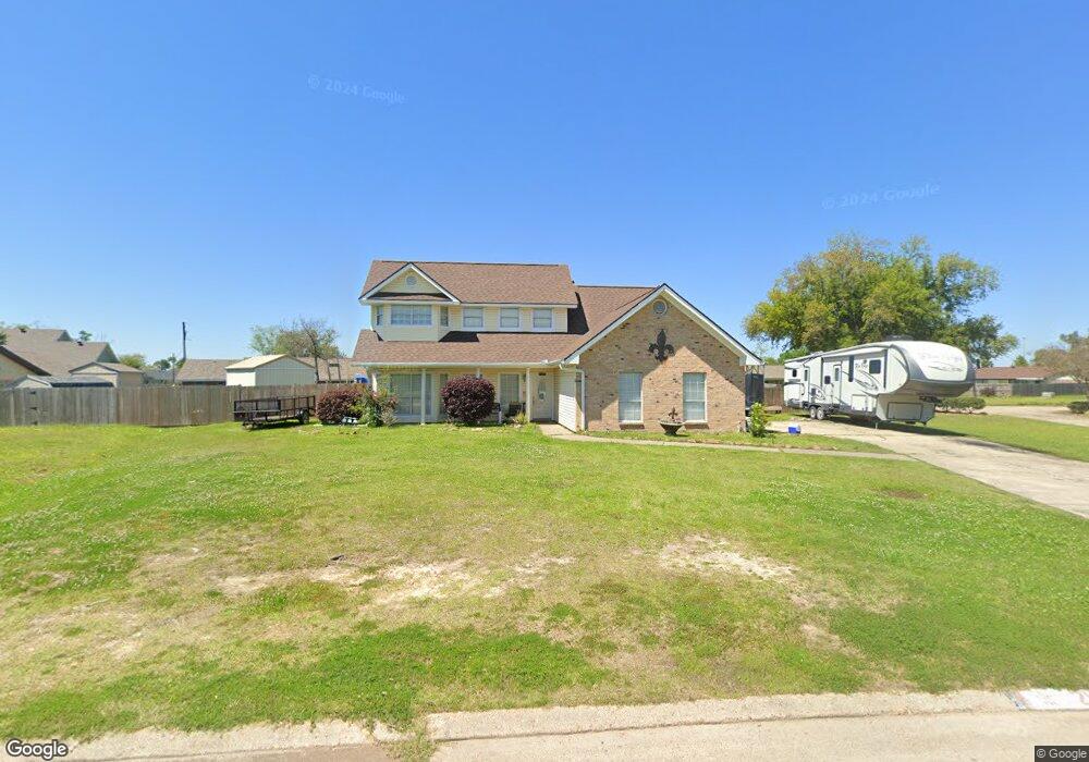
2012 Marge Ln Sulphur, LA 70663
Estimated Value: $247,000 - $279,700
4
Beds
4
Baths
2,302
Sq Ft
$113/Sq Ft
Est. Value
About This Home
This home is located at 2012 Marge Ln, Sulphur, LA 70663 and is currently estimated at $260,175, approximately $113 per square foot. 2012 Marge Ln is a home located in Calcasieu Parish with nearby schools including Richard W. Vincent Elementary School, W.W. Lewis Middle School, and Sulphur High School.
Ownership History
Date
Name
Owned For
Owner Type
Purchase Details
Closed on
Sep 20, 2011
Sold by
Cole Trevor Dewayne and Cole Amber Marie
Bought by
Sawyer Mark Alton and Sawyer Kaleiah Lyndel
Current Estimated Value
Purchase Details
Closed on
Nov 7, 2008
Sold by
Palermo Lance Anthony and Palermo Tonia Dee
Bought by
Cole Trevor Dewayne and Cole Amber Marie
Home Financials for this Owner
Home Financials are based on the most recent Mortgage that was taken out on this home.
Original Mortgage
$207,264
Interest Rate
6.08%
Mortgage Type
FHA
Create a Home Valuation Report for This Property
The Home Valuation Report is an in-depth analysis detailing your home's value as well as a comparison with similar homes in the area
Home Values in the Area
Average Home Value in this Area
Purchase History
| Date | Buyer | Sale Price | Title Company |
|---|---|---|---|
| Sawyer Mark Alton | $175,000 | None Available | |
| Cole Trevor Dewayne | $210,000 | None Available |
Source: Public Records
Mortgage History
| Date | Status | Borrower | Loan Amount |
|---|---|---|---|
| Previous Owner | Cole Trevor Dewayne | $207,264 |
Source: Public Records
Tax History Compared to Growth
Tax History
| Year | Tax Paid | Tax Assessment Tax Assessment Total Assessment is a certain percentage of the fair market value that is determined by local assessors to be the total taxable value of land and additions on the property. | Land | Improvement |
|---|---|---|---|---|
| 2024 | $1,322 | $18,640 | $4,350 | $14,290 |
| 2023 | $1,322 | $18,640 | $4,350 | $14,290 |
| 2022 | $1,312 | $18,640 | $4,350 | $14,290 |
| 2021 | $1,026 | $18,640 | $4,350 | $14,290 |
| 2020 | $1,816 | $17,040 | $4,180 | $12,860 |
| 2019 | $1,975 | $18,320 | $4,030 | $14,290 |
| 2018 | $1,299 | $18,320 | $4,030 | $14,290 |
| 2017 | $2,053 | $18,320 | $4,030 | $14,290 |
| 2016 | $2,026 | $18,320 | $4,030 | $14,290 |
| 2015 | $2,001 | $17,270 | $4,540 | $12,730 |
Source: Public Records
Map
Nearby Homes
- 605 Alabama St
- 2021 Marge Ln
- 2036 Olene Dr
- 704 Alabama St
- 708 Alabama St
- 1232 Georgia St
- 424 Louisiana Ave
- 113 Arkansas St
- 306 Louisiana Ave
- 2001 Olene Dr
- 1201 Texas St
- 2117 Olene Dr
- 1125 Texas St
- 628 S Post Oak Rd
- 201 Louisiana Ave
- 2505 Rhua Dr
- 868 S Post Oak Rd
- 0 Highway 90 Unit SWL25002686
- 0 Highway 90 Unit SWL23004220
- 0 Louisiana 27 Unit SWL25003547