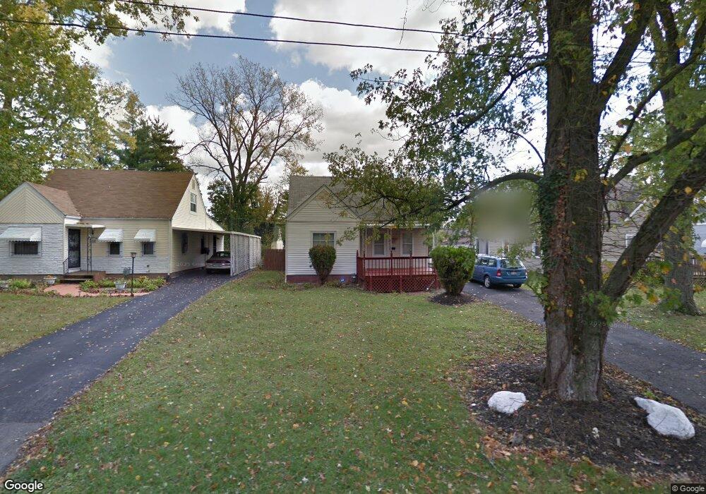
2012 Marston Rd Columbus, OH 43219
Woodland Holt NeighborhoodEstimated Value: $172,000 - $229,845
4
Beds
4
Baths
1,576
Sq Ft
$136/Sq Ft
Est. Value
About This Home
This home is located at 2012 Marston Rd, Columbus, OH 43219 and is currently estimated at $214,461, approximately $136 per square foot. 2012 Marston Rd is a home located in Franklin County with nearby schools including South Mifflin Stem Academy (K-6), Linden-Mckinley Stem School On Arcadia, and Cesar Chavez College Preparatory School.
Ownership History
Date
Name
Owned For
Owner Type
Purchase Details
Closed on
Sep 27, 2024
Sold by
Dreamhouse Llc
Bought by
Pitstick Rory
Current Estimated Value
Home Financials for this Owner
Home Financials are based on the most recent Mortgage that was taken out on this home.
Original Mortgage
$209,496
Outstanding Balance
$206,523
Interest Rate
6.46%
Mortgage Type
VA
Estimated Equity
$7,938
Purchase Details
Closed on
Feb 21, 2024
Sold by
White Stephen L
Bought by
Dreamhouse Llc
Purchase Details
Closed on
Mar 29, 2021
Sold by
Estate Of Ruth A White
Bought by
White Leroy and White Leroy Leon
Purchase Details
Closed on
Jun 28, 1983
Bought by
White Leroy and White Ruth A
Create a Home Valuation Report for This Property
The Home Valuation Report is an in-depth analysis detailing your home's value as well as a comparison with similar homes in the area
Home Values in the Area
Average Home Value in this Area
Purchase History
| Date | Buyer | Sale Price | Title Company |
|---|---|---|---|
| Pitstick Rory | $229,900 | Ohio Real Title | |
| Dreamhouse Llc | $72,000 | Axxis Title Agency | |
| White Leroy | -- | None Available | |
| White Leroy | -- | -- |
Source: Public Records
Mortgage History
| Date | Status | Borrower | Loan Amount |
|---|---|---|---|
| Open | Pitstick Rory | $209,496 |
Source: Public Records
Tax History
| Year | Tax Paid | Tax Assessment Tax Assessment Total Assessment is a certain percentage of the fair market value that is determined by local assessors to be the total taxable value of land and additions on the property. | Land | Improvement |
|---|---|---|---|---|
| 2025 | $2,554 | $37,940 | $8,120 | $29,820 |
| 2024 | $2,554 | $37,940 | $8,120 | $29,820 |
| 2023 | $2,062 | $37,940 | $8,120 | $29,820 |
| 2022 | $3,044 | $20,020 | $2,380 | $17,640 |
| 2021 | $1,096 | $20,020 | $2,380 | $17,640 |
| 2020 | $586 | $20,020 | $2,380 | $17,640 |
| 2019 | $402 | $15,370 | $1,890 | $13,480 |
| 2018 | $200 | $15,370 | $1,890 | $13,480 |
| 2017 | $212 | $15,370 | $1,890 | $13,480 |
| 2016 | $437 | $15,340 | $2,700 | $12,640 |
| 2015 | $198 | $15,340 | $2,700 | $12,640 |
| 2014 | $397 | $15,340 | $2,700 | $12,640 |
| 2013 | $246 | $17,010 | $2,975 | $14,035 |
Source: Public Records
Map
Nearby Homes
- 0 Mock Rd
- 0 Danby Dr
- 2321 Dunning Ct
- 2350 Edenburgh Dr S
- 1991 Woodland Ave
- 1816 Brentnell Ave
- 1893 Jermain Dr
- 2271 Century Dr
- 2310 Brentnell Ave
- 2282 Dawnlight Ave
- 2080 Parkwood Ave Unit 2090
- 0 Parkwood Ave
- 2169 Argyle Dr
- 2145 Argyle Dr
- 2131 Argyle Dr
- 2144 Toni St
- 2407 Marcia Dr
- 2192 Genessee Ave
- 2526 Queenswood Dr
- 1864 E Hudson St
- 2018 Marston Rd
- 2004 Marston Rd
- 1998 Marston Rd
- 2024 Marston Rd
- 2005 Brentnell Ave
- 2011 Brentnell Ave
- 1997 Brentnell Ave
- 1992 Marston Rd
- 1991 Brentnell Ave
- 2019 Brentnell Ave
- 1986 Marston Rd
- 2013 Marston Rd
- 1985 Brentnell Ave
- 2019 Marston Rd
- 2007 Marston Rd
- 1995 Marston Rd
- 2027 Marston Rd
- 1977 Brentnell Ave
- 1993 Marston Rd
- 1980 Marston Rd
Your Personal Tour Guide
Ask me questions while you tour the home.