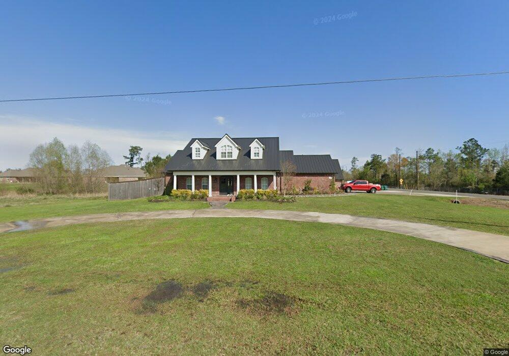
2012 Oak Forest Rd Westlake, LA 70669
Estimated Value: $520,000 - $554,000
--
Bed
--
Bath
--
Sq Ft
2,962
Sq Ft Lot
About This Home
This home is located at 2012 Oak Forest Rd, Westlake, LA 70669 and is currently estimated at $538,535. 2012 Oak Forest Rd is a home located in Calcasieu Parish with nearby schools including Westwood Elementary School, Western Heights Elementary School, and S.P. Arnett Middle School.
Ownership History
Date
Name
Owned For
Owner Type
Purchase Details
Closed on
Oct 18, 2005
Sold by
Highland Forest Subdivision Part 2 Llc
Bought by
Delano Richard Travis and Delano Amy Rae Murphy
Current Estimated Value
Home Financials for this Owner
Home Financials are based on the most recent Mortgage that was taken out on this home.
Original Mortgage
$26,617
Outstanding Balance
$14,148
Interest Rate
5.65%
Mortgage Type
Future Advance Clause Open End Mortgage
Estimated Equity
$524,387
Create a Home Valuation Report for This Property
The Home Valuation Report is an in-depth analysis detailing your home's value as well as a comparison with similar homes in the area
Home Values in the Area
Average Home Value in this Area
Purchase History
| Date | Buyer | Sale Price | Title Company |
|---|---|---|---|
| Delano Richard Travis | -- | None Available |
Source: Public Records
Mortgage History
| Date | Status | Borrower | Loan Amount |
|---|---|---|---|
| Open | Delano Richard Travis | $26,617 |
Source: Public Records
Tax History Compared to Growth
Tax History
| Year | Tax Paid | Tax Assessment Tax Assessment Total Assessment is a certain percentage of the fair market value that is determined by local assessors to be the total taxable value of land and additions on the property. | Land | Improvement |
|---|---|---|---|---|
| 2024 | $3,369 | $38,190 | $3,560 | $34,630 |
| 2023 | $3,369 | $38,190 | $3,560 | $34,630 |
| 2022 | $3,448 | $38,190 | $3,560 | $34,630 |
| 2021 | $3,363 | $38,190 | $3,560 | $34,630 |
| 2020 | $3,862 | $34,590 | $3,420 | $31,170 |
| 2019 | $4,384 | $37,930 | $3,300 | $34,630 |
| 2018 | $3,259 | $37,930 | $3,300 | $34,630 |
| 2017 | $3,687 | $33,430 | $3,300 | $30,130 |
| 2016 | $3,598 | $33,430 | $3,300 | $30,130 |
| 2015 | $3,598 | $33,430 | $3,300 | $30,130 |
Source: Public Records
Map
Nearby Homes
- 0 Mims Rd Unit SWL24003447
- 0 Mims Rd Unit Mims Rd 26-4577
- 16 Riviera Dr
- 0 Riviera Dr Unit 26-4895
- 1951 Riviera Dr
- 601 River Rd
- 625 River Rd
- 649 River Rd
- 0 River Rd Unit SWL24005170
- 12 River Rd
- 637 River Rd
- 0 Tbd Bagdad Rd
- 345 Fred Lutz Rd
- 1931 Miller Ave
- 2406 Miller Ave
- 1131 Baker Rd
- 0 River Road Island
- 0 Dewitt St
- 2502 & 2504 German Rd
- 36 River Rd
- 2011 Oak Forest Rd
- 2015 E Forest Rd
- 2026 Oak Forest Rd
- 2112 S Forest Way
- 2023 Oak Forest Rd
- 2021 E Forest Rd
- 2032 Oak Forest Rd
- 2010 Green Forest Rd
- 2016 Green Forest Rd
- 2029 Oak Forest Rd
- 2004 E Forest Rd
- 2012 E Forest Rd
- 2022 Green Forest Rd
- 0 Oak Forest Rd
- 2027 E Forest Rd
- 2109 Oak Forest Rd
- 2100 Green Forest Rd
- 2105 E Forest Rd
- 2013 Green Forest Rd
- 2108 Green Forest Rd