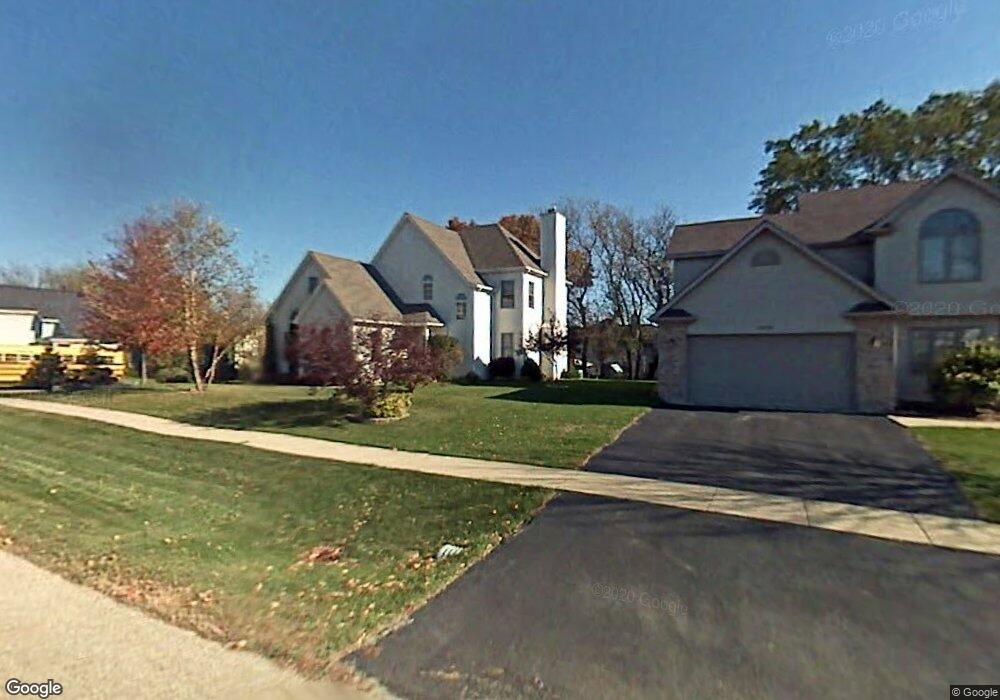
2012 Red Barn Rd Woodstock, IL 60098
Estimated Value: $356,140 - $397,000
3
Beds
3
Baths
1,938
Sq Ft
$193/Sq Ft
Est. Value
About This Home
This home is located at 2012 Red Barn Rd, Woodstock, IL 60098 and is currently estimated at $374,035, approximately $193 per square foot. 2012 Red Barn Rd is a home located in McHenry County with nearby schools including Olson Elementary School, Creekside Middle School, and Woodstock High School.
Ownership History
Date
Name
Owned For
Owner Type
Purchase Details
Closed on
Jan 20, 2000
Sold by
Mccann Daniel E
Bought by
Miranda Forrest G and Miranda Penny K
Current Estimated Value
Home Financials for this Owner
Home Financials are based on the most recent Mortgage that was taken out on this home.
Original Mortgage
$125,000
Outstanding Balance
$39,626
Interest Rate
7.81%
Estimated Equity
$334,409
Purchase Details
Closed on
Oct 30, 1998
Sold by
Kazmer Jerome A and Kazmer Laura A
Bought by
Mccann Daniel E
Home Financials for this Owner
Home Financials are based on the most recent Mortgage that was taken out on this home.
Original Mortgage
$147,900
Interest Rate
6.12%
Purchase Details
Closed on
Jun 19, 1996
Sold by
Mc Connell Road Ltd Partnership
Bought by
Kazmer Jerome A and Kazmer Laura A
Create a Home Valuation Report for This Property
The Home Valuation Report is an in-depth analysis detailing your home's value as well as a comparison with similar homes in the area
Home Values in the Area
Average Home Value in this Area
Purchase History
| Date | Buyer | Sale Price | Title Company |
|---|---|---|---|
| Miranda Forrest G | $193,000 | -- | |
| Mccann Daniel E | $185,000 | Golden Title | |
| Kazmer Jerome A | $41,000 | -- |
Source: Public Records
Mortgage History
| Date | Status | Borrower | Loan Amount |
|---|---|---|---|
| Open | Miranda Forrest G | $125,000 | |
| Previous Owner | Mccann Daniel E | $147,900 |
Source: Public Records
Tax History Compared to Growth
Tax History
| Year | Tax Paid | Tax Assessment Tax Assessment Total Assessment is a certain percentage of the fair market value that is determined by local assessors to be the total taxable value of land and additions on the property. | Land | Improvement |
|---|---|---|---|---|
| 2024 | $8,955 | $105,196 | $14,321 | $90,875 |
| 2023 | $8,524 | $95,131 | $12,951 | $82,180 |
| 2022 | $8,086 | $84,426 | $11,494 | $72,932 |
| 2021 | $7,691 | $78,881 | $10,739 | $68,142 |
| 2020 | $7,408 | $74,953 | $10,204 | $64,749 |
| 2019 | $7,191 | $71,547 | $9,740 | $61,807 |
| 2018 | $7,069 | $69,420 | $11,111 | $58,309 |
| 2017 | $6,940 | $65,336 | $10,457 | $54,879 |
| 2016 | $7,145 | $62,613 | $9,682 | $52,931 |
| 2013 | -- | $57,574 | $8,313 | $49,261 |
Source: Public Records
Map
Nearby Homes
- lot 1 Mcconnell Rd
- 2101 Red Barn Ct
- 2108 Aspen Dr
- 2019 Aspen Dr
- Lot 5 Olmstead Dr
- Lot 2 Olmstead Dr
- 2021 Aspen Dr
- 2101 Preswick Ln
- 2525 Applewood Ln
- Lot #23 Ridgemoor Trail
- Lot #22 Ridgemoor Trail
- Lot #21 Ridgemoor Trail
- 1624 Bull Valley Dr
- 1551 Bobolink Cir
- 1601 Bobolink Cir
- 1026 Heron Way
- Lot #34 W Longwood Dr
- Lot #33 W Longwood Dr
- Lot #28 W Longwood Dr
- Lot #29 W Longwood Dr
- 2008 Red Barn Rd
- 2021 Serenity Ln
- 2019 Serenity Ln
- 2016 Red Barn Rd
- 2004 Red Barn Rd
- 2005 Red Barn Rd
- 2017 Serenity Ln
- 2009 Red Barn Rd
- 2101 Serenity Ln
- 2013 Red Barn Rd
- 2000 Red Barn Rd
- 2015 Serenity Ln
- 2020 Red Barn Rd
- 2001 Red Barn Rd
- 2103 Serenity Ln
- 2108 Red Barn Ct
- 2104 Red Barn Ct
- 2018 Serenity Ln
- 2016 Serenity Ln
- 2100 Red Barn Ct