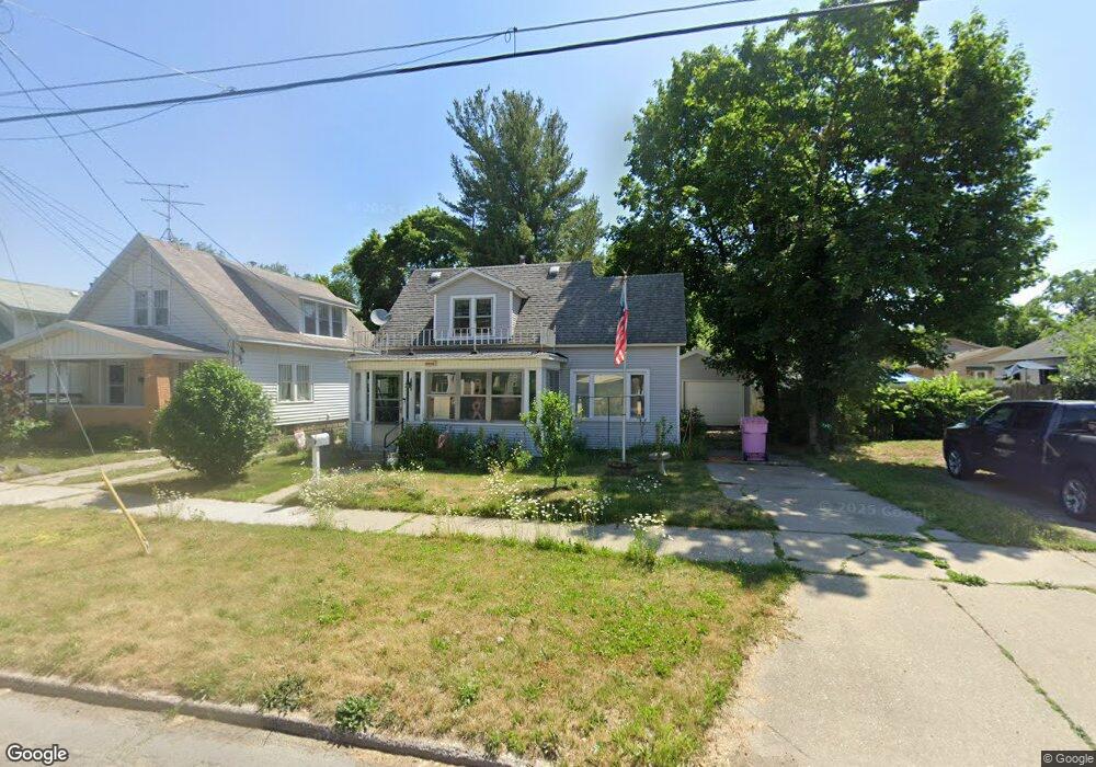
2012 Rowe Ave NE Grand Rapids, MI 49505
Creston NeighborhoodEstimated Value: $258,750 - $292,000
--
Bed
--
Bath
1,168
Sq Ft
$240/Sq Ft
Est. Value
About This Home
This home is located at 2012 Rowe Ave NE, Grand Rapids, MI 49505 and is currently estimated at $280,688, approximately $240 per square foot. 2012 Rowe Ave NE is a home located in Kent County with nearby schools including Riverside Middle School, Union High School, and ISJ Academy.
Ownership History
Date
Name
Owned For
Owner Type
Purchase Details
Closed on
May 25, 2023
Sold by
Lee Karen
Bought by
Lee Karen and Nelson Amee
Current Estimated Value
Home Financials for this Owner
Home Financials are based on the most recent Mortgage that was taken out on this home.
Original Mortgage
$55,000
Outstanding Balance
$53,471
Interest Rate
6.39%
Mortgage Type
New Conventional
Estimated Equity
$227,217
Purchase Details
Closed on
Aug 25, 2015
Sold by
Osburn Richard R and Osburn Deneen C
Bought by
Osburn Richard R and Osburn Deneen C
Purchase Details
Closed on
Feb 24, 2014
Sold by
Osburn Richard R and Estate Of Doris I Osburn
Bought by
Osburn Richard R and Osburn Deneen C
Purchase Details
Closed on
Mar 16, 1997
Sold by
Osburn Rollo R
Bought by
Osburn Doris
Create a Home Valuation Report for This Property
The Home Valuation Report is an in-depth analysis detailing your home's value as well as a comparison with similar homes in the area
Home Values in the Area
Average Home Value in this Area
Purchase History
| Date | Buyer | Sale Price | Title Company |
|---|---|---|---|
| Lee Karen | -- | None Listed On Document | |
| Lee Karen | $40,000 | Bell Title | |
| Osburn Richard R | -- | Attorney | |
| Osburn Richard R | -- | None Available | |
| Osburn Doris | -- | -- |
Source: Public Records
Mortgage History
| Date | Status | Borrower | Loan Amount |
|---|---|---|---|
| Open | Lee Karen | $55,000 |
Source: Public Records
Tax History Compared to Growth
Tax History
| Year | Tax Paid | Tax Assessment Tax Assessment Total Assessment is a certain percentage of the fair market value that is determined by local assessors to be the total taxable value of land and additions on the property. | Land | Improvement |
|---|---|---|---|---|
| 2025 | $1,765 | $119,000 | $0 | $0 |
| 2024 | $1,765 | $109,400 | $0 | $0 |
| 2023 | $1,790 | $91,900 | $0 | $0 |
| 2022 | $1,700 | $78,000 | $0 | $0 |
| 2021 | $1,662 | $76,400 | $0 | $0 |
| 2020 | $1,589 | $72,000 | $0 | $0 |
| 2019 | $1,607 | $65,000 | $0 | $0 |
| 2018 | $1,607 | $56,000 | $0 | $0 |
| 2017 | $1,564 | $48,200 | $0 | $0 |
| 2016 | $1,583 | $44,700 | $0 | $0 |
| 2015 | $2,285 | $44,700 | $0 | $0 |
| 2013 | -- | $37,300 | $0 | $0 |
Source: Public Records
Map
Nearby Homes
- 2038 Melita Ave NE
- 738 Graceland St NE
- 612 Woodridge St NE
- 778 Eleanor St NE
- 1825 Meadowfield Dr NE
- 1848 Emerald Ave NE
- 1757 Westlane Dr NE
- 2019 Plainfield Ave NE
- 465 Kenwood St NE
- 2030 Sinclair Ave NE
- 861 Aberdeen St NE
- 321 Knapp St NE
- 1824 Herrick Ave NE
- 1119 Kentwood Dr NE
- 240 Eleanor St NE
- 2100 Dawson Ave NE
- 2471 Union Ave NE
- 1922 Coit Ave NE
- 1335 Knapp St NE
- 2027 Joan Ave NE
- 2016 Rowe Ave NE
- 771 Knapp St NE
- 773 Knapp St NE
- 767 Knapp St NE
- 2022 Rowe Ave NE
- 2013 Eastern Ave NE
- 779 Knapp St NE
- 779 Knapp St NE Unit 781
- 2017 Eastern Ave NE
- 2023 Eastern Ave NE
- 755 Knapp St NE
- 2013 Rowe Ave NE
- 785 Knapp St NE
- 2017 Rowe Ave NE
- 2029 Eastern Ave NE
- 2032 Rowe Ave NE
- 751 Knapp St NE
- 2023 Rowe Ave NE
- 2029 Eastern Ave NE
- 2029 Rowe Ave NE