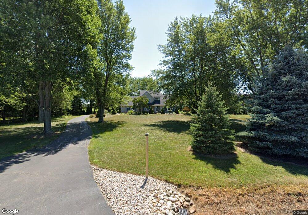
2012 W Rockey Weed Rd Stevensville, MI 49127
Estimated Value: $524,000 - $628,000
4
Beds
3
Baths
2,600
Sq Ft
$217/Sq Ft
Est. Value
About This Home
This home is located at 2012 W Rockey Weed Rd, Stevensville, MI 49127 and is currently estimated at $564,984, approximately $217 per square foot. 2012 W Rockey Weed Rd is a home located in Berrien County with nearby schools including Lakeshore High School and St. Paul's Lutheran School.
Ownership History
Date
Name
Owned For
Owner Type
Purchase Details
Closed on
Jun 23, 2011
Sold by
Burg John R and Burg Kristin
Bought by
Burg John R and Burg Kristin
Current Estimated Value
Purchase Details
Closed on
Jun 22, 2000
Purchase Details
Closed on
Aug 15, 1995
Purchase Details
Closed on
Sep 18, 1989
Purchase Details
Closed on
Jul 13, 1987
Purchase Details
Closed on
Nov 28, 1978
Create a Home Valuation Report for This Property
The Home Valuation Report is an in-depth analysis detailing your home's value as well as a comparison with similar homes in the area
Home Values in the Area
Average Home Value in this Area
Purchase History
| Date | Buyer | Sale Price | Title Company |
|---|---|---|---|
| Burg John R | -- | None Available | |
| -- | $244,000 | -- | |
| -- | $180,000 | -- | |
| -- | $13,000 | -- | |
| -- | $9,100 | -- | |
| -- | $8,000 | -- |
Source: Public Records
Tax History Compared to Growth
Tax History
| Year | Tax Paid | Tax Assessment Tax Assessment Total Assessment is a certain percentage of the fair market value that is determined by local assessors to be the total taxable value of land and additions on the property. | Land | Improvement |
|---|---|---|---|---|
| 2025 | $4,632 | $258,100 | $0 | $0 |
| 2024 | $3,376 | $225,800 | $0 | $0 |
| 2023 | $3,216 | $197,200 | $0 | $0 |
| 2022 | $3,047 | $196,200 | $0 | $0 |
| 2021 | $4,054 | $177,500 | $20,400 | $157,100 |
| 2020 | $4,003 | $185,400 | $0 | $0 |
| 2019 | $3,713 | $160,200 | $23,800 | $136,400 |
| 2018 | $3,628 | $160,200 | $0 | $0 |
| 2017 | $3,755 | $158,000 | $0 | $0 |
| 2016 | $3,632 | $151,500 | $0 | $0 |
| 2015 | $3,589 | $148,600 | $0 | $0 |
| 2014 | $2,791 | $153,600 | $0 | $0 |
Source: Public Records
Map
Nearby Homes
- 6225 Comiskey Rd
- 6211 Comiskey Rd
- 6199 Comiskey Rd
- 6257 Lara Ln
- 2025 Joni Ln
- 6157 Longhorn Trail
- 6175 Lara Ln
- 2430 Ulrich Ln
- 6035 Racine Dr
- 2394 Ulrich Ln
- 2516 Heritage Way
- 2600 Bell Cir
- 5906 Wacker Dr
- 2626 Heritage Way
- 5801 Wacker Dr
- 2191 W Linco Rd
- Integrity 2280 Plan at Wyndstone Estates - Integrity
- Elements 2090 Plan at Wyndstone Estates
- Traditions 3400 V8.0b Plan at Wyndstone Estates - Traditions
- Traditions 1600 V8.0b Plan at Wyndstone Estates - Traditions
- 2040 W Rockey Weed Rd
- 1978 W Rockey Weed Rd
- 2060 W Rockey Weed Rd
- 2090 W Rockey Weed Rd
- 1950 W Rockey Weed Rd
- 2089 W Rockey Weed Rd
- 1947 W Rockey Weed Rd
- 2039 W Rockey Weed Rd
- 6306 Comiskey Rd
- 6303 Comiskey Rd
- 2228 W Rockey Weed Rd
- 6298 Comiskey Rd
- 6800 Cleveland Ave
- 2268 W Rockey Weed Rd
- 1791 W Rockey Weed Rd
- 6299 Comiskey Rd
- 6276 Comiskey Rd
- 6281 Comiskey Rd
- 2292 W Rockey Weed Rd
- 6262 Comiskey Rd