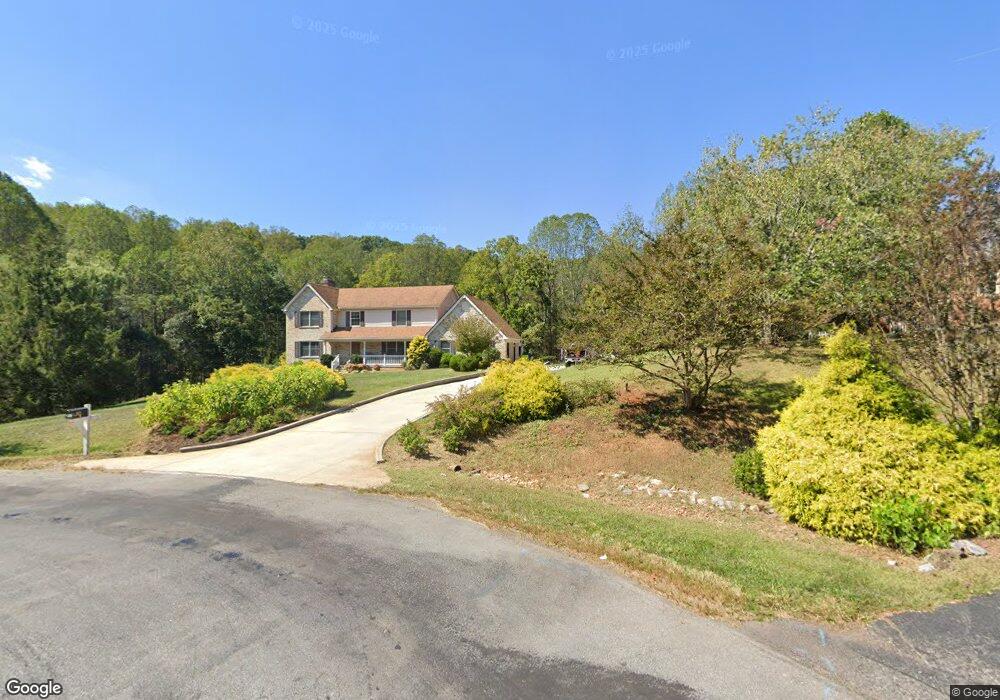
2012 Weather Hill Rd Forest, VA 24551
Estimated Value: $566,000 - $595,000
3
Beds
3
Baths
2,578
Sq Ft
$224/Sq Ft
Est. Value
About This Home
This home is located at 2012 Weather Hill Rd, Forest, VA 24551 and is currently estimated at $577,520, approximately $224 per square foot. 2012 Weather Hill Rd is a home located in Bedford County with nearby schools including Forest Elementary School, Forest Middle School, and Jefferson Forest High School.
Ownership History
Date
Name
Owned For
Owner Type
Purchase Details
Closed on
Sep 20, 2017
Sold by
Helmey John M
Bought by
Robertson Eric L and Robertson Ashley R
Current Estimated Value
Home Financials for this Owner
Home Financials are based on the most recent Mortgage that was taken out on this home.
Original Mortgage
$339,000
Outstanding Balance
$283,013
Interest Rate
3.89%
Mortgage Type
VA
Estimated Equity
$294,507
Create a Home Valuation Report for This Property
The Home Valuation Report is an in-depth analysis detailing your home's value as well as a comparison with similar homes in the area
Home Values in the Area
Average Home Value in this Area
Purchase History
| Date | Buyer | Sale Price | Title Company |
|---|---|---|---|
| Robertson Eric L | $339,000 | Title & Closing Works Llc |
Source: Public Records
Mortgage History
| Date | Status | Borrower | Loan Amount |
|---|---|---|---|
| Open | Robertson Eric L | $339,000 |
Source: Public Records
Tax History Compared to Growth
Tax History
| Year | Tax Paid | Tax Assessment Tax Assessment Total Assessment is a certain percentage of the fair market value that is determined by local assessors to be the total taxable value of land and additions on the property. | Land | Improvement |
|---|---|---|---|---|
| 2025 | $1,934 | $471,800 | $99,500 | $372,300 |
| 2024 | $1,934 | $471,800 | $99,500 | $372,300 |
| 2023 | $1,934 | $235,900 | $0 | $0 |
| 2022 | $98 | $164,450 | $0 | $0 |
| 2021 | $1,645 | $328,900 | $79,500 | $249,400 |
| 2020 | $1,645 | $328,900 | $79,500 | $249,400 |
| 2019 | $1,645 | $328,900 | $79,500 | $249,400 |
| 2018 | $1,565 | $300,900 | $65,600 | $235,300 |
| 2017 | $1,565 | $300,900 | $65,600 | $235,300 |
| 2016 | $1,565 | $300,900 | $65,600 | $235,300 |
| 2015 | $1,565 | $300,900 | $65,600 | $235,300 |
| 2014 | $1,489 | $286,400 | $55,600 | $230,800 |
Source: Public Records
Map
Nearby Homes
- 2006 Weatherhill Rd
- 9-Lot Lakepointe Dr
- 1547 Gilfield Dr
- 0 Gilfield Dr
- 1148 Val Terrace Ct
- 100 Quail Ridge Dr
- 112 Haines Point Terrace
- 118 Sailview Dr
- 1019 Ivy Court Ln
- 1170 Grandset Dr
- 43-Lot Grandset Dr
- 18-Lot Grandset Dr
- 16-Lot Grandset Dr
- 1196 Grandset Dr
- 1031 Maple Leaf Ct
- 1024 Riley Run Rd
- 0 Perrowville Rd
- 0 Perrowville Rd
- 1079 High Oaks Dr
- 1510 Autumn Run Dr
- 2012 Weatherhill Rd
- 2010 Weather Hill Rd
- 2010 Weatherhill Rd
- 2013 Weather Hill Rd
- 2013 Weatherhill Rd
- 2008 Weather Hill Rd
- 2011 Weather Hill Rd
- 2009 Weather Hill Rd
- 2009 Weatherhill Rd
- 2007 Weatherhill Rd
- 2004 Weather Hill Rd
- 2005 Weatherhill Rd
- 2005 Weather Hill Rd
- 117 Meadowgate Dr
- 2002 Weather Hill Rd
- 2002 Weatherhill Rd
- 2003 Weather Hill Rd
- 2003 Weatherhill Rd
- 112 Meadowgate Dr
- 115 Meadowgate Dr