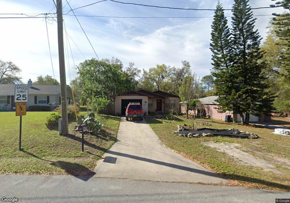
2013 Butler St Leesburg, FL 34748
Estimated Value: $173,000 - $209,000
2
Beds
2
Baths
968
Sq Ft
$191/Sq Ft
Est. Value
About This Home
This home is located at 2013 Butler St, Leesburg, FL 34748 and is currently estimated at $184,951, approximately $191 per square foot. 2013 Butler St is a home located in Lake County with nearby schools including Leesburg Elementary School, Oak Park Middle School, and Leesburg High School.
Ownership History
Date
Name
Owned For
Owner Type
Purchase Details
Closed on
Jul 6, 2007
Sold by
Carter Terri L
Bought by
Holt Eric B
Current Estimated Value
Home Financials for this Owner
Home Financials are based on the most recent Mortgage that was taken out on this home.
Original Mortgage
$148,015
Outstanding Balance
$91,787
Interest Rate
6.35%
Mortgage Type
VA
Estimated Equity
$93,164
Purchase Details
Closed on
Oct 31, 1994
Sold by
Little Robert D
Bought by
Carter Terri L
Home Financials for this Owner
Home Financials are based on the most recent Mortgage that was taken out on this home.
Original Mortgage
$43,550
Interest Rate
8.62%
Create a Home Valuation Report for This Property
The Home Valuation Report is an in-depth analysis detailing your home's value as well as a comparison with similar homes in the area
Home Values in the Area
Average Home Value in this Area
Purchase History
| Date | Buyer | Sale Price | Title Company |
|---|---|---|---|
| Holt Eric B | $144,900 | None Available | |
| Carter Terri L | $47,500 | -- |
Source: Public Records
Mortgage History
| Date | Status | Borrower | Loan Amount |
|---|---|---|---|
| Open | Holt Eric B | $148,015 | |
| Previous Owner | Carter Terri L | $43,550 |
Source: Public Records
Tax History Compared to Growth
Tax History
| Year | Tax Paid | Tax Assessment Tax Assessment Total Assessment is a certain percentage of the fair market value that is determined by local assessors to be the total taxable value of land and additions on the property. | Land | Improvement |
|---|---|---|---|---|
| 2025 | $601 | $59,610 | -- | -- |
| 2024 | $601 | $59,610 | -- | -- |
| 2023 | $601 | $56,200 | $0 | $0 |
| 2022 | $537 | $54,570 | $0 | $0 |
| 2021 | $526 | $52,989 | $0 | $0 |
| 2020 | $549 | $52,258 | $0 | $0 |
| 2019 | $524 | $51,084 | $0 | $0 |
| 2018 | $510 | $50,132 | $0 | $0 |
| 2017 | $495 | $49,101 | $0 | $0 |
| 2016 | $483 | $48,092 | $0 | $0 |
| 2015 | $489 | $47,758 | $0 | $0 |
| 2014 | $428 | $47,379 | $0 | $0 |
Source: Public Records
Map
Nearby Homes
- 2013 Vine St
- 108 N Truett St
- 206 Cooke St
- 2004 High St
- 0 W Main 2010 High St Unit G5052467
- 104 N Chester St
- 107 N Oakland St
- 109 N Oakland St
- 1805 High St
- 405 Louis St
- 1803 High St
- 2210 Mahoney Ave
- 112 S Moss St
- 2008 Hollywood Dr
- 0 Gourley Ave Unit MFRG5098327
- 1506 High St
- 1502 High St
- 0 Thomas Ave Unit MFRG5084639
- 0 Harcourt Dr
- 811 S Lone Oak Dr