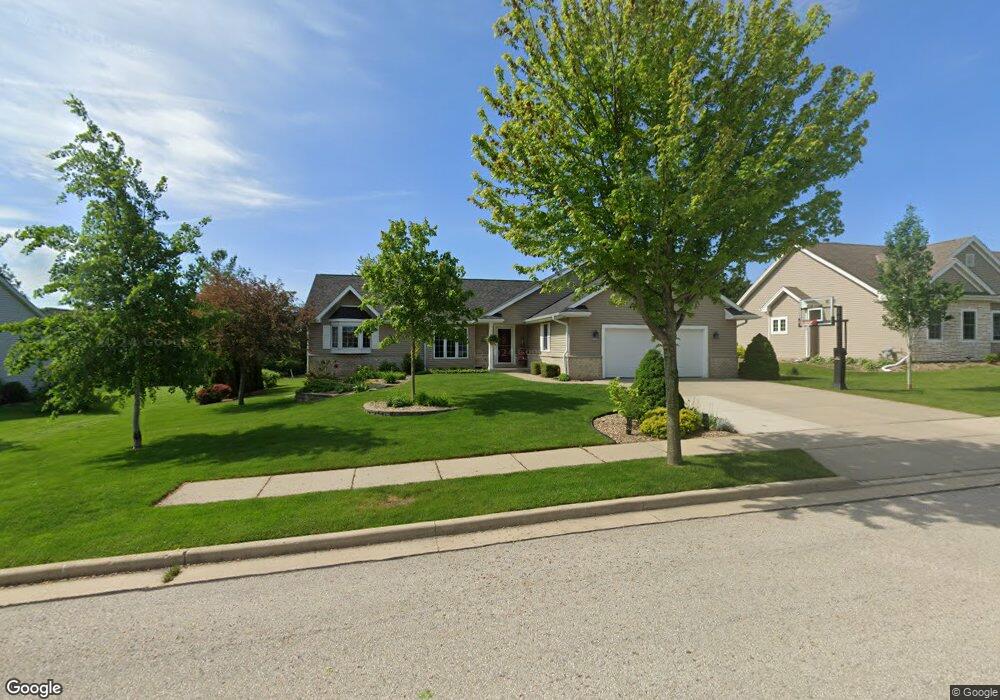
2013 Carrier Ct Grafton, WI 53024
Estimated Value: $483,101 - $538,000
3
Beds
2
Baths
--
Sq Ft
0.26
Acres
About This Home
This home is located at 2013 Carrier Ct, Grafton, WI 53024 and is currently estimated at $521,775. 2013 Carrier Ct is a home located in Ozaukee County with nearby schools including Kennedy Elementary School, John Long Middle School, and Grafton High School.
Ownership History
Date
Name
Owned For
Owner Type
Purchase Details
Closed on
May 17, 2017
Sold by
Ahles Roger
Bought by
Schumacher John P and Schumacher Amy E
Current Estimated Value
Home Financials for this Owner
Home Financials are based on the most recent Mortgage that was taken out on this home.
Original Mortgage
$233,625
Outstanding Balance
$194,288
Interest Rate
4.1%
Mortgage Type
New Conventional
Estimated Equity
$327,487
Purchase Details
Closed on
Oct 9, 2005
Sold by
The Herro Company Inc
Bought by
Ahles Roger
Home Financials for this Owner
Home Financials are based on the most recent Mortgage that was taken out on this home.
Original Mortgage
$236,000
Interest Rate
5.82%
Mortgage Type
New Conventional
Purchase Details
Closed on
Jul 21, 2005
Sold by
2M Group Llc
Bought by
The Herro Company Inc
Create a Home Valuation Report for This Property
The Home Valuation Report is an in-depth analysis detailing your home's value as well as a comparison with similar homes in the area
Home Values in the Area
Average Home Value in this Area
Purchase History
| Date | Buyer | Sale Price | Title Company |
|---|---|---|---|
| Schumacher John P | $311,500 | Knight Barry Title | |
| Ahles Roger | $286,000 | None Available | |
| The Herro Company Inc | $93,000 | None Available |
Source: Public Records
Mortgage History
| Date | Status | Borrower | Loan Amount |
|---|---|---|---|
| Open | Schumacher John P | $233,625 | |
| Previous Owner | Ahles Roger | $236,000 |
Source: Public Records
Tax History Compared to Growth
Tax History
| Year | Tax Paid | Tax Assessment Tax Assessment Total Assessment is a certain percentage of the fair market value that is determined by local assessors to be the total taxable value of land and additions on the property. | Land | Improvement |
|---|---|---|---|---|
| 2024 | $5,165 | $315,000 | $85,500 | $229,500 |
| 2023 | $4,765 | $315,000 | $85,500 | $229,500 |
| 2022 | $4,759 | $315,000 | $85,500 | $229,500 |
| 2021 | $4,945 | $315,000 | $85,500 | $229,500 |
| 2020 | $5,066 | $315,000 | $85,500 | $229,500 |
| 2019 | $5,410 | $264,300 | $82,000 | $182,300 |
| 2018 | $5,344 | $264,300 | $82,000 | $182,300 |
| 2017 | $5,441 | $264,300 | $82,000 | $182,300 |
| 2016 | $5,088 | $264,300 | $82,000 | $182,300 |
| 2015 | $5,188 | $264,300 | $82,000 | $182,300 |
| 2014 | $5,170 | $264,300 | $82,000 | $182,300 |
| 2013 | $5,225 | $272,800 | $86,000 | $186,800 |
Source: Public Records
Map
Nearby Homes
- 1985 Cedar St
- 1984 Comanche Ct
- 2135 Seminole St
- 2161 Falls Rd
- 1895 16th Ave
- Waterford Estate Plan at Blue Stem
- 1300 Bridge St
- 1241 Westwood Dr
- 1208 Bridge St
- 1123 12th Ave
- 1335 11th Ave Unit 112
- 1961 17th Ave
- 925 Mary Grace Ct Unit 48
- 948 N Green Bay Rd
- 1197 Harmony Ln
- 1193 Harmony Ln
- 1021 9th Ave
- 1135 8th Ave
- 1177 Harmony Ln
- The Caspian Plan at River Bend Meadows