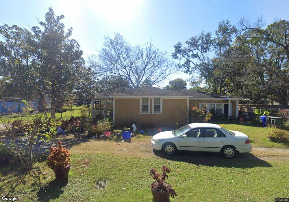
2013 Ferris and Cyrus Rd Charleston, SC 29412
James Island NeighborhoodEstimated Value: $542,135 - $766,000
4
Beds
2
Baths
1,856
Sq Ft
$340/Sq Ft
Est. Value
About This Home
This home is located at 2013 Ferris and Cyrus Rd, Charleston, SC 29412 and is currently estimated at $630,534, approximately $339 per square foot. 2013 Ferris and Cyrus Rd is a home located in Charleston County with nearby schools including Murray-LaSaine Montessori School, James Island Elementary School, and Camp Road Middle.
Ownership History
Date
Name
Owned For
Owner Type
Purchase Details
Closed on
Dec 20, 2016
Sold by
Legare Sylvia and Pinckney Wiggins Ellen
Bought by
Cohen Veronica
Current Estimated Value
Purchase Details
Closed on
Dec 19, 2016
Sold by
Estate Of Mary Pinckney and Pinckney Leroy L
Bought by
Cohen Veronica
Purchase Details
Closed on
Mar 21, 2008
Sold by
Pinckney Leroy
Bought by
Pinckney Leroy L and Pinckney Mary M
Home Financials for this Owner
Home Financials are based on the most recent Mortgage that was taken out on this home.
Original Mortgage
$234,000
Interest Rate
2.52%
Mortgage Type
Reverse Mortgage Home Equity Conversion Mortgage
Create a Home Valuation Report for This Property
The Home Valuation Report is an in-depth analysis detailing your home's value as well as a comparison with similar homes in the area
Home Values in the Area
Average Home Value in this Area
Purchase History
| Date | Buyer | Sale Price | Title Company |
|---|---|---|---|
| Cohen Veronica | -- | None Available | |
| Cohen Veronica | -- | -- | |
| Pinckney Leroy L | -- | -- |
Source: Public Records
Mortgage History
| Date | Status | Borrower | Loan Amount |
|---|---|---|---|
| Previous Owner | Pinckney Leroy L | $234,000 |
Source: Public Records
Tax History Compared to Growth
Tax History
| Year | Tax Paid | Tax Assessment Tax Assessment Total Assessment is a certain percentage of the fair market value that is determined by local assessors to be the total taxable value of land and additions on the property. | Land | Improvement |
|---|---|---|---|---|
| 2024 | $2,907 | $9,720 | $0 | $0 |
| 2023 | $2,907 | $9,720 | $0 | $0 |
| 2022 | $2,666 | $9,720 | $0 | $0 |
| 2021 | $2,634 | $9,720 | $0 | $0 |
| 2020 | $2,615 | $9,720 | $0 | $0 |
| 2019 | $2,394 | $8,450 | $0 | $0 |
| 2017 | $2,290 | $8,450 | $0 | $0 |
| 2016 | $534 | $5,630 | $0 | $0 |
| 2015 | $549 | $5,630 | $0 | $0 |
| 2014 | $450 | $0 | $0 | $0 |
| 2011 | -- | $0 | $0 | $0 |
Source: Public Records
Map
Nearby Homes
- 0 Lucky Rd Unit 24028810
- 2134 Bradham Rd
- 1981 Central Park Rd
- 2138 Terrabrook Ln
- 1950 Bradham Rd
- 0 Folly Beach Rd Unit 21025250
- 779 Riverland Dr
- 1916 Hollings Rd
- 679 & 683 Riley Rd
- 644 Stoneboro Ct
- 475 Woodland Shores Rd
- 521 W Wimbledon Dr
- 2131 Pentland Dr
- 2152 Pentland Dr
- 752 Minton Rd
- 748 Minton Rd
- 750 Minton Rd
- 746 Minton Rd
- 744 Minton Rd
- Harden Plan at Central Park
- 2003 Ferris and Cyrus Rd
- 2017 Ferris and Cyrus Rd
- 2020 Lucky Rd
- 659 Riverland Dr
- 2023 Ferris and Cyrus Rd
- 651 Riverland Dr
- 2018 Lucky Rd
- 2009 Ferris and Cyrus Rd
- 647 Riverland Dr
- 2014 Lucky Rd
- 675 Riverland Dr
- 2022 Lucky Rd
- 641 Riverland Dr
- 2035 Ferris and Cyrus Rd
- 633 Riverland Dr
- 633 Riverland Dr
- 2051 Ferris and Cyrus Rd
- 2024 Lucky Rd
- 629 Riverland Dr
- 2044 Bradham Rd