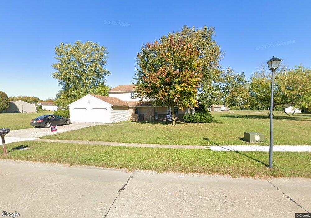
2013 Fox Run Trail Sandusky, OH 44870
Estimated Value: $140,000 - $206,235
6
Beds
3
Baths
2,500
Sq Ft
$69/Sq Ft
Est. Value
About This Home
This home is located at 2013 Fox Run Trail, Sandusky, OH 44870 and is currently estimated at $172,059, approximately $68 per square foot. 2013 Fox Run Trail is a home located in Erie County with nearby schools including Sandusky High School and Monroe Preparatory Academy.
Ownership History
Date
Name
Owned For
Owner Type
Purchase Details
Closed on
Jan 24, 2012
Sold by
Eh Pooled 711 Lp
Bought by
Slisher Karson D
Current Estimated Value
Purchase Details
Closed on
Aug 23, 2011
Sold by
Wells Fargo Bank Na
Bought by
Eh Pooled 711 Lp
Purchase Details
Closed on
Nov 29, 2010
Sold by
Scales Annie E
Bought by
Wells Fargo Bank Na
Purchase Details
Closed on
May 24, 2006
Sold by
Estate Of Annie E Scales
Bought by
Scales Darlene C and Shelton Larry
Create a Home Valuation Report for This Property
The Home Valuation Report is an in-depth analysis detailing your home's value as well as a comparison with similar homes in the area
Home Values in the Area
Average Home Value in this Area
Purchase History
| Date | Buyer | Sale Price | Title Company |
|---|---|---|---|
| Slisher Karson D | $23,000 | Lawyers Title Ins Corp | |
| Eh Pooled 711 Lp | $18,000 | None Available | |
| Wells Fargo Bank Na | $35,000 | Attorney | |
| Scales Darlene C | -- | None Available |
Source: Public Records
Tax History Compared to Growth
Tax History
| Year | Tax Paid | Tax Assessment Tax Assessment Total Assessment is a certain percentage of the fair market value that is determined by local assessors to be the total taxable value of land and additions on the property. | Land | Improvement |
|---|---|---|---|---|
| 2024 | $1,863 | $47,306 | $12,229 | $35,077 |
| 2023 | $1,863 | $41,695 | $9,551 | $32,144 |
| 2022 | $2,114 | $41,699 | $9,555 | $32,144 |
| 2021 | $2,133 | $41,700 | $9,560 | $32,140 |
| 2020 | $2,281 | $40,980 | $9,560 | $31,420 |
| 2019 | $2,345 | $40,980 | $9,560 | $31,420 |
| 2018 | $2,348 | $40,980 | $9,560 | $31,420 |
| 2017 | $2,172 | $37,800 | $13,370 | $24,430 |
| 2016 | $2,171 | $37,800 | $13,370 | $24,430 |
| 2015 | $1,967 | $37,800 | $13,370 | $24,430 |
| 2014 | $1,955 | $37,800 | $13,370 | $24,430 |
| 2013 | $741 | $37,800 | $13,370 | $24,430 |
Source: Public Records
Map
Nearby Homes
- 2033 S Oldgate St
- 1200 E Perkins Ave
- 0 E Perkins Ave
- 2038 Rohde St
- 1910 E Perkins Ave
- 0 Cleveland Rd W
- 1640 Cleveland Rd W
- 1417 E Strub Rd
- 2252 Pipe St
- 2501 E Perkins Ave
- 32 Marina Point Dr
- 90 Marina Point Dr
- 81 Marina Point Dr Unit 81
- 2821 Hinde Ave
- 0 U S 250 Unit 9066253
- 0 U S 250 Unit 9066251
- 0 U S 250 Unit 5105470
- 0 U S 250 Unit 5105459
- 0 U S 250 Unit 20250772
- 0 U S 250 Unit 20250775
- 2019 Fox Run Trail
- 2028 Heritage Dr
- V/L Oldgate
- 2001 Fox Run Trail
- 0 Fox Run Trail
- 1995 Fox Run Trail
- 2062 S Oldgate St
- 2001 Heritage Dr
- 1992 Heritage Dr
- 2014 Foxborough Cir
- 0 Foxborough Cir
- 2052 Heritage Dr
- 1996 Fox Run Trail
- 36 Harrison St
- 2027 Heritage Dr
- 1989 Fox Run Trail
- 2430 Pioneer Trail
- 2058 Heritage Dr
- 2008 E Oldgate St
- 2033 Heritage Dr