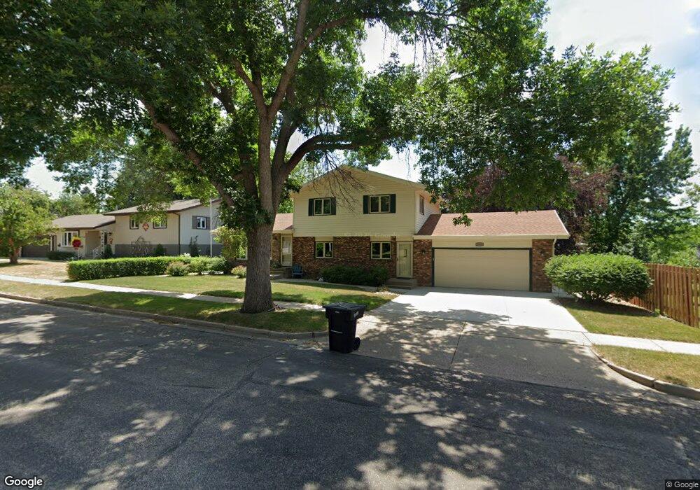
2013 Grimsrud Dr Bismarck, ND 58501
Highland Acres NeighborhoodEstimated Value: $323,000 - $385,000
4
Beds
2
Baths
1,924
Sq Ft
$182/Sq Ft
Est. Value
About This Home
This home is located at 2013 Grimsrud Dr, Bismarck, ND 58501 and is currently estimated at $349,746, approximately $181 per square foot. 2013 Grimsrud Dr is a home located in Burleigh County with nearby schools including Grimsrud Elementary School, Horizon Middle School, and Century High School.
Ownership History
Date
Name
Owned For
Owner Type
Purchase Details
Closed on
Jun 29, 2022
Sold by
Preifle Diana M and Mayer Diana M
Bought by
Mayer Diana M and Pfeifle Ryan
Current Estimated Value
Purchase Details
Closed on
Feb 8, 2012
Sold by
Mayer Diana M and Pfeifle Diana M
Bought by
Mayer Diana M and Mayer Orville C
Home Financials for this Owner
Home Financials are based on the most recent Mortgage that was taken out on this home.
Original Mortgage
$96,493
Interest Rate
3.95%
Mortgage Type
Future Advance Clause Open End Mortgage
Create a Home Valuation Report for This Property
The Home Valuation Report is an in-depth analysis detailing your home's value as well as a comparison with similar homes in the area
Home Values in the Area
Average Home Value in this Area
Purchase History
| Date | Buyer | Sale Price | Title Company |
|---|---|---|---|
| Mayer Diana M | -- | None Listed On Document | |
| Mayer Diana M | -- | None Available |
Source: Public Records
Mortgage History
| Date | Status | Borrower | Loan Amount |
|---|---|---|---|
| Previous Owner | Mayer Diana M | $96,493 |
Source: Public Records
Tax History
| Year | Tax Paid | Tax Assessment Tax Assessment Total Assessment is a certain percentage of the fair market value that is determined by local assessors to be the total taxable value of land and additions on the property. | Land | Improvement |
|---|---|---|---|---|
| 2025 | $1,713 | $155,250 | $29,000 | $126,250 |
| 2024 | $3,077 | $143,300 | $26,000 | $117,300 |
| 2023 | $3,352 | $143,300 | $26,000 | $117,300 |
| 2022 | $3,207 | $147,600 | $26,000 | $121,600 |
| 2021 | $3,745 | $140,000 | $24,000 | $116,000 |
| 2020 | $3,422 | $129,650 | $24,000 | $105,650 |
| 2019 | $3,317 | $128,350 | $0 | $0 |
| 2018 | $3,103 | $128,350 | $24,000 | $104,350 |
| 2017 | $2,429 | $128,350 | $24,000 | $104,350 |
| 2016 | $2,429 | $128,350 | $19,000 | $109,350 |
| 2014 | -- | $115,850 | $0 | $0 |
Source: Public Records
Map
Nearby Homes
- 1929 Marian Dr
- 306 W Turnpike Ave
- 2135 N Washington St Unit 5
- 2430 Winchester Dr
- 2421 Winchester Dr
- 2105 N Kavaney Dr Unit 1
- 524 Weatherby Way
- 1232 E Coulee Rd
- 218 E Owens Ave
- 111 Seminole Ave
- 1825 S Grandview Ln Unit 11
- 1825 S Grandview Ln Unit 16
- 121 Sioux Ave
- 1821 S Grandview Ln Unit 5
- 405 E Interstate Ave
- 700 Aspen Ave
- 216 Tower Ave
- 2972 Ontario Ln Unit XII
- 528 E Capitol Ave
- 916 N Anderson St
- 2009 Grimsrud Dr
- 1959 Thompson St
- 820 W Saint Benedict Dr
- 826 W Saint Benedict Dr
- 814 W Saint Benedict Dr
- 2001 Grimsrud Dr
- 834 W Saint Benedict Dr
- 2003 Thompson St
- 2010 Grimsrud Dr
- 2024 Grimsrud Dr
- 2004 Grimsrud Dr
- 2023 Grimsrud Dr
- 1946 N Bell St
- 2011 Thompson St
- 1956 Thompson St
- 811 W Saint Benedict Dr
- 1950 Thompson St
- 821 W Saint Benedict Dr
- 2012 N Bell St
- 815 W Saint Benedict Dr
Your Personal Tour Guide
Ask me questions while you tour the home.