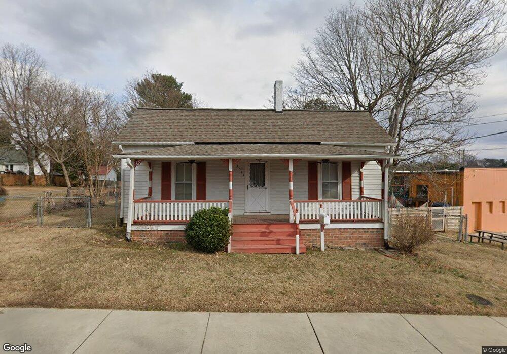
2013 Hollyrood St Unit combo,box Winston Salem, NC 27127
Washington Park NeighborhoodEstimated Value: $144,000 - $168,000
2
Beds
1
Bath
902
Sq Ft
$173/Sq Ft
Est. Value
About This Home
This home is located at 2013 Hollyrood St Unit combo,box, Winston Salem, NC 27127 and is currently estimated at $156,241, approximately $173 per square foot. 2013 Hollyrood St Unit combo,box is a home located in Forsyth County with nearby schools including Diggs-Latham Elementary School, Philo-Hill Magnet Academy, and Parkland High.
Ownership History
Date
Name
Owned For
Owner Type
Purchase Details
Closed on
Sep 21, 2010
Sold by
Branch Banking & Trust Company
Bought by
Omeara Joslyn G
Current Estimated Value
Purchase Details
Closed on
Jul 21, 2004
Sold by
Holder Properties and Holder Benjamin M
Bought by
Hayes Stephen Joe
Home Financials for this Owner
Home Financials are based on the most recent Mortgage that was taken out on this home.
Original Mortgage
$44,000
Interest Rate
6.24%
Mortgage Type
Purchase Money Mortgage
Purchase Details
Closed on
Apr 7, 2004
Sold by
Hmf Properties
Bought by
Holder Properties
Create a Home Valuation Report for This Property
The Home Valuation Report is an in-depth analysis detailing your home's value as well as a comparison with similar homes in the area
Home Values in the Area
Average Home Value in this Area
Purchase History
| Date | Buyer | Sale Price | Title Company |
|---|---|---|---|
| Omeara Joslyn G | $16,000 | None Available | |
| Hayes Stephen Joe | $55,000 | -- | |
| Holder Properties | -- | -- |
Source: Public Records
Mortgage History
| Date | Status | Borrower | Loan Amount |
|---|---|---|---|
| Previous Owner | Hayes Stephen Joe | $44,000 |
Source: Public Records
Tax History Compared to Growth
Tax History
| Year | Tax Paid | Tax Assessment Tax Assessment Total Assessment is a certain percentage of the fair market value that is determined by local assessors to be the total taxable value of land and additions on the property. | Land | Improvement |
|---|---|---|---|---|
| 2025 | $853 | $86,000 | $31,400 | $54,600 |
| 2024 | $853 | $63,700 | $28,200 | $35,500 |
| 2023 | $853 | $63,700 | $28,200 | $35,500 |
| 2022 | $837 | $63,700 | $28,200 | $35,500 |
| 2021 | $822 | $63,700 | $28,200 | $35,500 |
| 2020 | $666 | $48,200 | $25,400 | $22,800 |
| 2019 | $670 | $48,200 | $25,400 | $22,800 |
| 2018 | $637 | $48,200 | $25,400 | $22,800 |
| 2016 | $625 | $47,487 | $25,394 | $22,093 |
| 2015 | $616 | $47,487 | $25,394 | $22,093 |
| 2014 | -- | $47,487 | $25,394 | $22,093 |
Source: Public Records
Map
Nearby Homes
- 215 W Banner Ave
- 418 W Acadia Ave
- 220 Gloria Ave
- 507 W Banner Ave
- 504 W Sprague St
- 112 Gloria Ave
- 2242 Hollyrood St
- 112 W Devonshire St
- 1541 S Broad St Unit 1016
- 1525 S Broad St Unit 1015
- 1721 S Main St
- 1519 S Broad St Unit 1014
- 213 E Monmouth St
- 225 E Monmouth St
- 214 W Lemly St
- 2756 Trent St
- 2709 Konnoak Dr
- 425 E Sprague St
- 925 Walnut St SW
- 2930,2970,3050 Buchanan St
- 2013 Hollyrood St
- 239 W Acadia Ave
- 229 W Acadia Ave
- 2002 Hollyrood St
- 216 W Banner Ave
- 307 W Acadia Ave
- 308 W Banner Ave
- 2112 W Acadia Ave
- 212 W Banner Ave
- 235 Park Blvd
- 224 W Acadia Ave Unit 20
- 224 W Acadia Ave
- 2100 Hollyrood St
- 313 W Acadia Ave
- 310 W Banner Ave
- 2102 Hollyrood St
- 229 W Banner Ave
- 2113 Hollyrood St
- 2104 Hollyrood St
- 1922 Hollyrood St