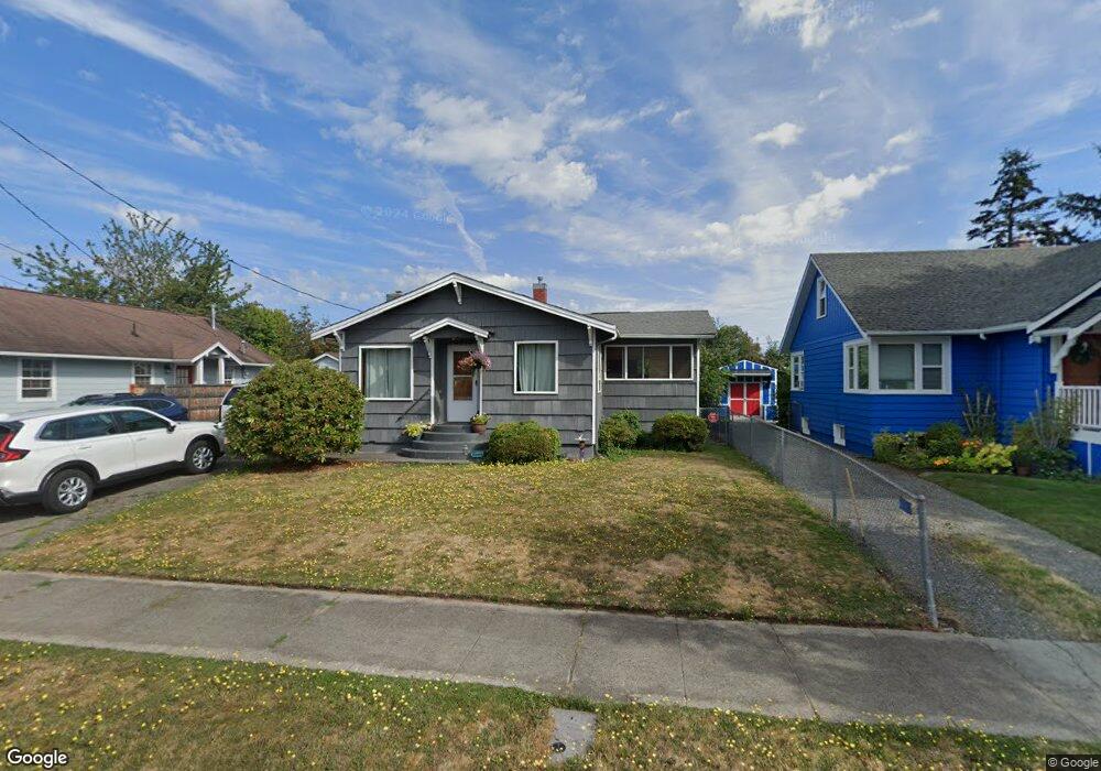
2013 Lincoln Ave Enumclaw, WA 98022
Estimated Value: $428,214 - $445,000
3
Beds
1
Bath
860
Sq Ft
$512/Sq Ft
Est. Value
About This Home
This home is located at 2013 Lincoln Ave, Enumclaw, WA 98022 and is currently estimated at $440,304, approximately $511 per square foot. 2013 Lincoln Ave is a home located in King County with nearby schools including Byron Kibler Elementary School, Enumclaw Middle School, and Enumclaw Senior High School.
Ownership History
Date
Name
Owned For
Owner Type
Purchase Details
Closed on
Aug 18, 1999
Sold by
Hanson Ronald L and Hanson Lisa R
Bought by
Hanson Tammy L
Current Estimated Value
Home Financials for this Owner
Home Financials are based on the most recent Mortgage that was taken out on this home.
Original Mortgage
$105,539
Outstanding Balance
$30,115
Interest Rate
7.56%
Mortgage Type
FHA
Estimated Equity
$410,189
Purchase Details
Closed on
Jan 9, 1996
Sold by
Hanson Ronald L
Bought by
Hanson Leonard A
Purchase Details
Closed on
May 5, 1992
Sold by
Hanson Ronald L
Bought by
Hanson Ronald L and Hanson Lisa R
Create a Home Valuation Report for This Property
The Home Valuation Report is an in-depth analysis detailing your home's value as well as a comparison with similar homes in the area
Home Values in the Area
Average Home Value in this Area
Purchase History
| Date | Buyer | Sale Price | Title Company |
|---|---|---|---|
| Hanson Tammy L | $106,500 | Washington Title | |
| Hanson Leonard A | -- | -- | |
| Hanson Ronald L | -- | -- |
Source: Public Records
Mortgage History
| Date | Status | Borrower | Loan Amount |
|---|---|---|---|
| Open | Hanson Tammy L | $105,539 |
Source: Public Records
Tax History
| Year | Tax Paid | Tax Assessment Tax Assessment Total Assessment is a certain percentage of the fair market value that is determined by local assessors to be the total taxable value of land and additions on the property. | Land | Improvement |
|---|---|---|---|---|
| 2024 | $3,707 | $386,000 | $174,000 | $212,000 |
| 2023 | $3,330 | $331,000 | $150,000 | $181,000 |
| 2022 | $3,083 | $378,000 | $172,000 | $206,000 |
| 2021 | $2,492 | $307,000 | $149,000 | $158,000 |
| 2020 | $2,280 | $226,000 | $96,000 | $130,000 |
| 2018 | $2,183 | $209,000 | $89,000 | $120,000 |
| 2017 | $1,937 | $178,000 | $81,000 | $97,000 |
| 2016 | $1,907 | $163,000 | $75,000 | $88,000 |
| 2015 | $2,043 | $158,000 | $71,000 | $87,000 |
| 2014 | -- | $162,000 | $76,000 | $86,000 |
| 2013 | -- | $125,000 | $61,000 | $64,000 |
Source: Public Records
Map
Nearby Homes
- 1101 Wells St
- 1234 Lincoln Ave Unit A
- 1234 Lincoln Ave Unit B
- 2054 Roosevelt Ave
- 1107 Griffin Ave
- 1170 Cedar Dr
- 1137 Spruce Dr
- 520 Willow Dr Unit 111
- 525 Grand Fir Dr
- 1471 Florence St
- 901 Bathke Ave
- 915 Mountain Villa Dr
- 1722 Harding St
- 522 Harmony Ln
- 1705 Marshall Ave
- 823 Cottonwood Dr
- 806 Pine Dr
- 936 Mountain Villa Dr
- 1720 Garfield St Unit 4
- 272 Grand Fir Dr Unit 26
- 2023 Lincoln Ave
- 2007 Lincoln Ave
- 2016 Nielson Ave
- 2033 Lincoln Ave
- 2016 Neilson Ave
- 1325 Lincoln Ave
- 2004 Nielson Ave
- 2004 Neilson Ave
- 2030 Neilson Ave
- 2043 Lincoln Ave
- 2010 Lincoln Ave
- 1131 Porter St
- 1310 Lincoln Ave
- 1115 Lafromboise St
- 1108 Wells St
- 2032 Lincoln Ave
- 1125 Lafromboise St
- 2022 Lincoln Ave
- 2054 Neilson Ave
- 2055 Lincoln Ave
Your Personal Tour Guide
Ask me questions while you tour the home.