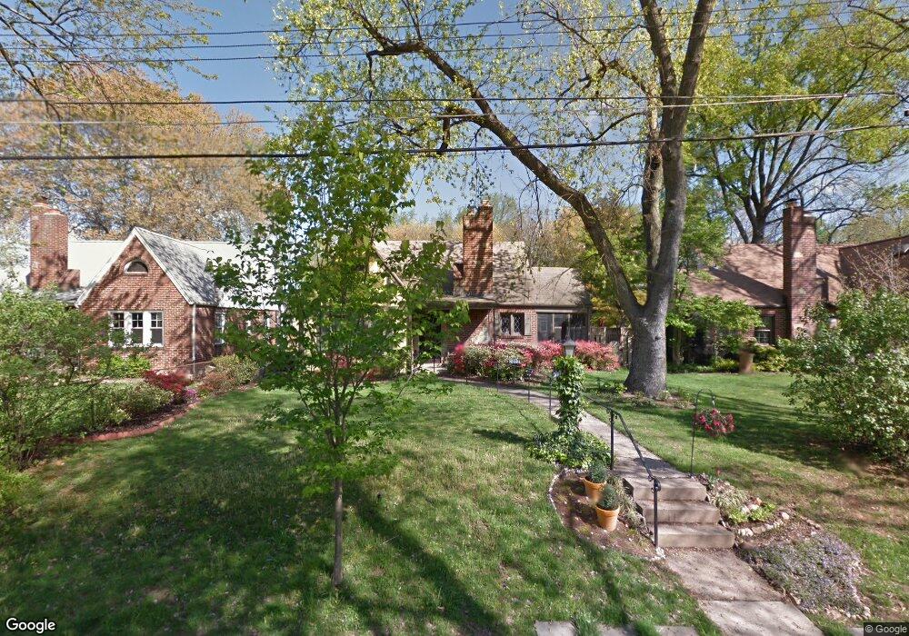
2013 Osborn Dr Silver Spring, MD 20910
Estimated Value: $570,000 - $596,000
Studio
1
Bath
1,392
Sq Ft
$416/Sq Ft
Est. Value
About This Home
This home is located at 2013 Osborn Dr, Silver Spring, MD 20910 and is currently estimated at $578,536, approximately $415 per square foot. 2013 Osborn Dr is a home located in Montgomery County with nearby schools including Woodlin Elementary School, Sligo Middle School, and Albert Einstein High School.
Ownership History
Date
Name
Owned For
Owner Type
Purchase Details
Closed on
Mar 7, 2007
Sold by
Cooper Troy L
Bought by
Bylykbashi Andrea
Current Estimated Value
Home Financials for this Owner
Home Financials are based on the most recent Mortgage that was taken out on this home.
Original Mortgage
$364,500
Outstanding Balance
$221,109
Interest Rate
6.3%
Mortgage Type
Purchase Money Mortgage
Estimated Equity
$357,427
Purchase Details
Closed on
Feb 26, 2007
Sold by
Cooper Troy L
Bought by
Bylykbashi Andrea
Home Financials for this Owner
Home Financials are based on the most recent Mortgage that was taken out on this home.
Original Mortgage
$364,500
Outstanding Balance
$221,109
Interest Rate
6.3%
Mortgage Type
Purchase Money Mortgage
Estimated Equity
$357,427
Purchase Details
Closed on
Sep 17, 1999
Sold by
Summers Warren C and Summers I E
Bought by
Cooper Troy L
Create a Home Valuation Report for This Property
The Home Valuation Report is an in-depth analysis detailing your home's value as well as a comparison with similar homes in the area
Home Values in the Area
Average Home Value in this Area
Purchase History
| Date | Buyer | Sale Price | Title Company |
|---|---|---|---|
| Bylykbashi Andrea | $405,000 | -- | |
| Bylykbashi Andrea | $405,000 | -- | |
| Cooper Troy L | $137,100 | -- |
Source: Public Records
Mortgage History
| Date | Status | Borrower | Loan Amount |
|---|---|---|---|
| Open | Bylykbashi Andrea | $364,500 | |
| Closed | Bylykbashi Andrea | $364,500 |
Source: Public Records
Tax History
| Year | Tax Paid | Tax Assessment Tax Assessment Total Assessment is a certain percentage of the fair market value that is determined by local assessors to be the total taxable value of land and additions on the property. | Land | Improvement |
|---|---|---|---|---|
| 2025 | $5,688 | $469,700 | -- | -- |
| 2024 | $5,688 | $436,500 | $251,100 | $185,400 |
| 2023 | $6,159 | $418,967 | $0 | $0 |
| 2022 | $3,236 | $401,433 | $0 | $0 |
| 2021 | $4,076 | $383,900 | $251,100 | $132,800 |
| 2020 | $8,037 | $381,667 | $0 | $0 |
| 2019 | $3,961 | $379,433 | $0 | $0 |
| 2018 | $3,912 | $377,200 | $251,100 | $126,100 |
| 2017 | $3,782 | $364,800 | $0 | $0 |
| 2016 | $3,488 | $352,400 | $0 | $0 |
| 2015 | $3,488 | $340,000 | $0 | $0 |
| 2014 | $3,488 | $340,000 | $0 | $0 |
Source: Public Records
Map
Nearby Homes
- 9403 Warren St
- 2209 Ellis St
- 9800 Georgia Ave Unit 25301
- 9802 Georgia Ave Unit 26-202
- 2208 Kimball Place
- 9820 Georgia Ave Unit 2130
- 2101 Walsh View Terrace Unit 17103
- 2107 Walsh View Terrace Unit 14-301 & 304
- 2209 Kimball Place
- 2110 Bonnywood Ln Unit 102
- 9900 Georgia Ave Unit 113
- 9900 Georgia Ave
- 9900 Georgia Ave Unit 203
- 9900 Georgia Ave
- 9907 Blundon Dr Unit 302
- 9707 Saxony Rd
- 1819 Sanford Rd
- 1513 Flora Ln
- 2613 Linden Ln
- 2701 Hume Dr Unit 400
- 2011 Osborn Dr
- 2015 Osborn Dr
- 2014 Lansdowne Way
- 2009 Osborn Dr
- 2017 Osborn Dr
- 2012 Lansdowne Way
- 2018 Lansdowne Way
- 2008 Osborn Dr
- 2006 Osborn Dr
- 2010 Osborn Dr
- 2010 Lansdowne Way
- 2019 Osborn Dr
- 2007 Osborn Dr
- 2020 Lansdowne Way
- 2004 Osborn Dr
- 2012 Osborn Dr
- 2008 Lansdowne Way
- 2002 Osborn Dr
- 2005 Osborn Dr
- 2021 Osborn Dr
Your Personal Tour Guide
Ask me questions while you tour the home.