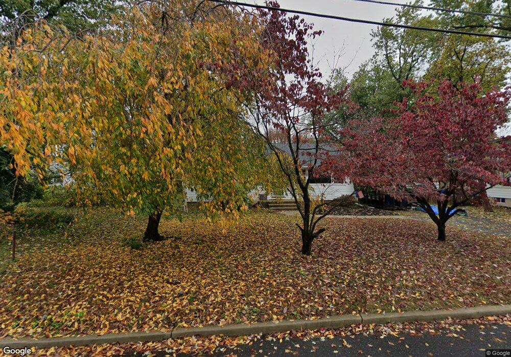
2013 Rowland St Cinnaminson, NJ 08077
Estimated Value: $214,109 - $296,000
--
Bed
--
Bath
960
Sq Ft
$280/Sq Ft
Est. Value
About This Home
This home is located at 2013 Rowland St, Cinnaminson, NJ 08077 and is currently estimated at $268,777, approximately $279 per square foot. 2013 Rowland St is a home located in Burlington County with nearby schools including New Albany Elementary School, Eleanor Rush Intermediate School, and Cinnaminson Middle School.
Ownership History
Date
Name
Owned For
Owner Type
Purchase Details
Closed on
Nov 15, 2005
Sold by
Watson Bodden Yolanda D and Bodden Juan
Bought by
Bodden Juan and Watson Bodden Yolanda D
Current Estimated Value
Home Financials for this Owner
Home Financials are based on the most recent Mortgage that was taken out on this home.
Original Mortgage
$130,000
Interest Rate
8.25%
Mortgage Type
Fannie Mae Freddie Mac
Purchase Details
Closed on
Apr 4, 2003
Sold by
Watson Walter E and Watson Vivian J
Bought by
Watson Bodden Yolanda D
Create a Home Valuation Report for This Property
The Home Valuation Report is an in-depth analysis detailing your home's value as well as a comparison with similar homes in the area
Home Values in the Area
Average Home Value in this Area
Purchase History
| Date | Buyer | Sale Price | Title Company |
|---|---|---|---|
| Bodden Juan | -- | None Available | |
| Watson Bodden Yolanda D | -- | -- |
Source: Public Records
Mortgage History
| Date | Status | Borrower | Loan Amount |
|---|---|---|---|
| Closed | Bodden Juan | $130,000 |
Source: Public Records
Tax History Compared to Growth
Tax History
| Year | Tax Paid | Tax Assessment Tax Assessment Total Assessment is a certain percentage of the fair market value that is determined by local assessors to be the total taxable value of land and additions on the property. | Land | Improvement |
|---|---|---|---|---|
| 2025 | $5,203 | $136,600 | $56,000 | $80,600 |
| 2024 | $5,077 | $136,600 | $56,000 | $80,600 |
| 2023 | $5,077 | $136,600 | $56,000 | $80,600 |
| 2022 | $4,967 | $136,600 | $56,000 | $80,600 |
| 2021 | $4,927 | $136,600 | $56,000 | $80,600 |
| 2020 | $4,879 | $136,600 | $56,000 | $80,600 |
| 2019 | $4,811 | $136,600 | $56,000 | $80,600 |
| 2018 | $4,777 | $136,600 | $56,000 | $80,600 |
| 2017 | $4,728 | $136,600 | $56,000 | $80,600 |
| 2016 | $4,662 | $136,600 | $56,000 | $80,600 |
| 2015 | $4,515 | $136,600 | $56,000 | $80,600 |
| 2014 | $4,299 | $136,600 | $56,000 | $80,600 |
Source: Public Records
Map
Nearby Homes
- 724 Pear St
- 803 James Ave
- 322 Amy Way Unit C322
- 1804 Nathan Dr Unit C1804
- 1917 Lukas Ct
- 194 Fela Dr
- 314 Helen Dr Unit C314
- 1910 Jakob Ct
- 1915 Jakob Ct
- 1521 Jason Dr Unit 1521
- 1531 Jason Dr Unit 1531
- 1511 Jason Dr Unit 1511
- 305 Nathan Dr
- 1536 Jason Dr Unit 1536
- 124 Nathan Dr
- 221 Nathan Dr
- 177 Nathan Dr
- 121 Helen Dr Unit 121
- 160 Helen Dr
- 601 8th St
- 2017 Rowland St
- 618 Pear St
- 2000 Rowland St
- 2021 Rowland St
- 614 Pear St
- 2008 Rowland St
- 2012 Rowland St
- 704 Pear St
- 2023 Rowland St
- 627 Pear St
- 612 Pear St
- 2020 Rowland St
- 708 Pear St
- 713 James Ave
- 701 Pear St
- 623 Union Landing Rd
- 619 Union Landing Rd
- 627 Union Landing Rd
- 2026 Rowland St
- 705 Pear St
