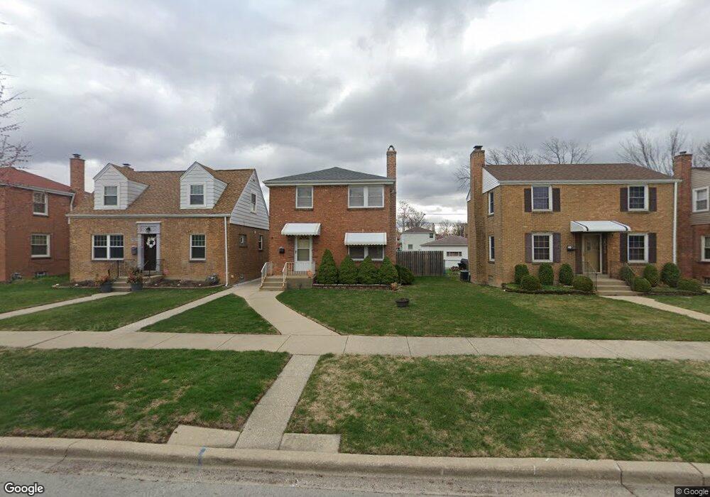
2013 S 22nd Ave Broadview, IL 60155
South Maywood NeighborhoodEstimated Value: $261,488 - $337,000
3
Beds
1
Bath
1,348
Sq Ft
$227/Sq Ft
Est. Value
About This Home
This home is located at 2013 S 22nd Ave, Broadview, IL 60155 and is currently estimated at $306,122, approximately $227 per square foot. 2013 S 22nd Ave is a home located in Cook County with nearby schools including Thurgood Marshall Elementary School, Roosevelt Middle School, and Proviso West High School.
Ownership History
Date
Name
Owned For
Owner Type
Purchase Details
Closed on
Oct 26, 2006
Sold by
Desanti Anthony and Desanti Mary C Byars
Bought by
Negron Maria M
Current Estimated Value
Home Financials for this Owner
Home Financials are based on the most recent Mortgage that was taken out on this home.
Original Mortgage
$217,000
Outstanding Balance
$153,760
Interest Rate
10.5%
Mortgage Type
Unknown
Estimated Equity
$152,362
Purchase Details
Closed on
May 10, 2006
Sold by
Armstrong Johnson Mary
Bought by
Desanti Anthony and Desanti Mary C Byars
Home Financials for this Owner
Home Financials are based on the most recent Mortgage that was taken out on this home.
Original Mortgage
$101,250
Interest Rate
7.75%
Mortgage Type
Unknown
Purchase Details
Closed on
May 5, 2006
Sold by
Chicago Title Land Trust Co
Bought by
Desanti Anthony and Desanti Mary C
Home Financials for this Owner
Home Financials are based on the most recent Mortgage that was taken out on this home.
Original Mortgage
$101,250
Interest Rate
7.75%
Mortgage Type
Unknown
Purchase Details
Closed on
Dec 2, 1997
Sold by
Mccall Frank and Mccall Rosie
Bought by
The Chicago Trust Company and Trust #1105162
Purchase Details
Closed on
Jun 3, 1997
Sold by
Mccall Frank and Mccall Rosie
Bought by
Amstrong Johnson Mary
Create a Home Valuation Report for This Property
The Home Valuation Report is an in-depth analysis detailing your home's value as well as a comparison with similar homes in the area
Home Values in the Area
Average Home Value in this Area
Purchase History
| Date | Buyer | Sale Price | Title Company |
|---|---|---|---|
| Negron Maria M | $217,000 | Enterprise Land Title Ltd | |
| Desanti Anthony | $135,000 | Pntn | |
| Desanti Anthony | -- | Pntn | |
| The Chicago Trust Company | -- | -- | |
| Amstrong Johnson Mary | -- | -- |
Source: Public Records
Mortgage History
| Date | Status | Borrower | Loan Amount |
|---|---|---|---|
| Open | Negron Maria M | $217,000 | |
| Previous Owner | Desanti Anthony | $101,250 |
Source: Public Records
Tax History
| Year | Tax Paid | Tax Assessment Tax Assessment Total Assessment is a certain percentage of the fair market value that is determined by local assessors to be the total taxable value of land and additions on the property. | Land | Improvement |
|---|---|---|---|---|
| 2025 | $854 | $18,000 | $2,873 | $15,127 |
| 2024 | $854 | $18,000 | $2,873 | $15,127 |
| 2023 | $1,032 | $18,000 | $2,873 | $15,127 |
| 2022 | $1,032 | $15,596 | $2,274 | $13,322 |
| 2021 | $964 | $15,595 | $2,274 | $13,321 |
| 2020 | $870 | $15,595 | $2,274 | $13,321 |
| 2019 | $1,046 | $11,419 | $2,034 | $9,385 |
| 2018 | $1,720 | $11,419 | $2,034 | $9,385 |
| 2017 | $1,714 | $11,419 | $2,034 | $9,385 |
| 2016 | $260 | $9,664 | $1,795 | $7,869 |
| 2015 | $266 | $9,664 | $1,795 | $7,869 |
| 2014 | $256 | $9,664 | $1,795 | $7,869 |
| 2013 | $241 | $11,012 | $1,795 | $9,217 |
Source: Public Records
Map
Nearby Homes
- 2023 S 23rd Ave
- 1910 S 22nd Ave
- 1909 S 22nd Ave
- 1908 S 23rd Ave
- 1909 S 20th Ave
- 2225 S 23rd Ave
- 1125 24th Ave
- 1615 S 20th Ave
- 1107 24th Ave
- 1924 S 15th Ave
- 2036 S 15th Ave
- 1846 S 15th Ave
- 1427 S 21st Ave
- 1420 S 21st Ave
- 2325 S 25th Ave
- 2227 S 16th Ave
- 2341 S 24th Ave
- 1924 S 13th Ave
- 1231 S 20th Ave
- 2305 S 15th Ave
- 2011 S 22nd Ave
- 2015 S 22nd Ave
- 2009 S 22nd Ave
- 2017 S 22nd Ave
- 2007 S 22nd Ave
- 2019 S 22nd Ave
- 2012 S 21st Ave
- 2005 S 22nd Ave
- 2014 S 21st Ave
- 2008 S 21st Ave
- 2021 S 22nd Ave
- 2016 S 21st Ave
- 2006 S 21st Ave
- 2003 S 22nd Ave
- 2018 S 21st Ave
- 2014 S 22nd Ave
- 2012 S 22nd Ave
- 2018 S 22nd Ave
- 2025 S 22nd Ave