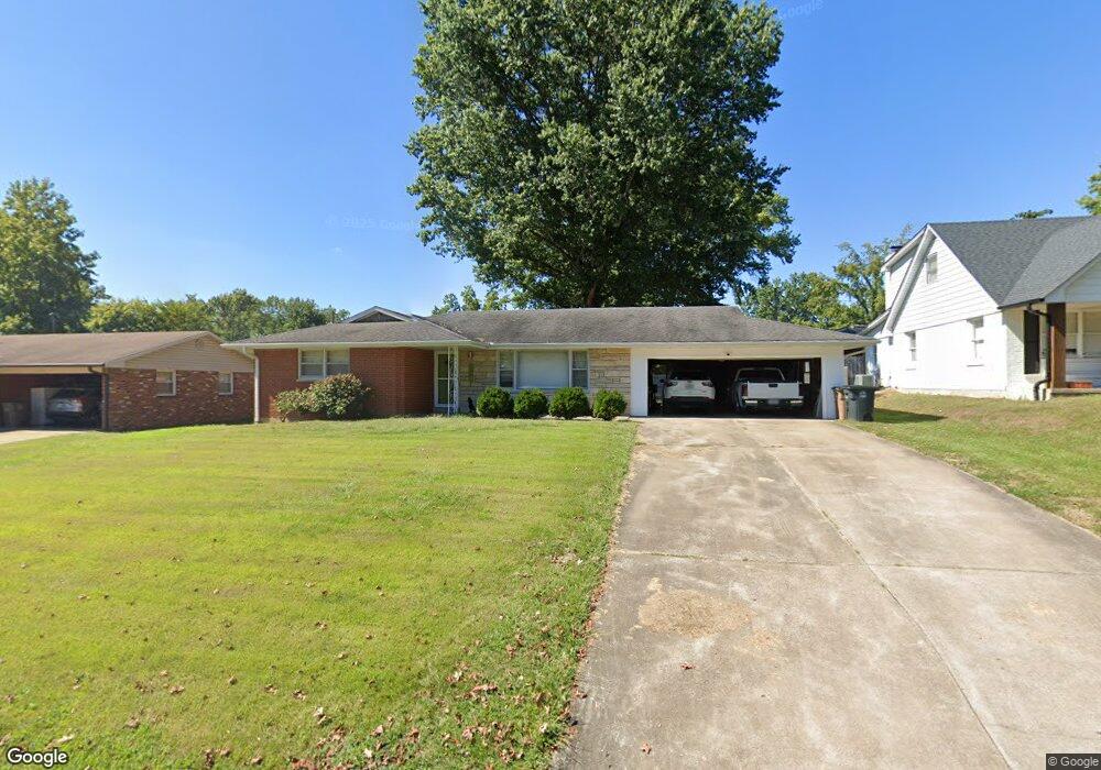
2013 Sherwood Dr Cape Girardeau, MO 63701
Estimated Value: $211,297 - $273,000
3
Beds
2
Baths
1,368
Sq Ft
$170/Sq Ft
Est. Value
About This Home
This home is located at 2013 Sherwood Dr, Cape Girardeau, MO 63701 and is currently estimated at $233,074, approximately $170 per square foot. 2013 Sherwood Dr is a home with nearby schools including Alma Schrader Elementary School, Central Middle School, and Central Junior High School.
Ownership History
Date
Name
Owned For
Owner Type
Purchase Details
Closed on
Jun 7, 2022
Sold by
Livingston and Kara
Bought by
Williams Spencer and Williams Samantha
Current Estimated Value
Home Financials for this Owner
Home Financials are based on the most recent Mortgage that was taken out on this home.
Original Mortgage
$144,500
Outstanding Balance
$137,275
Interest Rate
5.09%
Mortgage Type
New Conventional
Estimated Equity
$95,799
Purchase Details
Closed on
Jun 2, 2022
Sold by
David Wessel
Bought by
Wessel Austin and Wessel Joseph
Home Financials for this Owner
Home Financials are based on the most recent Mortgage that was taken out on this home.
Original Mortgage
$144,500
Outstanding Balance
$137,275
Interest Rate
5.09%
Mortgage Type
New Conventional
Estimated Equity
$95,799
Purchase Details
Closed on
Apr 11, 2007
Sold by
Livingston Donna M and Livingston Calvin C
Bought by
Livingston Kenneth B and Hamilton Pamela Suie
Create a Home Valuation Report for This Property
The Home Valuation Report is an in-depth analysis detailing your home's value as well as a comparison with similar homes in the area
Home Values in the Area
Average Home Value in this Area
Purchase History
| Date | Buyer | Sale Price | Title Company |
|---|---|---|---|
| Williams Spencer | -- | None Listed On Document | |
| Wessel Austin | -- | None Listed On Document | |
| Livingston Kenneth B | -- | None Available |
Source: Public Records
Mortgage History
| Date | Status | Borrower | Loan Amount |
|---|---|---|---|
| Open | Williams Spencer | $144,500 |
Source: Public Records
Tax History Compared to Growth
Tax History
| Year | Tax Paid | Tax Assessment Tax Assessment Total Assessment is a certain percentage of the fair market value that is determined by local assessors to be the total taxable value of land and additions on the property. | Land | Improvement |
|---|---|---|---|---|
| 2025 | $12 | $24,640 | $2,970 | $21,670 |
| 2024 | $12 | $23,470 | $2,830 | $20,640 |
| 2023 | $1,220 | $23,470 | $2,830 | $20,640 |
| 2022 | $1,125 | $21,640 | $2,610 | $19,030 |
| 2021 | $1,125 | $21,640 | $2,610 | $19,030 |
| 2020 | $1,128 | $21,640 | $2,610 | $19,030 |
| 2019 | $1,126 | $21,630 | $0 | $0 |
| 2018 | $1,124 | $21,630 | $0 | $0 |
| 2017 | $1,127 | $21,630 | $0 | $0 |
| 2016 | $1,122 | $21,630 | $0 | $0 |
| 2015 | $1,123 | $21,630 | $0 | $0 |
| 2014 | $1,129 | $21,630 | $0 | $0 |
Source: Public Records
Map
Nearby Homes
- 1623 Lexington Ave
- 1608 Lexington Ave
- 1960 Briarwood Dr
- 1572 Lexington Ave
- 1912 Perryville Rd
- 1910 Sherwood Dr
- 2062 Concord Place
- 1577 Saratoga St
- 1938 Westwood Dr
- 1553 Valley Forge Ln
- 1966 Randol Ave
- 1413 Parkmor Dr
- 1230 Brookshire Rd Unit 1230 & 1232
- 2213 Crown Point Dr
- 2323 Brookwood Dr
- 1717 Perryville Rd
- 2412 Masters Dr
- 1546 Oak Lei Dr
- 0 W Cape Rock Drive (Lot# 2) Unit MIS25044464
- 11 Dumaine St
- 2017 Sherwood Dr
- 2009 Sherwood Dr
- 2007 Robinhood Cir
- 2018 Sherwood Dr
- 1924 Robinhood Cir
- 2010 Sherwood Dr
- 2013 Robinhood Cir
- 2021 Sherwood Dr
- 1930 Robinhood Cir
- 2022 Sherwood Dr
- 2014 Sherwood Dr
- 2002 Robinhood Cir
- 2008 Robinhood Cir
- 2006 Sherwood Dr
- 1936 Robinhood Cir
- 2019 Robinhood Cir
- 2014 Robinhood Cir
- 2026 Sherwood Dr
- 2020 Robinhood Cir
- 1942 Robinhood Cir