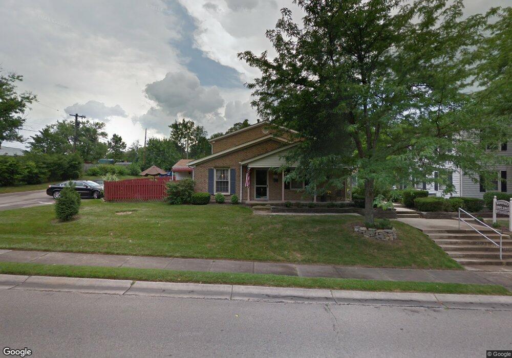
2013 Sunset Dr Unit A-2 Hamilton, OH 45013
Estimated Value: $147,000 - $204,000
3
Beds
2
Baths
1,400
Sq Ft
$121/Sq Ft
Est. Value
About This Home
This home is located at 2013 Sunset Dr Unit A-2, Hamilton, OH 45013 and is currently estimated at $169,426, approximately $121 per square foot. 2013 Sunset Dr Unit A-2 is a home located in Butler County with nearby schools including Brookwood Elementary School, Wilson Middle School, and Hamilton High School Main Campus.
Ownership History
Date
Name
Owned For
Owner Type
Purchase Details
Closed on
Jan 17, 2023
Sold by
Starkey-Smith Sarah and Rowland Eric
Bought by
Rice Jack B
Current Estimated Value
Home Financials for this Owner
Home Financials are based on the most recent Mortgage that was taken out on this home.
Original Mortgage
$82,500
Outstanding Balance
$79,226
Interest Rate
5.75%
Mortgage Type
New Conventional
Estimated Equity
$90,200
Purchase Details
Closed on
Jan 30, 2014
Sold by
Micale Carolyn J
Bought by
Starkey Sarah
Home Financials for this Owner
Home Financials are based on the most recent Mortgage that was taken out on this home.
Original Mortgage
$75,605
Interest Rate
4.5%
Mortgage Type
FHA
Purchase Details
Closed on
May 23, 2000
Sold by
Warner Rhonda L
Bought by
Micale Carolyn J
Home Financials for this Owner
Home Financials are based on the most recent Mortgage that was taken out on this home.
Original Mortgage
$53,600
Interest Rate
8.13%
Purchase Details
Closed on
Aug 1, 1985
Create a Home Valuation Report for This Property
The Home Valuation Report is an in-depth analysis detailing your home's value as well as a comparison with similar homes in the area
Home Values in the Area
Average Home Value in this Area
Purchase History
| Date | Buyer | Sale Price | Title Company |
|---|---|---|---|
| Rice Jack B | $110,000 | -- | |
| Starkey Sarah | $77,000 | None Available | |
| Micale Carolyn J | $67,000 | -- | |
| -- | $45,400 | -- |
Source: Public Records
Mortgage History
| Date | Status | Borrower | Loan Amount |
|---|---|---|---|
| Open | Rice Jack B | $82,500 | |
| Previous Owner | Starkey Sarah | $75,605 | |
| Previous Owner | Micale Carolyn J | $53,600 |
Source: Public Records
Tax History Compared to Growth
Tax History
| Year | Tax Paid | Tax Assessment Tax Assessment Total Assessment is a certain percentage of the fair market value that is determined by local assessors to be the total taxable value of land and additions on the property. | Land | Improvement |
|---|---|---|---|---|
| 2025 | $1,625 | $38,500 | $5,600 | $32,900 |
| 2024 | $1,625 | $38,500 | $5,600 | $32,900 |
| 2023 | $1,617 | $38,520 | $5,600 | $32,920 |
| 2022 | $1,172 | $23,600 | $5,600 | $18,000 |
| 2021 | $1,034 | $22,840 | $5,600 | $17,240 |
| 2020 | $1,078 | $22,840 | $5,600 | $17,240 |
| 2019 | $1,778 | $24,280 | $5,600 | $18,680 |
| 2018 | $1,129 | $24,280 | $5,600 | $18,680 |
| 2017 | $1,138 | $24,280 | $5,600 | $18,680 |
| 2016 | $1,144 | $23,260 | $5,600 | $17,660 |
| 2015 | $1,138 | $23,260 | $5,600 | $17,660 |
| 2014 | $539 | $23,260 | $5,600 | $17,660 |
| 2013 | $539 | $20,470 | $6,300 | $14,170 |
Source: Public Records
Map
Nearby Homes
- 16 Rockford Dr
- 540 Carlisle Ave
- 238 Twinbrook Dr
- 570 Fairhaven Dr
- 30 Berkshire Ct
- 974 Westview Ave
- 925 Carlisle Ave
- 987 Carlisle Ave
- 936 Elizabeth Dr
- 1326 Franklin St
- 1350 Stahlheber Rd
- 7 Victor Ct
- 732 Millville Ave
- 74 Thornhill Dr
- 108 Mollie Dr
- 672 Glenway Dr
- 82 Brookwood Ave
- 64 Brookwood Ave
- 1116 Azel Ave
- 1103 Hunt Ave
- 2013 Sunset Dr
- 2017 Sunset Dr Unit A3
- 2021 Sunset Dr Unit A4
- 2025 Sunset Dr Unit A5
- 2033 Sunset Dr Unit B10
- 2037 Sunset Dr
- 2029 Sunset Dr
- 2005 Sunset Dr
- 186 Revere Dr
- 2012 Sunset Dr
- 2014 Sunset Dr
- 2014 Sunset Dr Unit 21
- 2016 Sunset Dr
- 2008 Sunset Dr Unit E24
- 2018 Sunset Dr
- 2010 Sunset Dr Unit E23
- 2020 Sunset Dr
- 2006 Sunset Dr
- 174 Revere Dr
- 2026 Sunset Dr