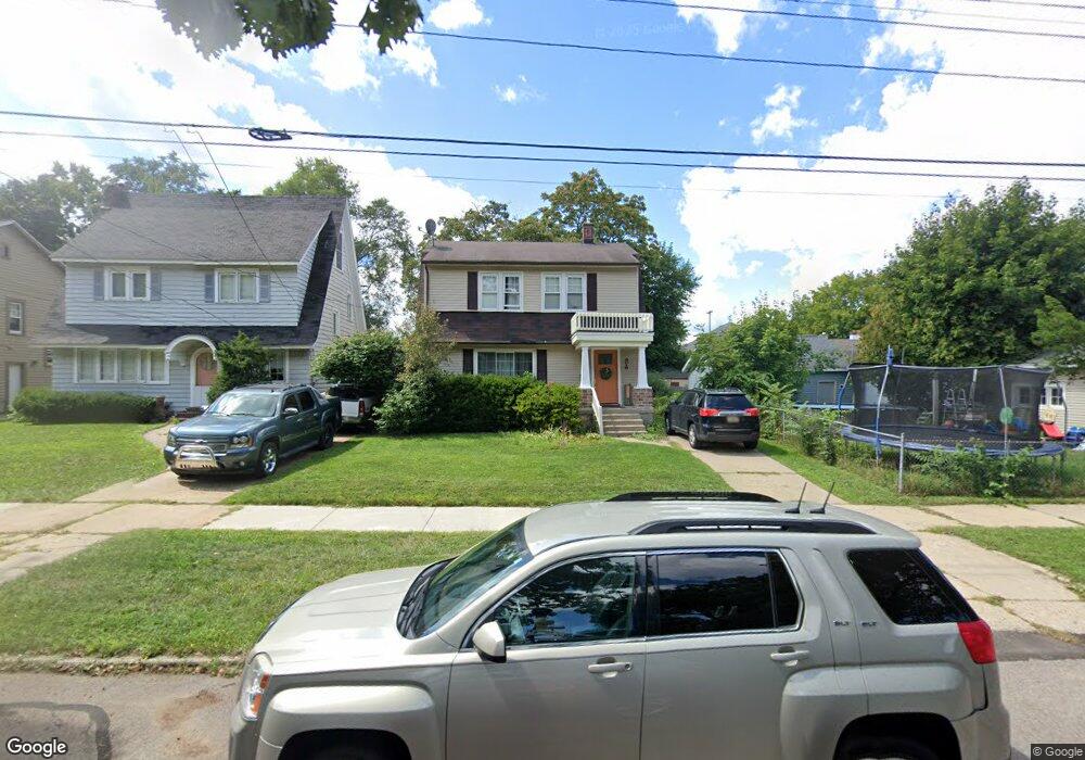
2013 Union Ave SE Grand Rapids, MI 49507
Garfield Park NeighborhoodEstimated Value: $266,000 - $280,000
2
Beds
2
Baths
1,237
Sq Ft
$221/Sq Ft
Est. Value
About This Home
This home is located at 2013 Union Ave SE, Grand Rapids, MI 49507 and is currently estimated at $273,228, approximately $220 per square foot. 2013 Union Ave SE is a home located in Kent County with nearby schools including Brookside Elementary School, Alger Middle School, and Ottawa Hills High School.
Ownership History
Date
Name
Owned For
Owner Type
Purchase Details
Closed on
Oct 13, 2015
Sold by
Swan Carol A and Davis Carol
Bought by
Swan Carol A
Current Estimated Value
Home Financials for this Owner
Home Financials are based on the most recent Mortgage that was taken out on this home.
Original Mortgage
$85,000
Outstanding Balance
$34,475
Interest Rate
3.88%
Mortgage Type
New Conventional
Estimated Equity
$238,753
Purchase Details
Closed on
Dec 13, 1984
Create a Home Valuation Report for This Property
The Home Valuation Report is an in-depth analysis detailing your home's value as well as a comparison with similar homes in the area
Home Values in the Area
Average Home Value in this Area
Purchase History
| Date | Buyer | Sale Price | Title Company |
|---|---|---|---|
| Swan Carol A | -- | Chicago Title | |
| -- | $36,000 | -- |
Source: Public Records
Mortgage History
| Date | Status | Borrower | Loan Amount |
|---|---|---|---|
| Open | Swan Carol A | $85,000 |
Source: Public Records
Tax History Compared to Growth
Tax History
| Year | Tax Paid | Tax Assessment Tax Assessment Total Assessment is a certain percentage of the fair market value that is determined by local assessors to be the total taxable value of land and additions on the property. | Land | Improvement |
|---|---|---|---|---|
| 2025 | $1,826 | $119,700 | $0 | $0 |
| 2024 | $1,826 | $107,000 | $0 | $0 |
| 2023 | $1,852 | $92,500 | $0 | $0 |
| 2022 | $1,758 | $82,500 | $0 | $0 |
| 2021 | $1,719 | $73,900 | $0 | $0 |
| 2020 | $1,644 | $67,700 | $0 | $0 |
| 2019 | $1,721 | $62,600 | $0 | $0 |
| 2018 | $1,662 | $57,300 | $0 | $0 |
| 2017 | $1,618 | $57,000 | $0 | $0 |
| 2016 | $1,638 | $51,500 | $0 | $0 |
| 2015 | $1,523 | $51,500 | $0 | $0 |
| 2013 | -- | $44,800 | $0 | $0 |
Source: Public Records
Map
Nearby Homes
- 2048 Paris Ave SE
- 2105 Willard Ave SE
- 2109 Willard Ave SE
- 2096 Willard Ave SE
- 2113 Willard Ave SE
- 2047 Linden Ave SE
- 2053 Linden Ave SE
- 2108 Willard Ave SE
- 2065 Linden Ave SE
- 2059 Linden Ave SE
- 2050 Linden Ave SE
- 2077 Linden Ave SE
- 2058 Linden Ave SE
- 2116 Willard Ave SE
- 2071 Linden Ave SE
- 2089 Linden Ave SE
- 2083 Linden Ave SE
- 2107 Linden Ave SE
- 2101 Linden Ave SE
- 2095 Linden Ave SE
- 2021 Union Ave SE
- 546 Burton St SE
- 542 Burton St SE
- 2023 Union Ave SE
- 2005 Union Ave SE
- 538 Burton St SE
- 2014 Paris Ave SE
- 2025 Union Ave SE
- 2018 Paris Ave SE
- 2022 Paris Ave SE
- 534 Burton St SE
- 534 Burton St SE Unit 536
- 2027 Union Ave SE
- 2026 Paris Ave SE
- 2030 Paris Ave SE
- 2035 Union Ave SE
- 2034 Paris Ave SE
- 2039 Union Ave SE
- 555 Burton St SE
- 551 Burton St SE