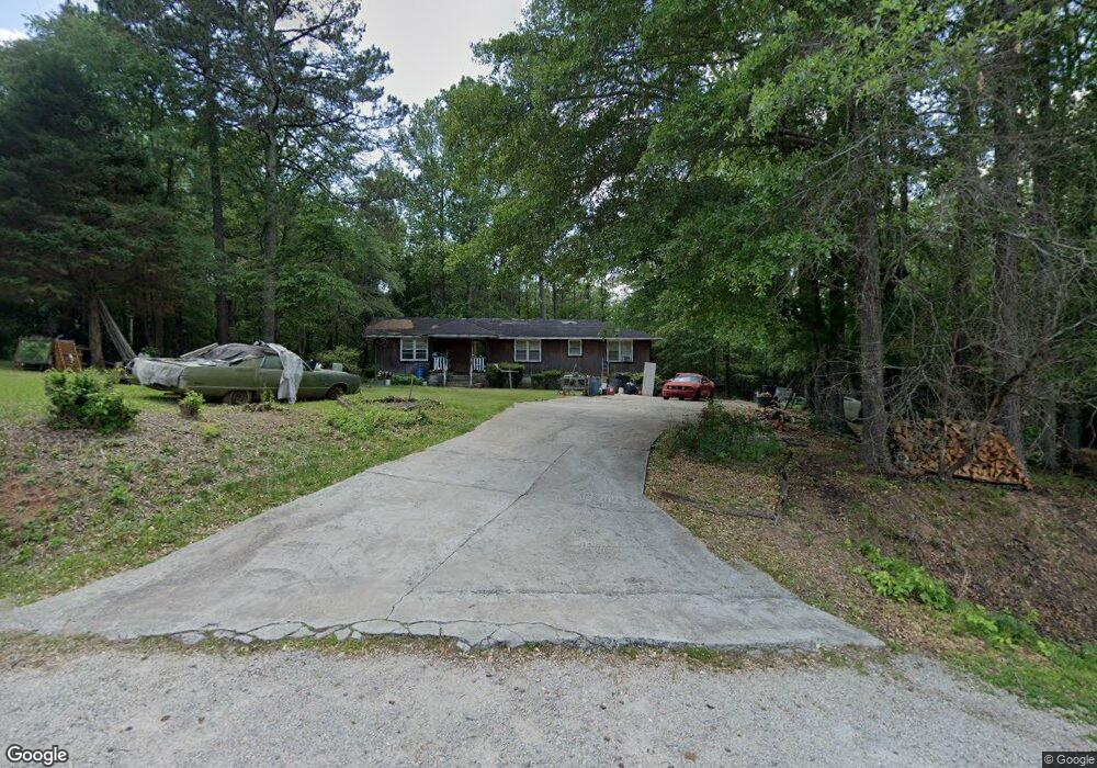
2013 West Cir Thomson, GA 30824
Estimated Value: $80,000 - $173,000
2
Beds
2
Baths
1,320
Sq Ft
$107/Sq Ft
Est. Value
About This Home
This home is located at 2013 West Cir, Thomson, GA 30824 and is currently estimated at $141,527, approximately $107 per square foot. 2013 West Cir is a home located in McDuffie County with nearby schools including Thomson High School.
Ownership History
Date
Name
Owned For
Owner Type
Purchase Details
Closed on
Oct 13, 2005
Sold by
Tcm Investments Llc
Bought by
Reese Rutha T
Current Estimated Value
Home Financials for this Owner
Home Financials are based on the most recent Mortgage that was taken out on this home.
Original Mortgage
$61,160
Interest Rate
5.71%
Mortgage Type
New Conventional
Purchase Details
Closed on
Jun 27, 2005
Sold by
Us Bank National Associati
Bought by
Tcm Investments Llc
Home Financials for this Owner
Home Financials are based on the most recent Mortgage that was taken out on this home.
Original Mortgage
$56,000
Interest Rate
5.57%
Mortgage Type
New Conventional
Purchase Details
Closed on
Nov 2, 2004
Sold by
Gloster Moses
Bought by
U S Bank National Assoc
Purchase Details
Closed on
Mar 21, 1990
Bought by
Gloster Moses
Create a Home Valuation Report for This Property
The Home Valuation Report is an in-depth analysis detailing your home's value as well as a comparison with similar homes in the area
Home Values in the Area
Average Home Value in this Area
Purchase History
| Date | Buyer | Sale Price | Title Company |
|---|---|---|---|
| Reese Rutha T | $67,500 | -- | |
| Tcm Investments Llc | $49,650 | -- | |
| Tcm Investments Llc | -- | -- | |
| U S Bank National Assoc | $46,100 | -- | |
| Gloster Moses | $11,000 | -- |
Source: Public Records
Mortgage History
| Date | Status | Borrower | Loan Amount |
|---|---|---|---|
| Closed | Reese Rutha T | $61,160 | |
| Previous Owner | Tcm Investments Llc | $56,000 |
Source: Public Records
Tax History Compared to Growth
Tax History
| Year | Tax Paid | Tax Assessment Tax Assessment Total Assessment is a certain percentage of the fair market value that is determined by local assessors to be the total taxable value of land and additions on the property. | Land | Improvement |
|---|---|---|---|---|
| 2024 | $279 | $33,998 | $2,520 | $31,478 |
| 2023 | $279 | $32,668 | $2,400 | $30,268 |
| 2022 | $238 | $32,012 | $2,400 | $29,612 |
| 2021 | $126 | $25,725 | $2,400 | $23,325 |
| 2020 | $58 | $21,809 | $2,959 | $18,850 |
| 2019 | $621 | $21,809 | $2,959 | $18,850 |
| 2018 | $507 | $21,809 | $2,959 | $18,850 |
| 2017 | $490 | $21,809 | $2,959 | $18,850 |
| 2016 | $688 | $29,029 | $2,959 | $26,070 |
| 2015 | $727 | $29,028 | $2,959 | $26,070 |
| 2014 | $728 | $29,029 | $2,959 | $26,070 |
| 2013 | -- | $29,028 | $2,958 | $26,070 |
Source: Public Records
Map
Nearby Homes
- 1919 Ridgeview Dr
- 2142 Ridgeview Dr
- 334 Bordeaux Dr
- 351 Bordeaux Dr
- 359 Bordeaux Dr
- 319 Bordeaux Dr
- 344 Bordeaux Dr
- 249 Seymour Dr S
- 1403 Tanyard Creek Dr
- 0 Earle St
- 875 Earle St
- 810 Earle St
- 0 3 Points Rd
- 106 Kennedy Ct
- 00 Three Points Rd
- 209 Hoey St
- Glenwood II Plan at Bentcreek Village
- Briarwood II Plan at Bentcreek Village
- Laurel II Plan at Bentcreek Village
- 0 Old Washington Rd Unit 539000
- 2013 West Cir
- 2031 West Cir
- 1741 West St
- 2040 West Cir
- 2163 Pope St
- 2146 Pope St
- 2060 Crawford Ave
- 2050 Crawford Ave
- 2040 Crawford Ave
- 2122 Pope St
- 1989 Crawford Ave
- 2102 Pope St
- 1990 Crawford Ave
- 2091 Pope St
- 1978 Crawford Ave
- 2116 Ridgeview Dr
- 2055 Ridgeview Dr
- 2045 Ridgeview Dr
- 2075 Ridgeview Dr
- 2095 Ridgeview Dr