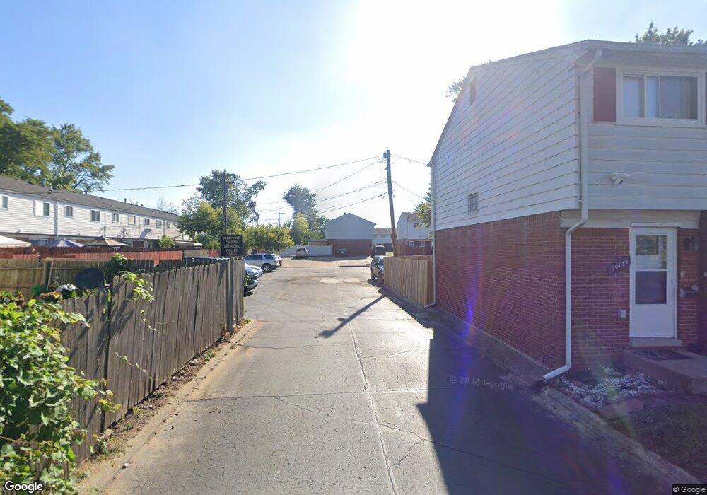
20132 Brian Ct Clinton Township, MI 48035
Estimated Value: $94,000 - $117,982
3
Beds
2
Baths
958
Sq Ft
$107/Sq Ft
Est. Value
About This Home
This home is located at 20132 Brian Ct, Clinton Township, MI 48035 and is currently estimated at $102,496, approximately $106 per square foot. 20132 Brian Ct is a home located in Macomb County with nearby schools including Clintondale High School and St. Thecla Catholic School.
Ownership History
Date
Name
Owned For
Owner Type
Purchase Details
Closed on
Dec 28, 2016
Sold by
Tobia Salwan Samir
Bought by
Patrah Sal Ghanim
Current Estimated Value
Purchase Details
Closed on
Oct 17, 2011
Sold by
Secretary Of Housing & Urban Development
Bought by
Tobia Salwan
Purchase Details
Closed on
Jul 19, 2011
Sold by
Phh Mortgage Corporation
Bought by
The Secretary Of Housing & Urban Develop
Purchase Details
Closed on
Jan 7, 2011
Sold by
Raines Lizzie M
Bought by
Phh Mortgage Corporation and Cendant Mortgage Corporation
Create a Home Valuation Report for This Property
The Home Valuation Report is an in-depth analysis detailing your home's value as well as a comparison with similar homes in the area
Home Values in the Area
Average Home Value in this Area
Purchase History
| Date | Buyer | Sale Price | Title Company |
|---|---|---|---|
| Patrah Sal Ghanim | -- | None Available | |
| Tobia Salwan | $13,050 | None Available | |
| The Secretary Of Housing & Urban Develop | -- | None Available | |
| Phh Mortgage Corporation | $75,813 | None Available |
Source: Public Records
Tax History
| Year | Tax Paid | Tax Assessment Tax Assessment Total Assessment is a certain percentage of the fair market value that is determined by local assessors to be the total taxable value of land and additions on the property. | Land | Improvement |
|---|---|---|---|---|
| 2025 | $1,041 | $45,200 | $0 | $0 |
| 2024 | $10 | $43,400 | $0 | $0 |
| 2023 | $966 | $36,800 | $0 | $0 |
| 2022 | $1,276 | $32,800 | $0 | $0 |
| 2021 | $1,240 | $29,600 | $0 | $0 |
| 2020 | $882 | $27,200 | $0 | $0 |
| 2019 | $1,171 | $22,400 | $0 | $0 |
| 2018 | $1,148 | $21,200 | $0 | $0 |
| 2017 | $1,131 | $19,500 | $3,000 | $16,500 |
| 2016 | $1,124 | $19,500 | $0 | $0 |
| 2015 | -- | $17,200 | $0 | $0 |
| 2014 | -- | $17,700 | $0 | $0 |
| 2011 | -- | $25,700 | $0 | $25,700 |
Source: Public Records
Map
Nearby Homes
- 0 0 15 Mile Lot 1 Cstrc Rd Unit 20251050297
- 0 0 15 Mile Lot 2 Cstrc Rd Unit 20251050304
- Sublot 41 Charles
- 0 000 15 Mile Rd Unit 20261017261
- 20011 Abrahm St
- 20355 15 Mile Rd
- 35501 Griswald St
- 0 Groesbeck Hwy Unit 20261014983
- 34559 Chope Place
- 35337 Little MacK Ave
- 34353 Chope Place
- 35375 Groesbeck Hwy
- 20401 Luna St
- 20346 Tullio St
- 20452 Dubois St
- 20500 McKishnie St
- 20219 Finley St
- 0 Abrahm St
- 20355 Caniff St
- 20541 Finley St
- 20130 Brian Ct
- 20128 Brian Ct
- 20126 Brian Ct
- 20124 Brian Ct
- 20130 15 Mile Rd
- 20140 15 Mile Rd
- 20144 15 Mile Rd
- 20144 15 Mile Rd Unit 197
- 20122 Brian Ct
- 20120 Brian Ct
- 20148 15 Mile Rd
- 20118 Brian Ct
- 20152 15 Mile Rd
- 20116 Brian Ct
- 20114 Brian Ct
- 20156 15 Mile Rd
- 20127 Merle Ct
- 20127 Merle Ct Unit 63
- 20125 Merle Ct
- 20121 Merle Ct
Your Personal Tour Guide
Ask me questions while you tour the home.