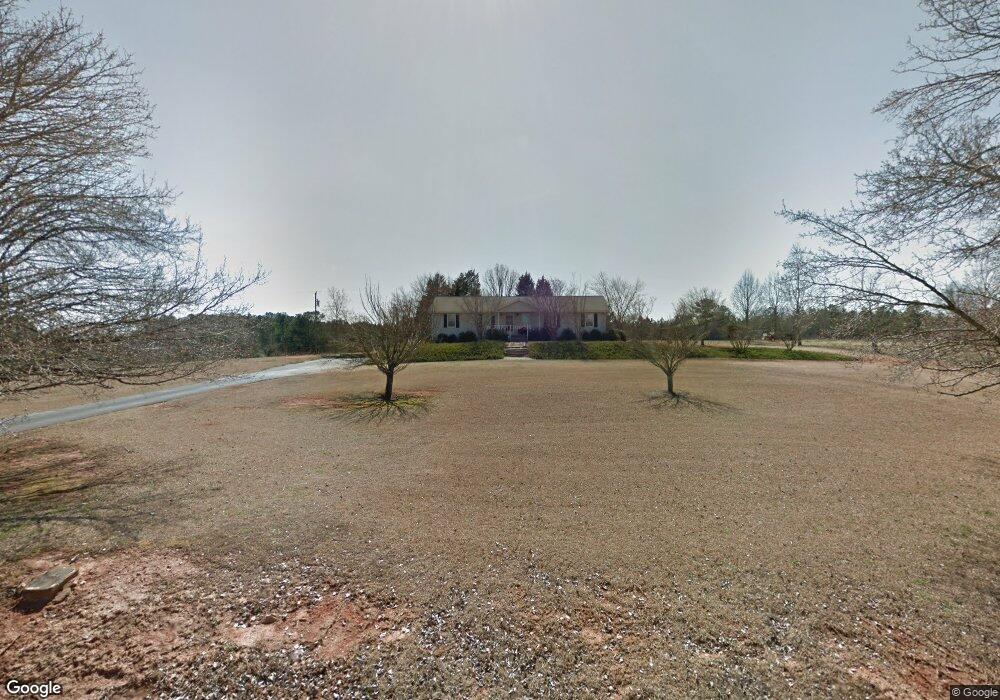
2014 Bishop Branch Rd Pendleton, SC 29670
Estimated Value: $354,000 - $517,000
Studio
--
Bath
1,713
Sq Ft
$259/Sq Ft
Est. Value
About This Home
This home is located at 2014 Bishop Branch Rd, Pendleton, SC 29670 and is currently estimated at $443,371, approximately $258 per square foot. 2014 Bishop Branch Rd is a home with nearby schools including Pendleton High School.
Ownership History
Date
Name
Owned For
Owner Type
Purchase Details
Closed on
Sep 28, 2018
Sold by
Ray Christopher L and Ray Rebecca M
Bought by
Kay Kevin K and Kay Tiffany W
Current Estimated Value
Home Financials for this Owner
Home Financials are based on the most recent Mortgage that was taken out on this home.
Original Mortgage
$228,000
Outstanding Balance
$198,830
Interest Rate
4.5%
Mortgage Type
New Conventional
Estimated Equity
$244,541
Purchase Details
Closed on
Nov 27, 2000
Sold by
Nvr
Bought by
Schell Laura D
Create a Home Valuation Report for This Property
The Home Valuation Report is an in-depth analysis detailing your home's value as well as a comparison with similar homes in the area
Home Values in the Area
Average Home Value in this Area
Purchase History
| Date | Buyer | Sale Price | Title Company |
|---|---|---|---|
| Kay Kevin K | $285,000 | None Available | |
| Schell Laura D | $190,070 | -- |
Source: Public Records
Mortgage History
| Date | Status | Borrower | Loan Amount |
|---|---|---|---|
| Open | Kay Kevin K | $228,000 |
Source: Public Records
Tax History
| Year | Tax Paid | Tax Assessment Tax Assessment Total Assessment is a certain percentage of the fair market value that is determined by local assessors to be the total taxable value of land and additions on the property. | Land | Improvement |
|---|---|---|---|---|
| 2024 | $1,173 | $7,480 | $580 | $6,900 |
| 2023 | $1,163 | $7,480 | $580 | $6,900 |
| 2022 | $1,020 | $7,480 | $580 | $6,900 |
| 2021 | $893 | $6,100 | $510 | $5,590 |
| 2020 | $878 | $6,100 | $510 | $5,590 |
| 2019 | $878 | $6,100 | $510 | $5,590 |
| 2018 | $803 | $5,580 | $350 | $5,230 |
| 2017 | -- | $5,580 | $350 | $5,230 |
| 2016 | $773 | $5,430 | $330 | $5,100 |
| 2015 | $777 | $5,430 | $330 | $5,100 |
| 2014 | $796 | $5,430 | $330 | $5,100 |
Source: Public Records
Map
Nearby Homes
- 119 Mcalister Dr
- 715 Melton Rd
- 00 Liberty Hwy
- 0 6 and 20 Rd Unit 1576377
- 6620 Liberty Hwy
- 212 Colonels Rd
- 208 Rogers Rd
- 102 Rogers Rd
- Lot 3 Rogers Rd
- 354 Harper Rd
- 5520 Old Greenville Hwy
- 00 Griffith Dr
- 145 Old Sanders Rd
- 02 Mill Pine Rd
- 012 Mill Pine Rd
- 013 Mill Pine Rd
- 09 Mill Pine Rd
- 010 Mill Pine Rd
- Lot 2 Mill Pine Rd
- 011 Mill Pine Rd
- 7106 Liberty Hwy
- 2010 Bishop Branch Rd
- 6936 Liberty Hwy
- 2211 Six and Twenty Rd
- 6925 Liberty Hwy
- 1934 Bishop Branch Rd
- 6921 Liberty Hwy
- 116 Peggys Way
- 110 Peggys Way
- 2224 Six and Twenty Rd
- 2301 Six and Twenty Rd
- 6914 Liberty Hwy
- 2300 6 and 20 Rd
- 1820 Bishop Branch Rd
- 2240 Six and Twenty Rd
- 2308 Six and Twenty Rd
- 6928 Liberty Hwy
- 7200 Liberty Hwy
- 1725 Bishop Branch Rd
- 1716 Bishop Branch Rd
Your Personal Tour Guide
Ask me questions while you tour the home.