Estimated Value: $269,791 - $301,000
3
Beds
2
Baths
1,316
Sq Ft
$220/Sq Ft
Est. Value
About This Home
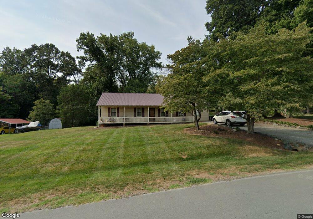
This home is located at 2014 Center Crest Dr, Elon, NC 27244 and is currently estimated at $288,948, approximately $219 per square foot. 2014 Center Crest Dr is a home located in Alamance County with nearby schools including Altamahaw Ossipee Elementary School, Western Alamance Middle School, and Western Alamance High School.
Ownership History
Date
Name
Owned For
Owner Type
Purchase Details
Closed on
Aug 30, 2012
Sold by
Lefler Michael H
Bought by
Hill Steven B
Current Estimated Value
Home Financials for this Owner
Home Financials are based on the most recent Mortgage that was taken out on this home.
Original Mortgage
$98,000
Interest Rate
3.56%
Mortgage Type
New Conventional
Purchase Details
Closed on
Sep 21, 2001
Sold by
Fitch Mary B
Bought by
Lefler Michael H
Home Financials for this Owner
Home Financials are based on the most recent Mortgage that was taken out on this home.
Original Mortgage
$115,050
Interest Rate
6.97%
Mortgage Type
Purchase Money Mortgage
Create a Home Valuation Report for This Property
The Home Valuation Report is an in-depth analysis detailing your home's value as well as a comparison with similar homes in the area
Home Values in the Area
Average Home Value in this Area
Purchase History
| Date | Buyer | Sale Price | Title Company |
|---|---|---|---|
| Hill Steven B | $118,000 | -- | |
| Lefler Michael H | $116,000 | -- |
Source: Public Records
Mortgage History
| Date | Status | Borrower | Loan Amount |
|---|---|---|---|
| Previous Owner | Hill Steven B | $98,000 | |
| Previous Owner | Lefler Michael H | $115,050 |
Source: Public Records
Tax History Compared to Growth
Tax History
| Year | Tax Paid | Tax Assessment Tax Assessment Total Assessment is a certain percentage of the fair market value that is determined by local assessors to be the total taxable value of land and additions on the property. | Land | Improvement |
|---|---|---|---|---|
| 2025 | $1,501 | $216,227 | $29,540 | $186,687 |
| 2024 | $1,403 | $216,227 | $29,540 | $186,687 |
| 2023 | $1,317 | $216,227 | $29,540 | $186,687 |
| 2022 | $1,189 | $134,307 | $29,540 | $104,767 |
| 2021 | $1,166 | $134,307 | $29,540 | $104,767 |
| 2020 | $1,366 | $134,307 | $29,540 | $104,767 |
| 2019 | $1,185 | $134,307 | $29,540 | $104,767 |
| 2018 | $0 | $134,307 | $29,540 | $104,767 |
| 2017 | $876 | $134,307 | $29,540 | $104,767 |
| 2016 | $885 | $135,643 | $29,540 | $106,103 |
| 2015 | $1,039 | $135,643 | $29,540 | $106,103 |
| 2014 | $973 | $135,872 | $29,540 | $106,332 |
Source: Public Records
Map
Nearby Homes
- 2048 Northcrest Dr
- 2119 Northcrest Dr
- 2201 Broken Arrow Ln
- 0 Barrington Rd
- 1630 Gerringer Mill Rd
- 1520 Reese Ct Unit 72 K.L.
- 1509 Reese Ct
- 1486 Kernodle Landing Dr
- 1425 Reading Ct
- 1425 Reading Ct Unit 78 K.L.
- 1407 Reading Ct
- 1407 Reading Ct Unit 76 K.L.
- 1406 Reading Ct
- 1406 Reading Ct Unit 93KL
- 1418 Reading Ct Unit Lot 90kl
- 1418 Reading Ct
- 1418 Reading Ct Unit 90 K.L.
- 2377 Barber Rd
- 1890 Terry Smith Trail
- 3564 Kirkland Ct
- 2014 Centercrest Dr
- 2004 Centercrest Dr
- 2001 Carroll Ct
- 2003 Carroll Ct
- 2121 Carroll Dr
- 2036 Centercrest Dr
- 2005 Carroll Ct
- 2106 Carroll Dr
- 2042 Centercrest Dr
- 2025 Northcrest Dr
- 2015 Northcrest Dr
- 2005 Northcrest Dr
- 2126 Carroll Dr
- 2031 Northcrest Dr
- 2136 Carroll Dr
- 2144 Carroll Dr
- 2152 Carroll Dr
- 2052 Centercrest Dr
- 2204 Carroll Dr
- 2041 Northcrest Dr