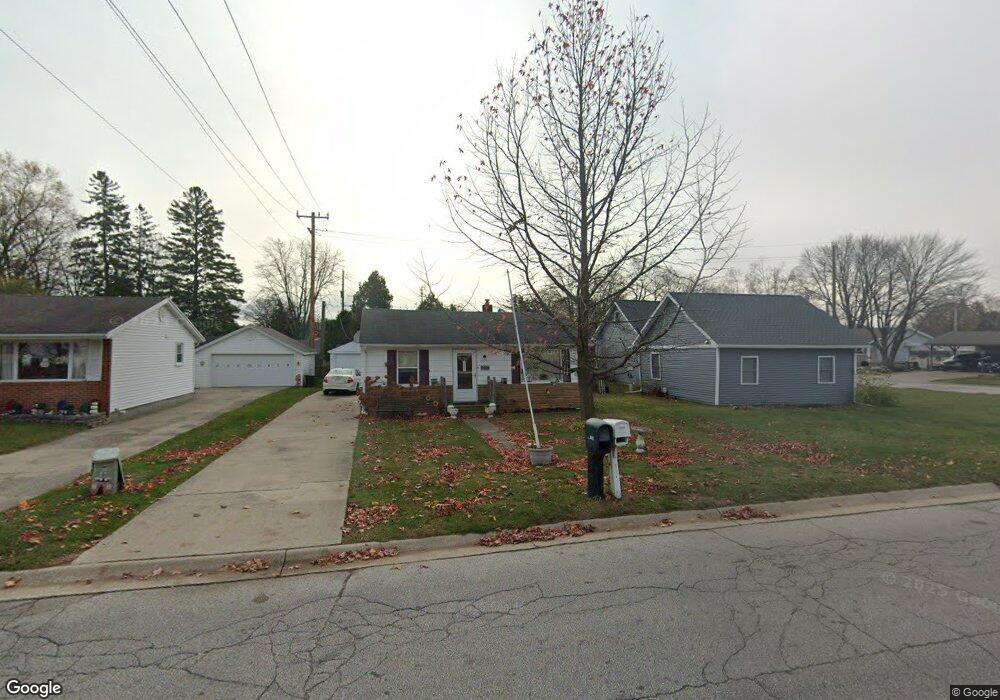
2014 Hancock St Port Huron, MI 48060
Estimated Value: $139,000 - $202,000
2
Beds
1
Bath
882
Sq Ft
$184/Sq Ft
Est. Value
About This Home
This home is located at 2014 Hancock St, Port Huron, MI 48060 and is currently estimated at $162,281, approximately $183 per square foot. 2014 Hancock St is a home located in St. Clair County with nearby schools including H.D. Crull Elementary School, Holland Woods Middle School, and Port Huron Northern High School.
Ownership History
Date
Name
Owned For
Owner Type
Purchase Details
Closed on
Apr 22, 2015
Sold by
Sanderson John W and Sanderson Katherine A
Bought by
R & D Legacy Llc
Current Estimated Value
Purchase Details
Closed on
Sep 29, 2009
Sold by
Secretary Of Housing & Urban Development
Bought by
Sanderson John W
Purchase Details
Closed on
May 14, 2009
Sold by
Back Home Loans Servicing Lp
Bought by
The Secretary Of Housing & Urban Develop
Purchase Details
Closed on
Nov 19, 2008
Sold by
Mortgage Electronic Registration Systems
Bought by
Countrywide Home Loans
Purchase Details
Closed on
Nov 13, 2008
Sold by
Silverthorn Jeffrey
Bought by
Mortgage Electronic Registration Systems
Create a Home Valuation Report for This Property
The Home Valuation Report is an in-depth analysis detailing your home's value as well as a comparison with similar homes in the area
Home Values in the Area
Average Home Value in this Area
Purchase History
| Date | Buyer | Sale Price | Title Company |
|---|---|---|---|
| R & D Legacy Llc | $38,000 | Liberty Title | |
| Sanderson John W | $32,000 | None Available | |
| The Secretary Of Housing & Urban Develop | -- | None Available | |
| Countrywide Home Loans | -- | None Available | |
| Mortgage Electronic Registration Systems | $89,477 | None Available |
Source: Public Records
Tax History Compared to Growth
Tax History
| Year | Tax Paid | Tax Assessment Tax Assessment Total Assessment is a certain percentage of the fair market value that is determined by local assessors to be the total taxable value of land and additions on the property. | Land | Improvement |
|---|---|---|---|---|
| 2025 | $2,245 | $57,700 | $0 | $0 |
| 2024 | $1,966 | $53,100 | $0 | $0 |
| 2023 | $1,862 | $48,200 | $0 | $0 |
| 2022 | $1,864 | $42,900 | $0 | $0 |
| 2021 | $1,779 | $39,300 | $0 | $0 |
| 2020 | $1,787 | $37,200 | $37,200 | $0 |
| 2019 | $1,754 | $29,100 | $0 | $0 |
| 2018 | $1,715 | $29,100 | $0 | $0 |
| 2017 | $1,622 | $26,000 | $0 | $0 |
| 2016 | $1,400 | $26,000 | $0 | $0 |
| 2015 | $1,322 | $25,000 | $25,000 | $0 |
| 2014 | $1,322 | $25,200 | $25,200 | $0 |
| 2013 | -- | $24,800 | $0 | $0 |
Source: Public Records
Map
Nearby Homes
- 2215 Hancock St
- 2812 19th Ave
- 1907 Riverside Dr
- 1434 Schumaker St
- 1531 Robinson St
- 1819 Riverside Dr
- 2549 Riverwood Dr
- 2913 11th Ave
- 2857 Riverside Dr
- 2806 Woodstock Dr
- 1218 Garfield St
- 2838 Elmwood St
- 3208 Mount Vernon Rd
- 1116 Hancock St
- 2400 Stone St Unit 2414
- 1649 Whipple St
- 1620 McBrady St
- 1202 Palmer Ct
- 909 Elmwood St
- 0000 Campau Ave
- 2020 Hancock St
- 2010 Hancock St Unit Bldg-Unit
- 2010 Hancock St
- 2522 17th Ave
- 2000 Hancock St
- 2533 16th Ave
- 2520 17th Ave
- 2600 17th Ave
- 2017 Hancock St
- 2537 17th Ave
- 2604 17th Ave
- 2108 Hancock St
- 2609 16th Ave
- 2527 17th Ave
- 2517 16th Ave
- 2616 17th Ave
- 2515 17th Ave
- 2107 Hancock St
- 2536 16th Ave
- 2509 16th Ave