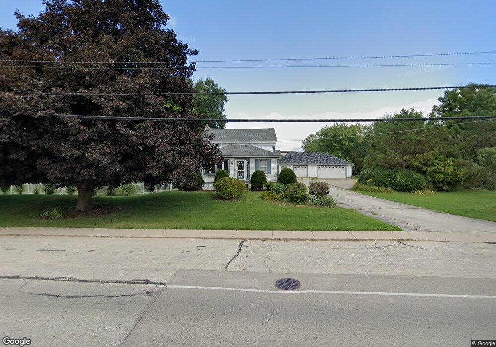
2014 Main Street Rd Spring Grove, IL 60081
Estimated Value: $174,000 - $449,000
--
Bed
1
Bath
--
Sq Ft
0.87
Acres
About This Home
This home is located at 2014 Main Street Rd, Spring Grove, IL 60081 and is currently estimated at $306,711. 2014 Main Street Rd is a home located in McHenry County with nearby schools including Spring Grove Elementary School, Nippersink Middle School, and Richmond-Burton High School.
Ownership History
Date
Name
Owned For
Owner Type
Purchase Details
Closed on
Apr 19, 2023
Sold by
Declaration Of Trust
Bought by
Linardos William A and Linardos Tammy A
Current Estimated Value
Purchase Details
Closed on
Nov 1, 2021
Sold by
Epstein Robert L and Epstein Eileen
Bought by
Epstein Robert L and Trust Of Robert L Epstein
Purchase Details
Closed on
Aug 1, 2006
Sold by
Regnier Donald J and Regnier Suzanne
Bought by
Epstein Robert L and Epstein Eileen
Home Financials for this Owner
Home Financials are based on the most recent Mortgage that was taken out on this home.
Original Mortgage
$350,000
Interest Rate
7.75%
Mortgage Type
Purchase Money Mortgage
Purchase Details
Closed on
Mar 31, 1997
Sold by
Miller Magdalen
Bought by
Regnier Donald J and Regnier Suzanne
Home Financials for this Owner
Home Financials are based on the most recent Mortgage that was taken out on this home.
Original Mortgage
$105,260
Interest Rate
7.73%
Create a Home Valuation Report for This Property
The Home Valuation Report is an in-depth analysis detailing your home's value as well as a comparison with similar homes in the area
Home Values in the Area
Average Home Value in this Area
Purchase History
| Date | Buyer | Sale Price | Title Company |
|---|---|---|---|
| Linardos William A | $8,000 | None Listed On Document | |
| Epstein Robert L | -- | Attorney | |
| Epstein Robert L | $320,000 | Multiple | |
| Regnier Donald J | $111,000 | Universal Title Services Inc |
Source: Public Records
Mortgage History
| Date | Status | Borrower | Loan Amount |
|---|---|---|---|
| Previous Owner | Epstein Robert L | $350,000 | |
| Previous Owner | Regnier Donald J | $105,260 |
Source: Public Records
Tax History Compared to Growth
Tax History
| Year | Tax Paid | Tax Assessment Tax Assessment Total Assessment is a certain percentage of the fair market value that is determined by local assessors to be the total taxable value of land and additions on the property. | Land | Improvement |
|---|---|---|---|---|
| 2024 | $6,053 | $80,596 | $15,805 | $64,791 |
| 2023 | $6,041 | $75,169 | $14,741 | $60,428 |
| 2022 | $5,630 | $66,123 | $12,967 | $53,156 |
| 2021 | $5,369 | $62,333 | $12,224 | $50,109 |
| 2020 | $5,264 | $59,586 | $11,685 | $47,901 |
| 2019 | $5,303 | $58,659 | $11,503 | $47,156 |
| 2018 | $5,422 | $56,845 | $11,147 | $45,698 |
| 2017 | $5,370 | $53,381 | $10,468 | $42,913 |
| 2016 | $4,772 | $50,980 | $9,997 | $40,983 |
| 2013 | -- | $48,098 | $4,410 | $43,688 |
Source: Public Records
Map
Nearby Homes
- 2214 Main Street Rd
- LOT 9 Mayo Ct
- Lot 65 & 66 Main Street Rd
- 1992 Red Oak Ln
- 1996 Red Oak Ln
- 1876 Red Oak Ln
- Lot 36 Red Oak Ln
- LOT 40 Red Oak Ln
- 7397 English Oak Ln
- 2003 Red Oak Ln
- 7710 Ravina Dr
- 2150 U S 12
- 1979 Red Oak Ln
- 7392 English Oak Ln
- 7393 English Oak Ln
- 1975 Red Oak Ln
- 7388 English Oak Ln
- 7389 English Oak Ln
- LOT 56 Beverly Way
- Lot 64 Beverly Way
- 2010 Main Street Rd
- 8021 Blivin St
- 2008 Main Street Rd
- 2025 Main Street Rd
- 8009 Blivin St
- 8101 Blivin St
- 2103 Main Street Rd Unit A
- 2103 Main Street Rd
- 2103 Main Street Rd Unit L
- 1928 Main Street Rd
- 1928 Main Street Rd
- 8016 Blivin St
- 8007 Blivin St
- 8020 Blivin St
- 8103 Blivin St
- 8010 Blivin St
- 8005 Blivin St
- 1923 Main Street Rd
- 8008 Blivin St
- 1924 Main Street Rd