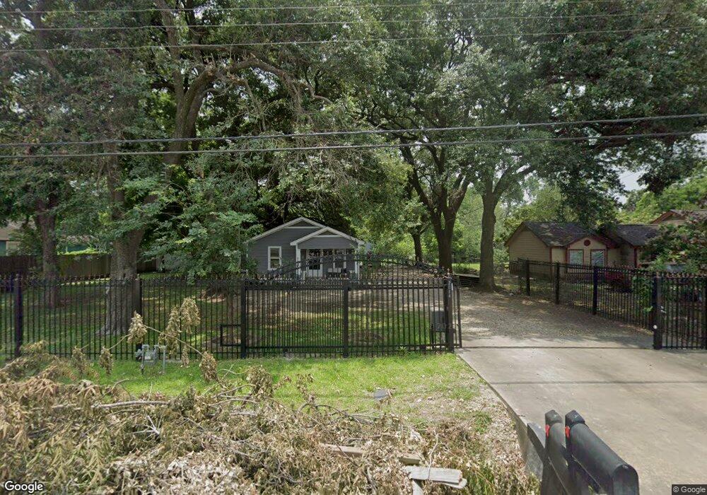
2014 Margaret St Houston, TX 77093
Eastex-Jensen NeighborhoodEstimated Value: $173,000 - $388,141
3
Beds
1
Bath
1,084
Sq Ft
$291/Sq Ft
Est. Value
About This Home
This home is located at 2014 Margaret St, Houston, TX 77093 and is currently estimated at $315,535, approximately $291 per square foot. 2014 Margaret St is a home located in Harris County with nearby schools including Coop Elementary School, Patrick Henry Middle School, and Sam Houston Math, Science & Technology Center.
Ownership History
Date
Name
Owned For
Owner Type
Purchase Details
Closed on
Jan 28, 2010
Sold by
Falcon Armando and Falcon Xiomara
Bought by
Garcia Omar
Current Estimated Value
Home Financials for this Owner
Home Financials are based on the most recent Mortgage that was taken out on this home.
Original Mortgage
$82,214
Outstanding Balance
$55,329
Interest Rate
5.37%
Mortgage Type
FHA
Estimated Equity
$260,206
Purchase Details
Closed on
Dec 17, 1998
Sold by
Rodriguez Rogelio and Rodriguez Maria Patricia
Bought by
Falcon Armando and Falcon Xiomara
Home Financials for this Owner
Home Financials are based on the most recent Mortgage that was taken out on this home.
Original Mortgage
$51,000
Interest Rate
6.87%
Purchase Details
Closed on
Jun 20, 1997
Sold by
Lane Thomas W and Lane Anna S
Bought by
Rodriguez Rogelio and Rodriguez Maria Patricia
Create a Home Valuation Report for This Property
The Home Valuation Report is an in-depth analysis detailing your home's value as well as a comparison with similar homes in the area
Home Values in the Area
Average Home Value in this Area
Purchase History
| Date | Buyer | Sale Price | Title Company |
|---|---|---|---|
| Garcia Omar | -- | Fidelity National Title | |
| Falcon Armando | -- | Houston Title Co | |
| Rodriguez Rogelio | -- | American Title Company |
Source: Public Records
Mortgage History
| Date | Status | Borrower | Loan Amount |
|---|---|---|---|
| Open | Garcia Omar | $82,214 | |
| Previous Owner | Falcon Armando | $51,000 |
Source: Public Records
Tax History Compared to Growth
Tax History
| Year | Tax Paid | Tax Assessment Tax Assessment Total Assessment is a certain percentage of the fair market value that is determined by local assessors to be the total taxable value of land and additions on the property. | Land | Improvement |
|---|---|---|---|---|
| 2025 | $7,596 | $355,700 | $259,838 | $95,862 |
| 2024 | $7,596 | $372,511 | $243,360 | $129,151 |
| 2023 | $7,596 | $302,534 | $190,125 | $112,409 |
| 2022 | $5,481 | $248,913 | $158,438 | $90,475 |
| 2021 | $4,431 | $190,112 | $114,075 | $76,037 |
| 2020 | $4,604 | $190,112 | $114,075 | $76,037 |
| 2019 | $4,811 | $190,112 | $114,075 | $76,037 |
| 2018 | $3,581 | $141,509 | $87,458 | $54,051 |
| 2017 | $2,853 | $112,821 | $87,458 | $25,363 |
| 2016 | $2,853 | $112,821 | $87,458 | $25,363 |
| 2015 | $2,359 | $91,781 | $62,150 | $29,631 |
| 2014 | $2,359 | $91,781 | $62,150 | $29,631 |
Source: Public Records
Map
Nearby Homes
- 10512 Exeter St
- 10514 Exeter St
- 1829 Skinner Rd
- 2332 Margaret St
- 2315 Langley Rd
- 2415 Goodloe St
- 2318 Cresline St
- 1908 Little York Rd
- 9910 E Hardy Rd
- 1731 Schilder Dr
- 1002 Grenfell Ln
- 2122 Kowis St
- 1802 Kowis St
- 2633 Hollis St
- 10022 E Hardy Rd
- 2152 William Tell St
- 1105 Soren Ln
- 2636 Lone Oak Rd
- 1930 Cromwell St
- 11314 Courtshire Rd
- 1938 Margaret St
- 2018 Margaret St
- 2024 Margaret St
- 1936 Margaret St
- 2042 Margaret St
- 2019 Margaret St
- 2015 Margaret St
- 10423 Burden St
- 2027 Margaret St
- 1930 Margaret St
- 2047 Margaret St
- 2017 Charles Rd
- 0 Margaret St
- 1929 Margaret St
- 2044 Margaret St
- 2045 Margaret St
- 10436 Burden St
- 10452 Burden St
- 10432 Burden St
- 10428 Burden St Unit A