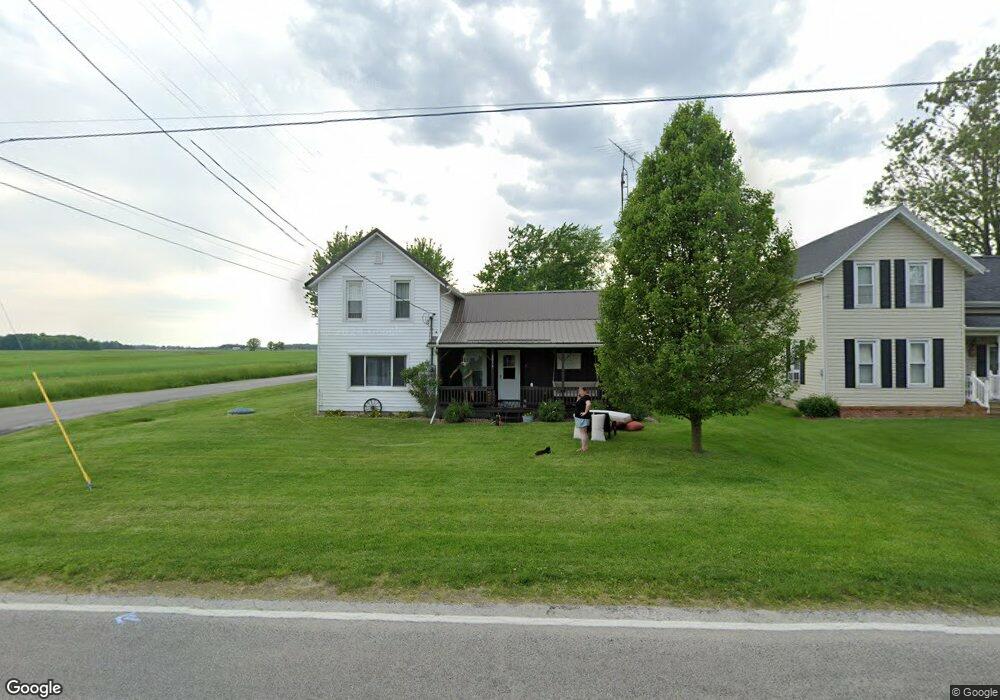
2014 N Elliston Trowbridge Rd Graytown, OH 43432
Estimated Value: $136,868 - $238,000
4
Beds
1
Bath
1,864
Sq Ft
$104/Sq Ft
Est. Value
About This Home
This home is located at 2014 N Elliston Trowbridge Rd, Graytown, OH 43432 and is currently estimated at $193,967, approximately $104 per square foot. 2014 N Elliston Trowbridge Rd is a home located in Ottawa County with nearby schools including Oak Harbor High School.
Ownership History
Date
Name
Owned For
Owner Type
Purchase Details
Closed on
Nov 3, 2010
Sold by
Green Jarrell K and Green Debra K
Bought by
Purtee Alex T and Purtee Kasey L
Current Estimated Value
Home Financials for this Owner
Home Financials are based on the most recent Mortgage that was taken out on this home.
Original Mortgage
$94,312
Interest Rate
4.17%
Mortgage Type
New Conventional
Create a Home Valuation Report for This Property
The Home Valuation Report is an in-depth analysis detailing your home's value as well as a comparison with similar homes in the area
Home Values in the Area
Average Home Value in this Area
Purchase History
| Date | Buyer | Sale Price | Title Company |
|---|---|---|---|
| Purtee Alex T | $94,350 | Titleblu Agency Llc |
Source: Public Records
Mortgage History
| Date | Status | Borrower | Loan Amount |
|---|---|---|---|
| Closed | Purtee Alex T | $94,312 |
Source: Public Records
Tax History Compared to Growth
Tax History
| Year | Tax Paid | Tax Assessment Tax Assessment Total Assessment is a certain percentage of the fair market value that is determined by local assessors to be the total taxable value of land and additions on the property. | Land | Improvement |
|---|---|---|---|---|
| 2024 | $1,345 | $36,733 | $3,364 | $33,369 |
| 2023 | $1,345 | $29,432 | $2,237 | $27,195 |
| 2022 | $1,216 | $29,432 | $2,237 | $27,195 |
| 2021 | $1,227 | $29,440 | $2,240 | $27,200 |
| 2020 | $1,257 | $29,150 | $1,950 | $27,200 |
| 2019 | $1,215 | $29,150 | $1,950 | $27,200 |
| 2018 | $1,113 | $29,150 | $1,950 | $27,200 |
| 2017 | $951 | $27,220 | $1,560 | $25,660 |
| 2016 | $953 | $27,220 | $1,560 | $25,660 |
| 2015 | $930 | $27,220 | $1,560 | $25,660 |
| 2014 | $502 | $27,990 | $1,560 | $26,430 |
| 2013 | $984 | $28,160 | $1,560 | $26,600 |
Source: Public Records
Map
Nearby Homes
- 1861 N Opfer-Lentz Rd
- 3784 N Stange Rd
- 0 W Walbridge E Unit 6135427
- 14642 W 3rd St
- 14339 3rd St
- 21490 Holts Rd E
- 19383 Courtland Ave
- 14339 & 14363 W 3rd St
- 19395 W Walbridge Rd
- 19433 W Walbridge Rd
- 0 W Walbridge Rd
- Track 1 W Walbridge Rd
- 19481 W Walbridge Rd
- 19367 W Walbridge Rd
- 1615 N Thyre Dr
- 207 E 11th St
- 20876 W Camper Rd
- 1301 West St
- 904 Main St
- 18574 W State Route 105
- 2020 N Elliston Trowbridge Rd
- 999999 W Hellwig Rd
- 2016 N Commercial St
- 2040 N Commercial St
- 2011 N Elliston Trowbridge Rd
- 2052 N Elliston Trowbridge Rd
- 2043 N Elliston Trowbridge Rd
- 2060 N Commercial St
- 2090 N Elliston Trowbridge Rd
- 2083 N Elliston Trowbridge Rd
- 2080 N Commercial St
- 2100 N Elliston Trowbridge Rd
- 1880 N Elliston Trowbridge Rd
- 2103 N Elliston Trowbridge Rd
- 17944 W Railroad St
- 2120 Main
- 17910 W Railroad St
- 17959 W Elliston East and Rd W
- 17959 W Elliston East West Rd
- 2160 N Elliston Trowbridge Rd