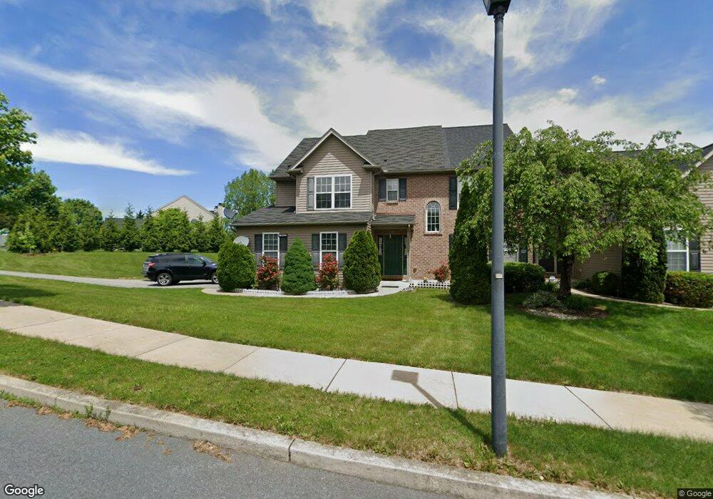
2014 Rolling Meadow Dr Macungie, PA 18062
Lower Macungie Township East NeighborhoodEstimated Value: $449,847 - $520,000
3
Beds
3
Baths
2,044
Sq Ft
$237/Sq Ft
Est. Value
About This Home
This home is located at 2014 Rolling Meadow Dr, Macungie, PA 18062 and is currently estimated at $483,462, approximately $236 per square foot. 2014 Rolling Meadow Dr is a home located in Lehigh County with nearby schools including Willow Lane Elementary School, Eyer Middle School, and Emmaus High School.
Ownership History
Date
Name
Owned For
Owner Type
Purchase Details
Closed on
Jan 30, 2020
Sold by
Varma Vishal
Bought by
Varma Vishal and Bhatnagar Swati
Current Estimated Value
Purchase Details
Closed on
Jun 16, 2006
Sold by
K & M Developers Inc
Bought by
Varma Vishal
Home Financials for this Owner
Home Financials are based on the most recent Mortgage that was taken out on this home.
Original Mortgage
$229,667
Outstanding Balance
$135,403
Interest Rate
6.62%
Mortgage Type
Purchase Money Mortgage
Estimated Equity
$348,059
Create a Home Valuation Report for This Property
The Home Valuation Report is an in-depth analysis detailing your home's value as well as a comparison with similar homes in the area
Home Values in the Area
Average Home Value in this Area
Purchase History
| Date | Buyer | Sale Price | Title Company |
|---|---|---|---|
| Varma Vishal | -- | None Available | |
| Varma Vishal | $287,085 | None Available |
Source: Public Records
Mortgage History
| Date | Status | Borrower | Loan Amount |
|---|---|---|---|
| Open | Varma Vishal | $229,667 |
Source: Public Records
Tax History Compared to Growth
Tax History
| Year | Tax Paid | Tax Assessment Tax Assessment Total Assessment is a certain percentage of the fair market value that is determined by local assessors to be the total taxable value of land and additions on the property. | Land | Improvement |
|---|---|---|---|---|
| 2025 | $5,818 | $227,900 | $34,300 | $193,600 |
| 2024 | $5,629 | $227,900 | $34,300 | $193,600 |
| 2023 | $5,517 | $227,900 | $34,300 | $193,600 |
| 2022 | $5,386 | $227,900 | $193,600 | $34,300 |
| 2021 | $5,272 | $227,900 | $34,300 | $193,600 |
| 2020 | $5,221 | $227,900 | $34,300 | $193,600 |
| 2019 | $5,132 | $227,900 | $34,300 | $193,600 |
| 2018 | $5,065 | $227,900 | $34,300 | $193,600 |
| 2017 | $4,977 | $227,900 | $34,300 | $193,600 |
| 2016 | -- | $227,900 | $34,300 | $193,600 |
| 2015 | -- | $227,900 | $34,300 | $193,600 |
| 2014 | -- | $227,900 | $34,300 | $193,600 |
Source: Public Records
Map
Nearby Homes
- 6007 Timberknoll Dr
- 2154 Gorton Rd
- 6522 Trafalgar Dr
- 2056 Autumn Ridge Rd
- 6022 Eli Cir
- 6179 Fairway Ln
- 1991 Autumn Ridge Rd
- 6779 Hickory Rd
- 2252 Eldemere Cir
- 6645 Stein Way Unit 6639-6661
- 5736 Greens Dr
- 2225 Four Seasons Blvd Unit 116A0
- 1897 Alexander Dr Unit I6
- 5673 Wedge Ln
- 2173 Brookside Rd
- 5280 Townsquare Dr
- 1360 Walnut Ln
- 1675 Hamlet Dr
- 6528 Carmel Dr
- 5175 Meadowview Dr
- 2018 Rolling Meadow Dr
- 2010 Rolling Meadow Dr
- 2022 Rolling Meadow Dr
- 2006 Rolling Meadow Dr
- 2005 Rolling Meadow Dr
- 2026 Rolling Meadow Dr
- 2001 Rolling Meadow Dr
- 6111 Timberknoll Dr
- 1997 Rolling Meadow Dr
- 2002 Rolling Meadow Dr
- 2030 Rolling Meadow Dr
- 2019 Rolling Meadow Dr
- 1993 Rolling Meadow Dr
- 6119 Timberknoll Dr
- 6119 Timberknoll Dr Unit 95
- 2021 Rolling Meadow Dr
- 1989 Rolling Meadow Dr
- 2034 Rolling Meadow Dr
- 6123 Timberknoll Dr
- 1998 Rolling Meadow Dr