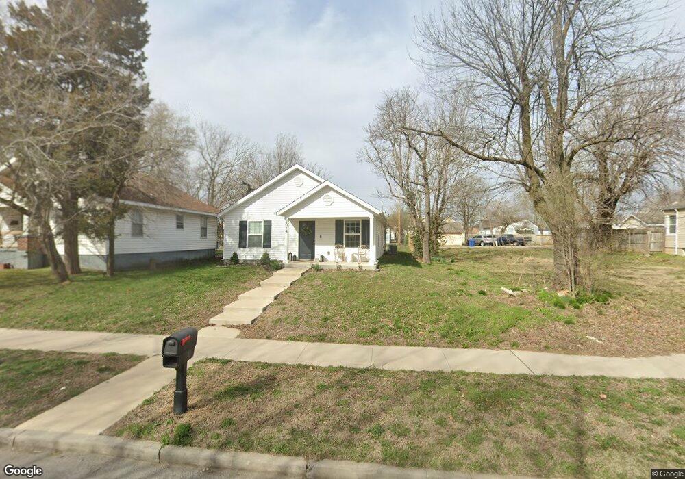
2014 S Connor Ave Joplin, MO 64804
Blendville South NeighborhoodEstimated Value: $170,000 - $223,000
3
Beds
2
Baths
1,217
Sq Ft
$159/Sq Ft
Est. Value
About This Home
This home is located at 2014 S Connor Ave, Joplin, MO 64804 and is currently estimated at $193,176, approximately $158 per square foot. 2014 S Connor Ave is a home located in Jasper County with nearby schools including Cecil Floyd Elementary School, North Middle School, and Joplin High School.
Ownership History
Date
Name
Owned For
Owner Type
Purchase Details
Closed on
Nov 11, 2022
Sold by
Ledford Construction And Development Com
Bought by
Hays Neal Carson and May Neal Sylvia
Current Estimated Value
Home Financials for this Owner
Home Financials are based on the most recent Mortgage that was taken out on this home.
Original Mortgage
$5,632
Outstanding Balance
$5,450
Interest Rate
7.08%
Estimated Equity
$187,726
Purchase Details
Closed on
Feb 1, 2022
Sold by
City Of Joplin Missouri
Bought by
Ledford Construction And Development Company
Purchase Details
Closed on
Dec 18, 2009
Sold by
Boyd Dorris A
Bought by
City Of Joplin
Purchase Details
Closed on
Aug 29, 2006
Sold by
Jenness Sarah E
Bought by
County Of Jasper
Create a Home Valuation Report for This Property
The Home Valuation Report is an in-depth analysis detailing your home's value as well as a comparison with similar homes in the area
Home Values in the Area
Average Home Value in this Area
Purchase History
| Date | Buyer | Sale Price | Title Company |
|---|---|---|---|
| Hays Neal Carson | -- | First American Title | |
| Ledford Construction And Development Company | $18,001 | First American Title | |
| City Of Joplin | -- | None Available | |
| County Of Jasper | $626 | None Available |
Source: Public Records
Mortgage History
| Date | Status | Borrower | Loan Amount |
|---|---|---|---|
| Open | Hays Neal Carson | $5,632 | |
| Open | Hays Neal Carson | $140,800 |
Source: Public Records
Tax History Compared to Growth
Tax History
| Year | Tax Paid | Tax Assessment Tax Assessment Total Assessment is a certain percentage of the fair market value that is determined by local assessors to be the total taxable value of land and additions on the property. | Land | Improvement |
|---|---|---|---|---|
| 2025 | $851 | $20,730 | $1,210 | $19,520 |
| 2024 | $850 | $18,420 | $1,210 | $17,210 |
| 2023 | $850 | $18,420 | $1,210 | $17,210 |
| 2022 | $56 | $1,210 | $1,210 | $0 |
| 2021 | -- | $0 | $0 | $0 |
| 2020 | $0 | $0 | $0 | $0 |
| 2019 | $0 | $0 | $0 | $0 |
| 2018 | $0 | $0 | $0 | $0 |
| 2017 | $0 | $0 | $0 | $0 |
| 2016 | -- | $0 | $0 | $0 |
| 2015 | -- | $0 | $0 | $0 |
| 2014 | -- | $0 | $0 | $0 |
Source: Public Records
Map
Nearby Homes
- 2026 Bird Ave
- 2031 Murphy Ave
- 1916 S Murphy Ave
- 2216 & 1/2 S Connor Ave
- 1814 S Sergeant Ave
- 2109 S Moffet Ave
- 1815 S Picher Ave
- 1901 S Moffet Ave
- 1815 S Empire Ave
- 2115 Byers Ave
- 1701 S Jackson Ave
- 1620 S Connor Ave
- 1619 S Murphy Ave
- 1417 W 20th St
- 2121 S Pearl Ave
- 2118 S Wall Ave
- 1730 Annie Baxter Ave
- 2108 S Harlem Ave
- 2114 S Joplin Ave
- 1507 S Sergeant Ave
- 2018 S Connor Ave
- 2012 S Connor Ave
- 2024 S Connor Ave
- 2006 S Connor Ave
- 2017 Bird Ave
- 2011 Bird Ave
- 2021 Bird Ave
- 2027 Bird Ave
- 2005 Bird Ave
- 2017 S Connor Ave
- 2002 S Connor Ave
- 2015 S Connor Ave
- 2019 S Connor Ave
- 2003 Bird Ave
- 2003 Bird Ave
- 2007 S Connor Ave
- 2025 S Connor Ave
- 2005 S Connor Ave
- 2029 S Connor Ave
- 906 W 21st St