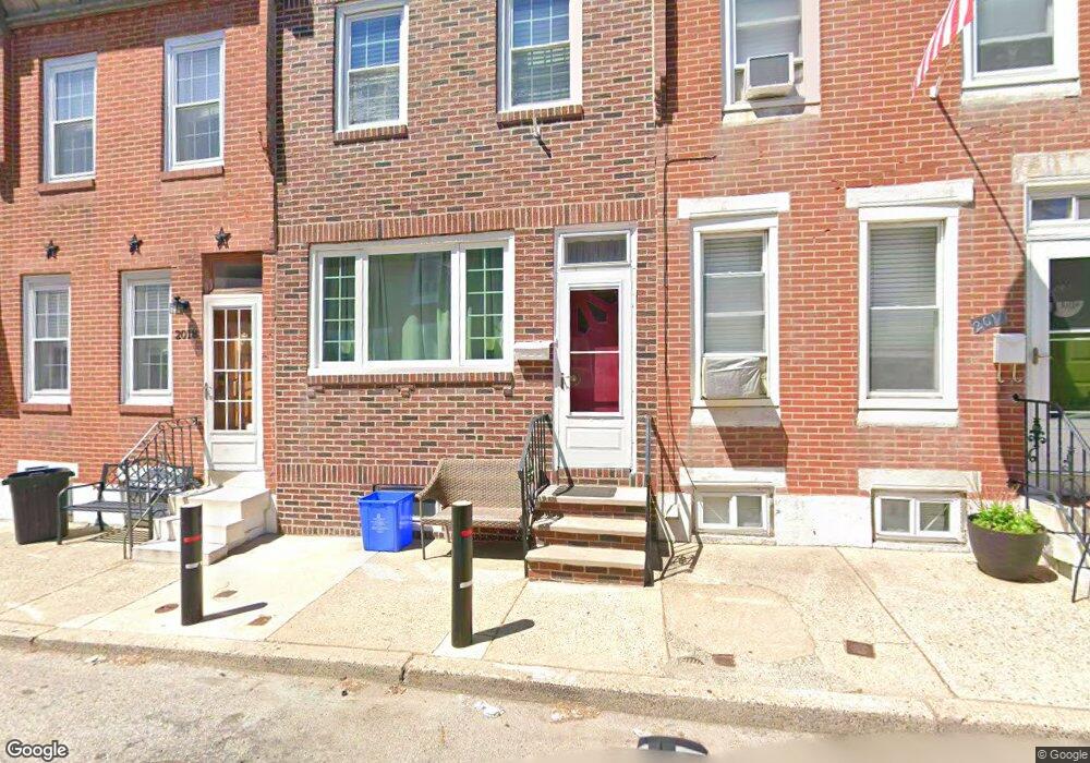
2014 S Philip St Philadelphia, PA 19148
Pennsport NeighborhoodEstimated Value: $216,309 - $290,000
2
Beds
1
Bath
784
Sq Ft
$315/Sq Ft
Est. Value
About This Home
This home is located at 2014 S Philip St, Philadelphia, PA 19148 and is currently estimated at $247,327, approximately $315 per square foot. 2014 S Philip St is a home located in Philadelphia County with nearby schools including George W. Sharswood School, Furness Horace High School, and St. Casimir School.
Ownership History
Date
Name
Owned For
Owner Type
Purchase Details
Closed on
Mar 28, 2003
Sold by
Lopez Patrick M
Bought by
Lopez Patrick M and Lopez Denise A
Current Estimated Value
Purchase Details
Closed on
Sep 30, 2002
Sold by
Amaro Jose
Bought by
Lopez Patrick M
Home Financials for this Owner
Home Financials are based on the most recent Mortgage that was taken out on this home.
Original Mortgage
$53,000
Interest Rate
6.27%
Create a Home Valuation Report for This Property
The Home Valuation Report is an in-depth analysis detailing your home's value as well as a comparison with similar homes in the area
Home Values in the Area
Average Home Value in this Area
Purchase History
| Date | Buyer | Sale Price | Title Company |
|---|---|---|---|
| Lopez Patrick M | -- | -- | |
| Lopez Patrick M | $66,300 | Multiple |
Source: Public Records
Mortgage History
| Date | Status | Borrower | Loan Amount |
|---|---|---|---|
| Closed | Lopez Patrick M | $53,000 |
Source: Public Records
Tax History Compared to Growth
Tax History
| Year | Tax Paid | Tax Assessment Tax Assessment Total Assessment is a certain percentage of the fair market value that is determined by local assessors to be the total taxable value of land and additions on the property. | Land | Improvement |
|---|---|---|---|---|
| 2025 | $2,381 | $196,900 | $39,380 | $157,520 |
| 2024 | $2,381 | $196,900 | $39,380 | $157,520 |
| 2023 | $2,381 | $170,100 | $34,020 | $136,080 |
| 2022 | $2,165 | $170,100 | $34,020 | $136,080 |
| 2021 | $2,165 | $0 | $0 | $0 |
| 2020 | $2,165 | $0 | $0 | $0 |
| 2019 | $1,999 | $0 | $0 | $0 |
| 2018 | $1,538 | $0 | $0 | $0 |
| 2017 | $1,538 | $0 | $0 | $0 |
| 2016 | $129 | $0 | $0 | $0 |
| 2015 | $1,958 | $0 | $0 | $0 |
| 2014 | -- | $146,100 | $11,238 | $134,862 |
| 2012 | -- | $8,544 | $641 | $7,903 |
Source: Public Records
Map
Nearby Homes
- 2038 S 2nd St
- 129 Dudley St
- 206 Mifflin St
- 138 Mercy St
- 116 Emily St
- 1923 S Galloway St
- 112 Hoffman St
- 112 Mifflin St
- 121 Mifflin St
- 143 Sigel St
- 137 Sigel St
- 160 Mcclellan St
- 2000 E Moyamensing Ave
- 1932 E Moyamensing Ave
- 118 Mcclellan St
- 327 Winton St
- 2031 S 4th St
- 2149 S 3rd St
- 220 Jackson St
- 207 Moore St
- 2012 S Philip St
- 2016 S Philip St
- 2010 S Philip St
- 2008 S Philip St
- 2015 S 3rd St
- 2011 S 3rd St
- 2017 S 3rd St
- 2009 S 3rd St
- 2013 S Philip St
- 2019 S 3rd St
- 2015 S Philip St
- 2017 S Philip St
- 2024 S Philip St
- 2019 S Philip St
- 212 Mckean St
- 216 Mckean St
- 2021 S 3rd St
- 2021 S Philip St
- 218 Mckean St
- 220 Mckean St